 o Popular
Marrakech
Imperial city with unique charm, bustling souks, hidden riads, and historic palaces.
o The Red CityMarrakech
Comprehensive Analytical Report: Historical Evolution, Architectural Heritage, and Logistical Dynamics of the Imperial City of Marrakech
The analysis of the historical, architectural, and socio-economic development of Marrakech reveals a trajectory of exceptional complexity, shaped by the rigors of the pre-Saharan environment, the fortunes of trans-Saharan caravan trade routes, and the political ambitions of successive dynasties. Founded in the eleventh century as a strategic military encampment, the city evolved to become the capital of multiple empires, weaving a network of influences extending from the banks of the Senegal River to the Ebro plains in Andalusia. This report offers an in-depth examination of the geopolitical genesis of Marrakech, its ancient environmental engineering, its monumental architectural pantheon, its resilience in the face of recent seismic crises, and establishes a corpus of logistical data for contemporary travelers and researchers.
The Almoravid Genesis: From Nomadic Fervor to Imperial Hegemony
The foundation of Marrakech is rooted in a context of territorial unification and rigorous theological reform. Aït the beginning of the 11th century, the vast confederation of the Sanhadja Berber tribes (composed notably of the Lamtuna, Judala, and Massufa tribes), which dominated the Saharan space from the Aïtlantic coast to the interior, was fragmented. Evolving in this inhospitable environment, the Lamtuna tribe was particularly distinguished by the epithet al-Mulaththamun (the "veiled ones"), a designation carrying strong social and cultural connotations, which some historians link to pre-Islamic customs while others associate it with the practical and symbolic imperatives of the reformist agenda.
It was among these tribes that the Maliki jurist Abdallah Ibn Yasin initiated a movement of puritanical spiritual and moral awakening. The followers of this movement, dedicated to jihad and orthodoxy, took the name of "Mourabitoun" (Al-Morabitin, the people of the ribat), a term that defines both a physical frontier post and an unwavering spiritual commitment, and which was later Hispanicized and Europeanized as "Almoravides". Following the martyrdom of Ibn Yasin in 1059 (or 451 of the Hegira), military command fell to Abu Bakr Ibn Umar, a member of the Lamtuna tribe.
In his campaign to conquer the Draa and Souss valleys, Abu Bakr allied with the Masmouda tribe, a crucial geostrategic maneuver to secure a passage through the High Atlas mountains and defeat the citadel of Aghmat in 1058, then controlled by the Maghrawa. However, the city of Aghmat, confined in a valley, proved geographically insufficient to accommodate the logistics of vast Saharan contingents. In 1070, seeking an optimal base of operations, Abu Bakr set up a military camp along the Tensift River and erected a stone fortress, the Qsar el Hajar, on the current site of the Koutoubia. This act marked the ex nihilo birth of Marrakech.
The true urban structuring of the capital fell to Abu Bakr's cousin, Youssef Ibn Tachfine, who took charge of the region around 1071. Replacing nomadic tents with pisé (rammed earth) buildings, he gave the city its characteristic ochre hue, earning it the name "Marrakush al Hamra" (Marrakech the Red). Youssef Ibn Tachfine elevated the city to the rank of imperial capital, formally recognized the authority of the Abbasid caliphate in Baghdad, and launched the empire into a dazzling northward expansion. Responding to the distress call of the Taifa kings of Andalusia (notably the king of Seville, Abbad II al-Mutadid) facing the Reconquista led by King Alfonso VI of Castile, Youssef Ibn Tachfine crossed the Strait of Gibraltar and won the decisive victory of Zallaqa (Sagrajas) in October 1086. Dismayed by the division of the Andalusian kingdoms, he subsequently unified all of Al-Andalus under the Almoravid banner, creating an empire extending from the Senegal River to the Ebro.
Political Economy: Trans-Saharan Trade and Fondouks
The meteoric rise of Marrakech relied fundamentally on the monopolization of trans-Saharan caravan routes, a macroeconomic trade network operating from about 500 BCE until the nineteenth century. The Almoravid empire, by unifying the Saharan and Maghrebi territories, secured an uninterrupted flow of the medieval era's main commodity: gold.
Maghrebi merchants, operating from hubs like Sijilmasa, transported dates, wheat, textiles, copper, brass, and especially precious Saharan rock salt to Sahelian kingdoms, such as ancient Ghana and Timbuktu. Salt, a vital commodity in sub-Saharan climates, was sometimes exchanged weight for weight against gold dust. This unprecedented accumulation of precious metals granted the Almoravids sovereign monetary power, allowing them to mint the famous Almoravid gold dinar. Numismatic analyses reveal that these coins, minted in Aghmat and Marrakech under rulers like Abu Ya'qub Yusuf ibn Tashfin (1087-1106), bore strict Quranic inscriptions affirming the regime's religious orthodoxy. The reliability and purity of this dinar were such that it became a major international currency, even prompting imitations minted in the Iberian Peninsula.
This large-scale economy required specialized urban logistical infrastructure, materialized by the construction of fondouks (or caravanserais). Derived from the Greek pandokeion (inn), the architectural model of the fondouk, traces of which are massively present in the medina of Marrakech (with over 96 units recorded, including 79 private properties), is structured around a central, generally square or rectangular courtyard. The ground floor, protected by heavy single doors, served as a secure warehouse for Saharan goods and mounts, while the upper floor housed rooms for travelers and passing merchants.
Historic establishments like Fondouk El Amri, Fondouk Salas, or Fondouk Al Misane were the true commodity exchanges of the time, located along strategic arteries to streamline the flow of goods. Over time, the sedentarization of merchants transformed the purpose of these buildings. Today, they form the heart of traditional Marrakchi craftsmanship. The Moroccan government recently implemented major rehabilitation programs aimed at transforming these fondouks into hubs for artisanal innovation and cultural attraction, while others have been repurposed into high-end dining spaces, proving the ability of these structures to adapt to global economic shifts.
Environmental Engineering: Khettaras and Survival in an Arid Environment
The establishment of an imperial capital in the arid Haouz plain posed a major hydrological challenge. Demographic growth and the creation of vast palm groves and enclosed gardens could not have materialized without the deployment of khettaras, a gravity-based hydraulic engineering system introduced as early as the eleventh century.
A khettara is a very gently sloping underground gallery designed to capture groundwater in the foothills of the High Atlas and transport it to the medina, over tens of kilometers, without any pumps or external energy input. Topography does all the work. The construction and maintenance of these underground canals required the excavation of dozens of aligned vertical access shafts, which simultaneously provided ventilation and allowed for the removal of debris. Choosing an underground pipeline was the perfect technological response to the pre-Saharan climate, as it eliminated the massive evaporation inherent in open-air aqueducts.
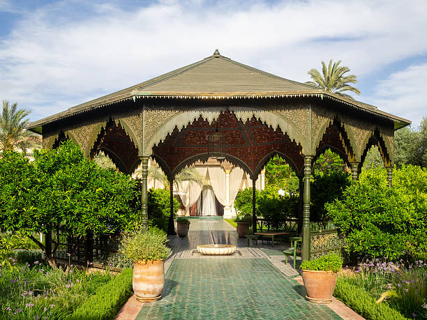
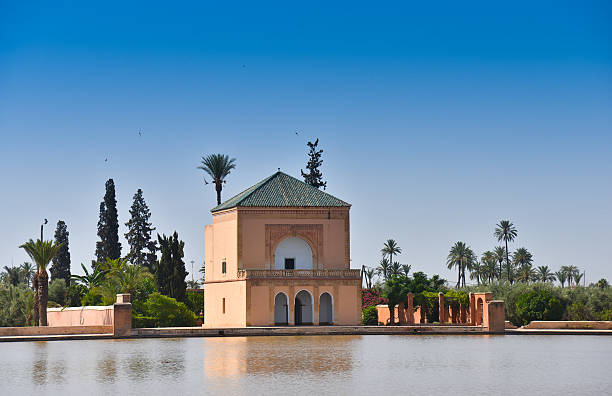
The footprint of this system is still visible in the configuration of grand palatial gardens, like the Le Jardin Secret complex. Originally laid out in the second half of the sixteenth century under the Saadian sultan Moulay Abd-Allah, this exceptional estate, divided into two historic riads, was directly irrigated by a network of khettaras dating back to the eleventh century. This water abundance allowed for the acclimatization of rare fruit trees and the flourishing of rich ornamental flora, transforming an arid plot into a botanical paradise. Although khettaras are currently endangered due to lowering water tables and the use of motorized mechanical boreholes, they remain a model of sustainable engineering studied by contemporary hydrologists.
| Hydraulic Component | Technological Function and Impact |
|---|---|
| Mother well | Initial capture point penetrating deeply into the water table at the foot of the Atlas. |
| Underground gallery | Inclined canal mathematically calculated to ensure continuous gravity flow without erosion or stagnation. |
| Vertical access shafts | Regularly spaced engineering works allowing for ventilation, initial excavation, and maintenance by well-diggers. |
| Urban distribution network | Complex ramifications supplying public fountains (qoubbas), mosques, fondouks, and riad gardens. |
The Architectural Pantheon: Stratification of Dynasties
The built landscape of Marrakech is a palimpsest where each dynasty (Almoravides or Al-Morabitin, Almohades or Al-Mowahidin, Mérinides or Al-Mariniyin, Saadiens or As-Saadiyin, Alaouites) imposed its stylistic vocabulary, often at the expense of its predecessors' buildings.
The Innovative Minimalism of the Almoravid Qoubba
The only intact architectural remnant of the Almoravid period in Marrakech, the Qoubba al-Baadiyn (or Almoravid Qoubba) is a monument of modest dimensions (about 5.45 m by 7.37 m and 10.80 m high) but of paramount historical importance. Erected in 1117 (or 1120) under the reign of Ali ben Youssef (son of Youssef Ibn Tachfine), this building was the ablution center for the faithful of the great congregational mosque (Ben Youssef Mosque), which has since disappeared in its original form.
Completely buried under rubble over the centuries, the Qoubba was accidentally rediscovered in 1948 by French archaeologists. Its architecture embodies the assimilation of Andalusian know-how by Berber builders. The building, with a centered rectangular plan, is topped by a slender dome. Inside, the transition between the square base and the circular dome is achieved using muqarnas (stalactite) vaults, which are among the oldest examples of this type in North Africa. The abundant stucco carved decorations (pine cones, acanthus leaves, palmettes) and the facade adorned with baked bricks in lobed polygonal arches testify to Almoravid refinement. Furthermore, an epigraphic band inside reveals one of the oldest uses of cursive Arabic writing in a monumental architectural context in the Maghreb. Formerly fed by the khettara network leading to a large cistern, it distributed water via bronze piping to the ablution basins, thus combining cutting-edge engineering with a purely cultic dimension.
The Monumental Orthodoxy of the Koutoubia Mosque
In 1147, the Almohad (Al-Mowahidin) Berber dynasty, originating from Tinmel in the High Atlas and advocating a moral and unitary reformism initiated by Mohamed Ibn Toumert, seized Marrakech and orchestrated the physical and ideological destruction of the Almoravid heritage. Caliph Abd al-Mumin ordered the construction of a new great mosque on the ruins of the Almoravid palatial complex, the Qsar el Hajar. The name of the mosque, Koutoubia, derives from the surrounding souk that housed the stalls of manuscript merchants (kutubiyyin).
The history of its construction is marked by a spectacular geodetic correction. After the completion of a first building in 1157, Almohad astronomers determined that the orientation of the qibla wall deviated from the strict norms of the direction of Mecca. Refusing theological compromises, the power commissioned the immediate construction of a second adjacent mosque, featuring a realigned plan. The old structure was gradually abandoned, although its foundations remain perfectly visible today, marking this massive architectural adjustment.
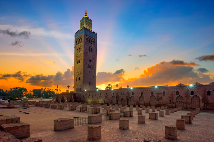
The prayer hall follows a traditional "T" shape configuration, featuring seventeen naves supported by pristine pillars. However, the triumph of the Koutoubia lies in its minaret. Completed in 1196 by Abd al-Mumin's grandson, Abu Yusuf Ya'qub al-Mansur, this square tower, 77 meters high, is decorated with horseshoe arches, floral interlacing, and a green ceramic frieze. It laid the foundation for a monumental archetype that was faithfully reproduced for the Giralda in Seville and the Hassan Tower in Rabat. The mosque also housed an invaluable minbar, crafted in Cordoba in 1137 by artisans of the Almoravid era. This marquetry masterpiece inlaid with bone and ivory (now preserved at the El Badi Palace) symbolizes the perpetual transfer of Hispano-Moorish art.
Saadian Splendor: The Ben Youssef Madrasa and El Badi Palace
From the middle of the sixteenth century, the Saadian (As-Saadiyin) dynasty shifted the axis of Maghrebi power back to Marrakech and undertook construction projects of unprecedented lavishness.
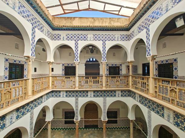
The Ben Youssef Madrasa, completed between 1557 and 1574 by Sultan Abdallah al-Ghalib, was erected on the site of a former Marinid institution to become the largest theological university in the Maghreb. The building is articulated around a central courtyard featuring a vast pool. The architecture combines with absolute mastery the three founding elements of Arab-Andalusian art: zellige (polychrome geometric mosaic in the lower part), finely chiseled stucco (in the middle section), and colossal lintels and corbels in richly carved cedar wood (in the upper part). This splendor of the collective spaces contrasted with the ascetic austerity of the 130 student cells located upstairs, devoid of outward-facing windows to ensure strict confinement conducive to Quranic and legal studies.
The pinnacle of Saadian absolutism, however, was the El Badi Palace (The Incomparable), commissioned in 1578 by Sultan Ahmad al-Mansur just months after his accession to the throne following the Battle of the Three Kings (Battle of Alcécer Quibir) against the Portuguese. The colossal ransoms extorted from the captive Portuguese aristocracy funded a construction project of continental scale, requiring nearly twenty-five years of labor. The 360-room complex illustrates the globalization of luxury materials of the time: Sahelian gold, extracted and transported by caravans from Timbuktu, covered the walls and ceilings; white Carrara marble, carved by Italian artisans, was shipped to Morocco in direct exchange for an equivalent quantity of Moroccan sugar, a very rare commodity at the time.
The demise of the Badi was decided at the beginning of the eighteenth century (1707-1708) by the powerful Alaouite sultan Moulay Ismaïl, who ordered its exhaustive dismantling to reuse its invaluable materials (marble, cedar, stucco) for the construction of his new imperial capital in Meknes. What remains today of the Incomparable is only a spectacular carcass of vast ochre pisé walls sheltering orange trees below, a monumental skeleton that now hosts the National Festival of Popular Arts and the museum presentation of the Koutoubia minbar.
The Twentieth Century and the Protectorate Period: Dar El Bacha
The city's relationship with twentieth-century geopolitical modernity is encapsulated in the walls of Dar El Bacha. Built in 1910, this stately palace was the urban residence of Thami El Glaoui, one of the most powerful men in the country, appointed Pasha of Marrakech by Sultan Moulay Youssef in 1912 under the auspices of the nascent French protectorate.
El Glaoui, exercising an almost feudal hold over the south of the country through strategic alliances, was a leader of spectacular contradictions: on the one hand deeply rooted in traditionalism (maintaining a vast harem), and on the other hand fascinated by European cosmopolitanism. Dar El Bacha served as a state drawing room, hosting illustrious international figures such as Winston Churchill, General de Gaulle, and Charlie Chaplin.
The palace's architecture redefines the excellence of the riad model: a central courtyard dominated by symmetrical orange gardens, surrounded by reception rooms adorned with kaleidoscopic zelliges, deeply incised stucco arches, and massive cedar wood ceilings painted with organic pigments (saffron, poppy, indigo).
Confiscated after El Glaoui's fall following independence in 1956, the palace fell into relative obscurity before being taken over by the National Foundation of Museums (FNM) in 2014. Under the direction of Mehdi Qotbi, and after rigorous scientific restoration, it was reopened in 2017 by King Mohammed VI as Dar El Bacha - Museum of Confluences. The museum strives to celebrate the nation's cultural crossroads. It notably houses the exceptional donation of Patti Cadby Birch, an American archaeologist and philanthropist attached to the Metropolitan Museum of Art (MET), whose bequeathed collection brings together over 1,340 Islamic, Pre-Columbian, Asian, and Moroccan artifacts. In parallel, the establishment houses the sumptuous Bacha Coffee Room & Boutique, a reminiscence of early twentieth-century opulence, serving internationally renowned 100% Arabica coffee in an Art Nouveau decor blended with Moroccan decorative arts.
Tectonic Shock and Resilience Planning (2023 Earthquake)
The integrity of the historical urban morphology was brutally put to the test on the night of September 8, 2023, when a violent earthquake of magnitude 6.8 to 6.9 (Mw) struck the Al Haouz province, constituting the most destructive seismic event recorded in the region in a century. The shockwave devastated part of the High Atlas and caused profound and tragic damage to the medina of Marrakech (a UNESCO World Heritage site since 1985), with a national human toll rising to several thousand victims.
Vernacular pisé structures, combined with stone masonry lacking chaining and reinforcements, revealed their extreme vulnerability to the lateral shear forces of the earthquake. The dense ancient residential quarters, whose old, interwoven houses bear vertically upon one another, concentrated the most severe damage in the old city, causing total collapses and structural cracking. However, post-seismic technical analysis highlighted a striking dichotomy. Monumental foundations proved unexpectedly resilient: the secular minaret of the Koutoubia, despite swaying dangerously under the seismic acceleration, absorbed the energy without collapsing, requiring only a precautionary closure for engineering inspections. Vast palatial complexes like the Saadian Tombs or the remains of the El Badi Palace remained almost intact. On a residential scale, numerous historic riads that had recently undergone underpinning by engineering firms survived without the slightest major crack, validating the effectiveness of rehabilitations that respect the plasticity of traditional materials combined with the rigidity of modern foundations.
Post-disaster urban recovery is unfolding through a holistic resilience approach. In addition to emergency restoration launched by the Ministry of Culture under royal direction (including the scrupulous use of earth and lime mortars to respect the authenticity and thermodynamics of the walls), the city accelerated the "Sustainable Marrakech City" project supported by the UNDP (United Nations Development Programme). This environmental strategy plans to transform the medina by progressively introducing low-emission zones (inspired by European models like Madrid) and integrating nature-based solutions, aiming to map and multiply green spaces to combat intensifying urban heat islands and pollution.
| Structural Typology (Medina) | Behavior during the Al Haouz Earthquake (Sept. 2023) | Resilience Protocol / Current Restoration |
|---|---|---|
| Traditional Pisé Houses | Extreme vulnerability to shear, multiple collapses, loss of waterproofing in old mortars. | Subsidized reconstruction, ban on the use of cement concrete in favor of stabilized earth concrete and reinforced tie beams. |
| Islamic Monuments (Koutoubia Mosque) | Remarkable ductile behavior of massive masonry, no structural collapse. | Preventive securing, micro-seismic mapping, and selective reopening. |
| Grand Historic Palaces (Badi, Bahia) | Cracking of superficial plasters, total maintenance of the load-bearing capacity of peripheral walls. | Emergency repairs completed in a few months (fast progress rate) under the control of the Ministry of Culture. |
| Recently Consolidated Riads | Structural integrity maintained (100%), seismic behavior validated thanks to underpinning. | Immediate resumption of accommodation capacities, basic model for private urban renewal. |
Essential Historical Landmarks and Aïttractions for Visitors
Marrakech is a globally renowned tourist hub, drawing millions of visitors eager to witness its breathtaking monuments. For travelers and clients looking to build an unforgettable itinerary, the city offers a wealth of highly accessible historical landmarks that must not be missed:
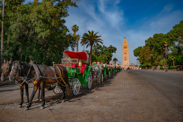
- The Koutoubia Mosque: The absolute spiritual and visual symbol of Marrakech. While non-Muslims cannot enter the prayer hall, the magnificent 77-meter-high minaret is the focal point of the city and a premier example of Almohad architecture. The vast surrounding gardens offer a perfect vantage point for photography, sunset strolls, and relaxing away from the medina's bustle.
- El Badi Palace: Commissioned by Sultan Ahmad al-Mansur in the 16th century, this once-lavish palace is a breathtaking monumental ruin. Today, visitors can explore the vast sunken gardens, towering ancient walls, and sprawling courtyards. The site houses a museum with exhibits showcasing Moroccan heritage—most notably the original 12th-century Koutoubia Minbar—and visitors can often observe storks nesting on the high palace ramparts.
- Bahia Palace: A masterpiece of 19th-century Moroccan architecture, this expansive palace was built to capture the pinnacle of Islamic and Moroccan design. Clients can wander through its beautifully preserved, sunlit courtyards lined with orange trees, admire the incredibly intricate zellige tilework, and explore the lavish rooms with painted cedarwood ceilings.
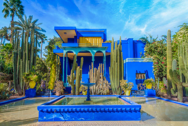
- Jardin Majorelle (Majorelle Garden): Located just outside the ancient walls, this striking botanical oasis was created by French painter Jacques Majorelle and famously restored by fashion designer Yves Saint Laurent. Known for its vibrant cobalt-blue accents (Majorelle Blue), exotic cacti, and tranquil bamboo pathways, it is one of the most photographed and visited locations in the city.
Accommodations: The Authentic Riad Experience vs. Modern Hotels
Choosing where to stay in Marrakech defines the entire travel experience. The city offers two beautifully distinct styles of accommodation catering to different tastes:
- Traditional Riads (Inside the Medina): For a deeply authentic and culturally immersive experience, clients should book a stay in a Riad. These are historic Moroccan homes tucked away in the narrow alleys of the ancient medina. Riads are uniquely built facing inward around a central, open-air courtyard—often featuring a plunge pool, a trickling fountain, and lush gardens. The moment you step through a Riad's heavy wooden door, the bustling noise of the souks vanishes, replaced by utter tranquility and personalized Moroccan hospitality.
- Modern Hotels and Luxury Resorts (Gueliz, Hivernage, and Palmeraie): For visitors seeking expansive spaces, large swimming pools, contemporary luxury, and easy car access, the modern districts outside the medina walls are ideal. Neighborhoods like Hivernage and Gueliz offer world-class, multi-star hotels and international brands with modern amenities. Further out, the Palmeraie (the vast palm grove on the city's outskirts) provides ultra-luxurious, sprawling resort experiences perfect for relaxation and family vacations.
Logistical Guidelines and City Navigation
Accessing and moving around the hyper-complexity of Marrakech is highly convenient, thanks to a well-developed, multi-modal transport network designed to facilitate tourism.
Comprehensive Transportation to the City
Marrakech is exceptionally well-connected both domestically and internationally:
- Air Travel: The Marrakech Menara Airport (RAK) is a modern international hub located just a short 15-minute drive from the city center. It offers direct, frequent flights connecting to major European capitals and global destinations.
- Intercity Rail (ONCF): The national railway system is highly reliable. The modern Marrakech train station, located centrally in the Gueliz district, is the southern terminus for the "Al Atlas" train service. This network seamlessly connects Marrakech to the northern economic hubs like Casablanca, Rabat, and Tangier (linking up with the high-speed Al Boraq train), with daily departures scheduled on an almost hourly basis.
- Premium Coach Services (CTM and Supratours): For destinations not covered by the rail network—such as the coastal cities of Agadir and Essaouira, or routes heading south toward the Sahara desert—national premium bus companies like CTM and Supratours provide highly comfortable, air-conditioned coach travel with designated, safe bus terminals.
- Taxis (Grand Taxis): For regional travel to nearby valleys like Ourika or towns in the High Atlas, shared or private "Grand Taxis" (typically larger vans or sedans) are readily available at designated ranks.
Ease of Navigation within Marrakech
Getting around the city is straightforward, provided you choose the right method for the right neighborhood:
- Petit Taxis: For moving between the modern districts (Gueliz, Hivernage) or traveling from the modern city to the edge of the old medina, "Petit Taxis" (small yellow cabs) are omnipresent. They are a highly affordable and quick way to navigate, though travelers should always request the driver to use the meter (le compteur).
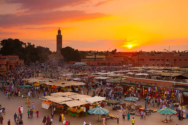
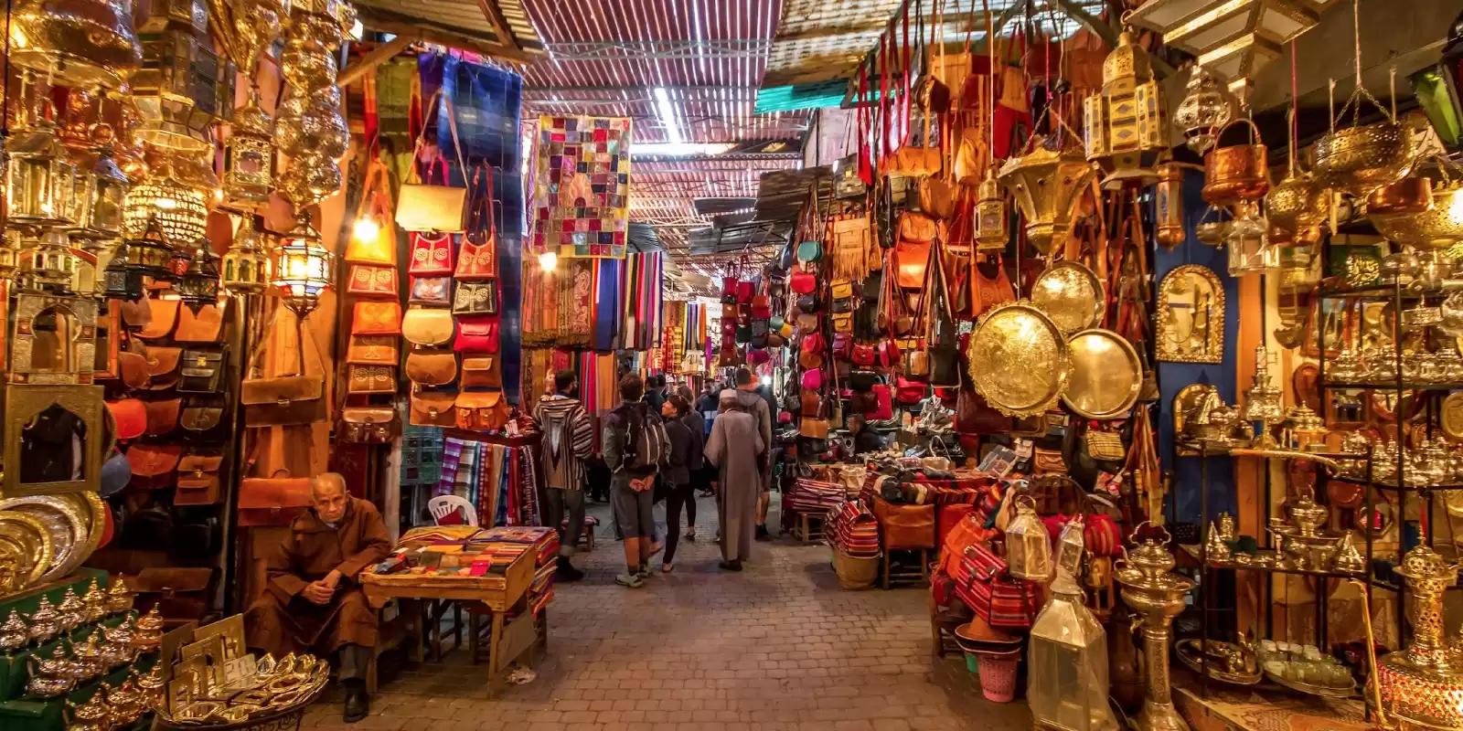
- Walking the Medina: The historic heart of the city—the ancient Medina—is largely pedestrian-only. Navigating its labyrinthine souks, vibrant squares (like Jemaa el-Fnaa), and historical monuments is best done on foot. Walking allows clients to fully absorb the sensory experience of the city.
- Calèches (Horse-Drawn Carriages): For a leisurely, scenic, and romantic way to travel—especially between the medina walls and landmarks like the Majorelle Garden—traditional green horse-drawn carriages line up near Jemaa el-Fnaa and offer dedicated touring routes.
How to travel to Marrakech
Marrakech Menara Airport – national and international flights
ONCF from Casablanca, Rabat and Fes
CTM & Supratours – comfortable journeys
Well accessible highways and national roads
Our Experiences around Marrakech
Hover to explore · Click to book
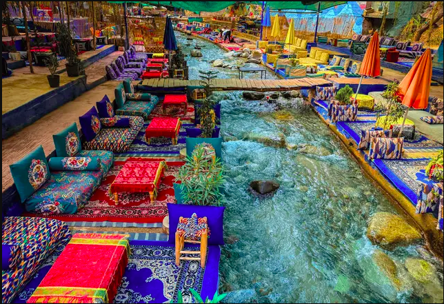
Ourika Valley
Atlas · Waterfalls · Berber Villages
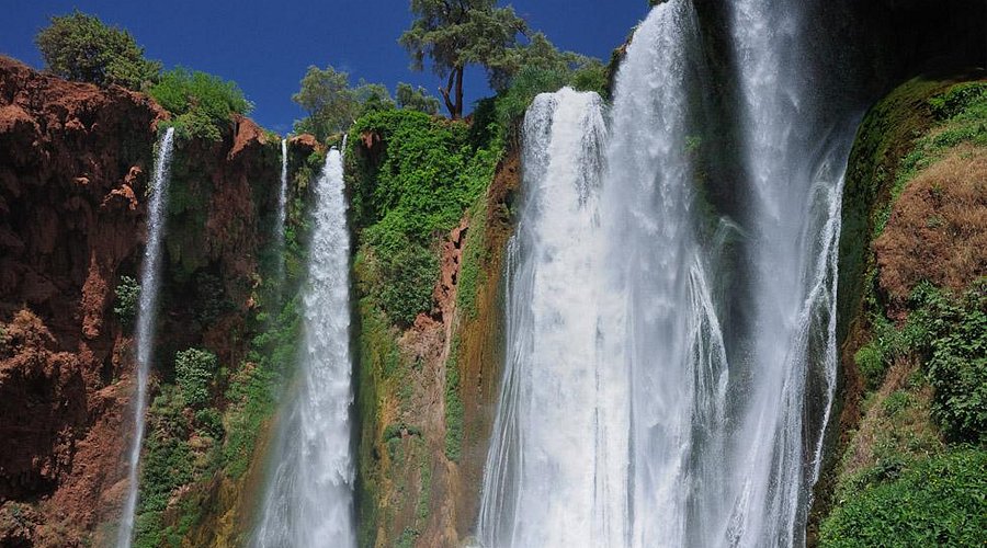
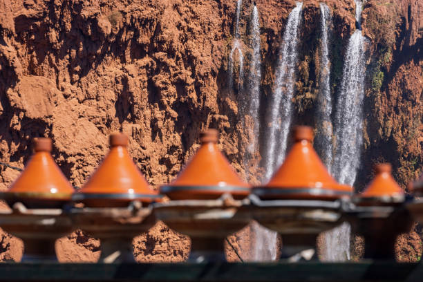
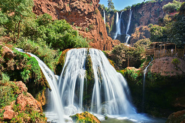
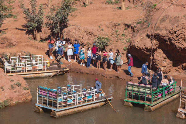
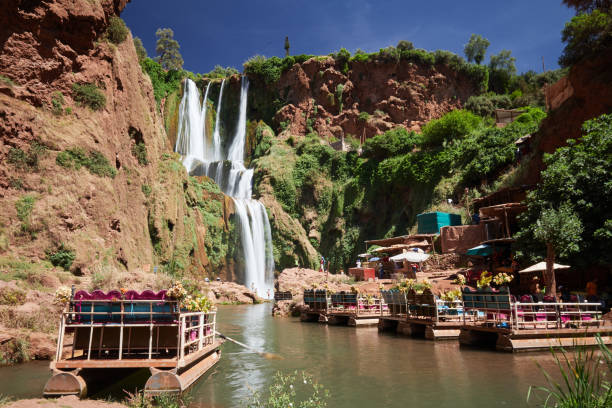
Ouzoud Waterfalls
Nature · Hiking · Panoramic Views
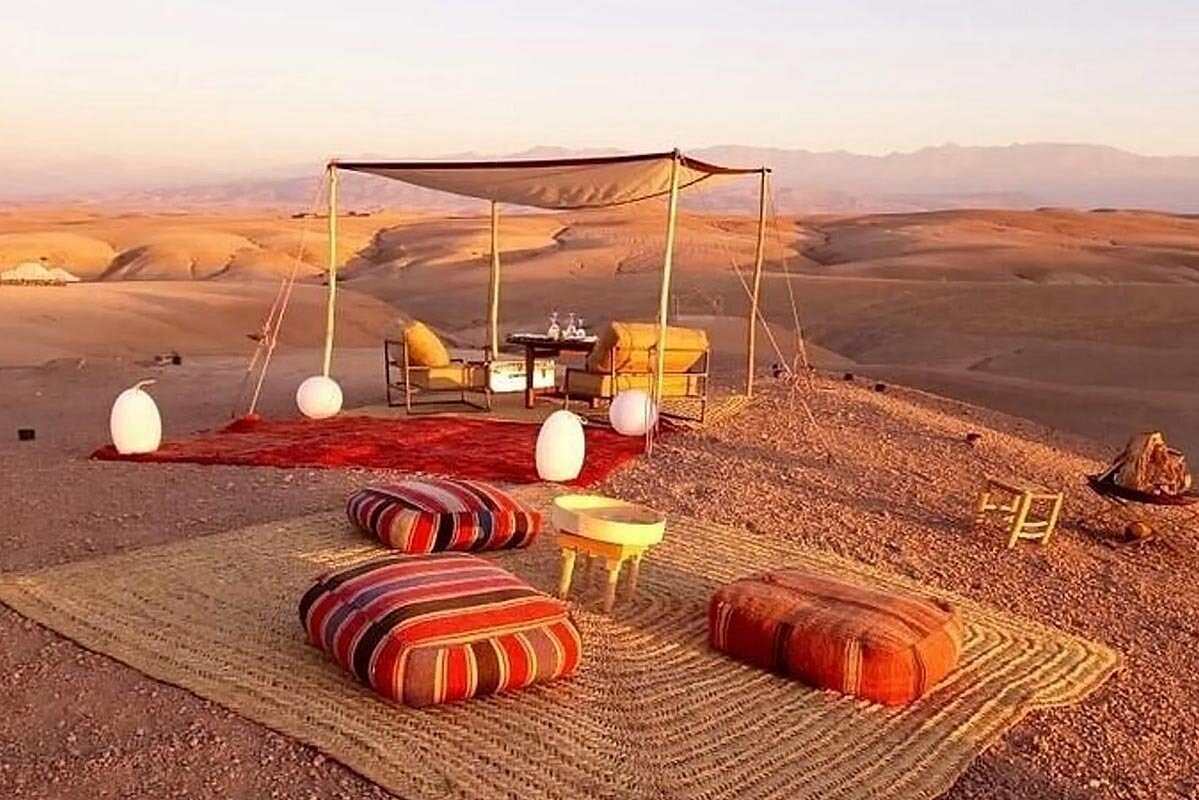
Agafay Desert
Quad · Camel · Sunset Dinner
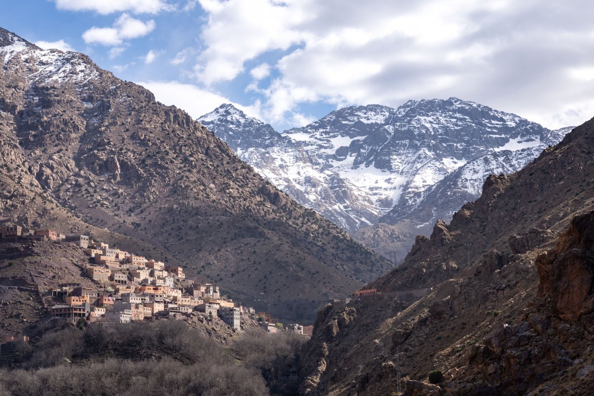
Imlil & Atlas
Hiking · Berber Villages · Mt Toubkal
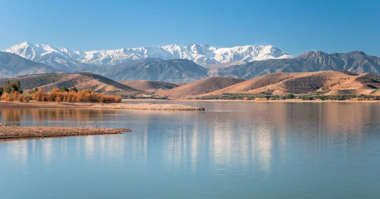
Lalla Takerkoust Lake
Desert Lake · Jet Ski · Relaxation
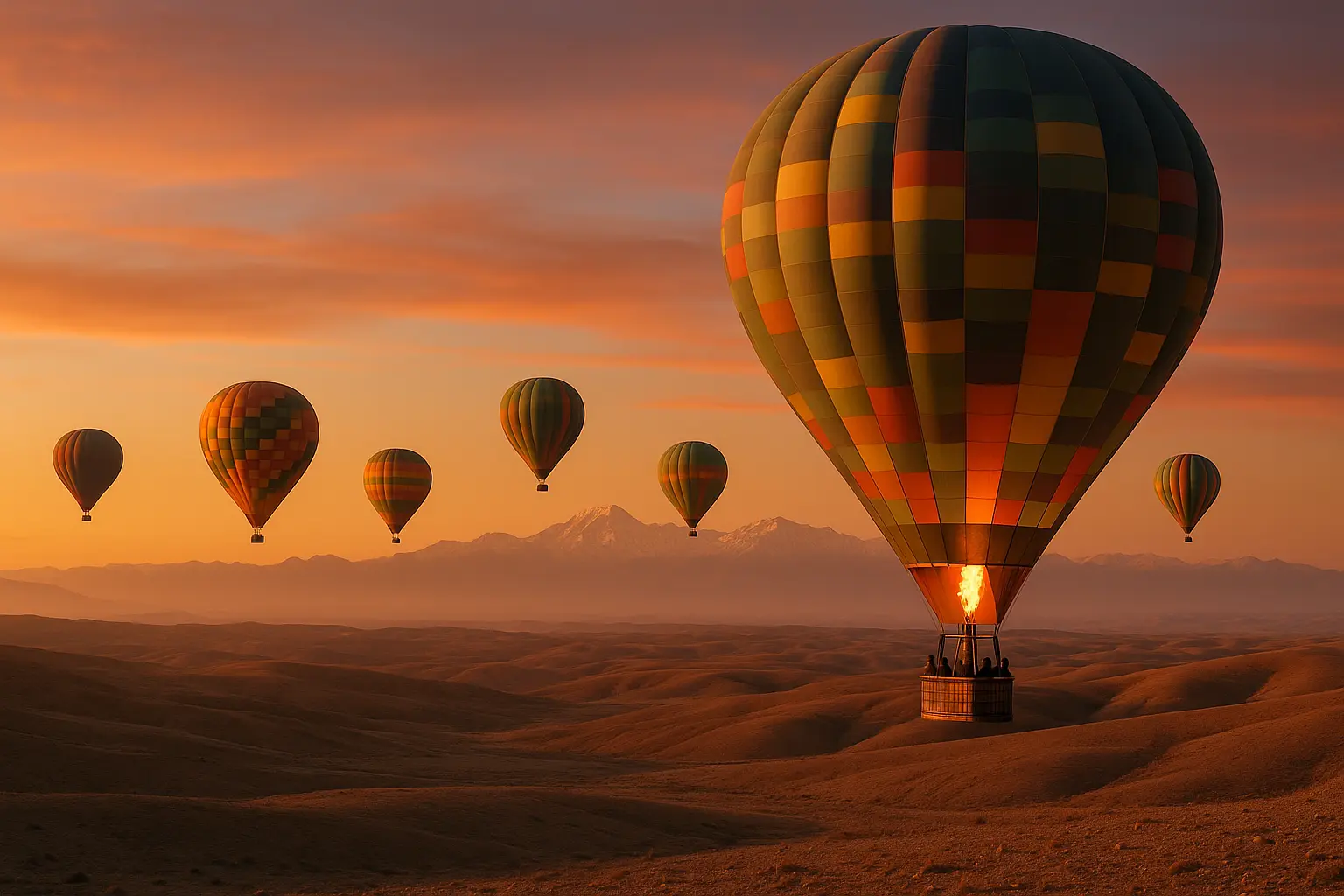
Hot Air Balloon
Sunrise Flight · Berber Breakfast
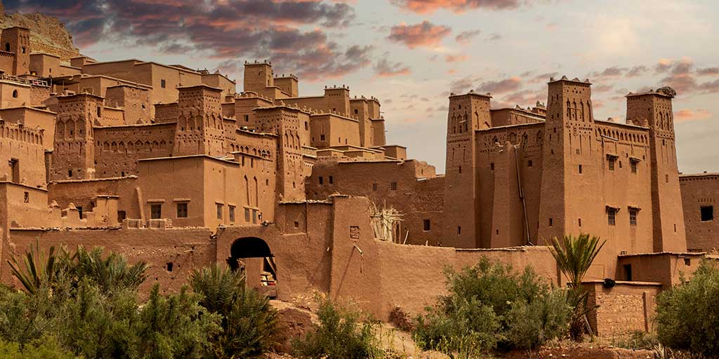 o UNESCO
Ouarzazate
The gateway to the desert and cinema. Ancient kasbahs and desert film studios.
o Door of the DesertOuarzazate
Comprehensive Analytical Report: Historical Monuments, Earthen Architecture, and Heritage Dynamics of Ouarzazate
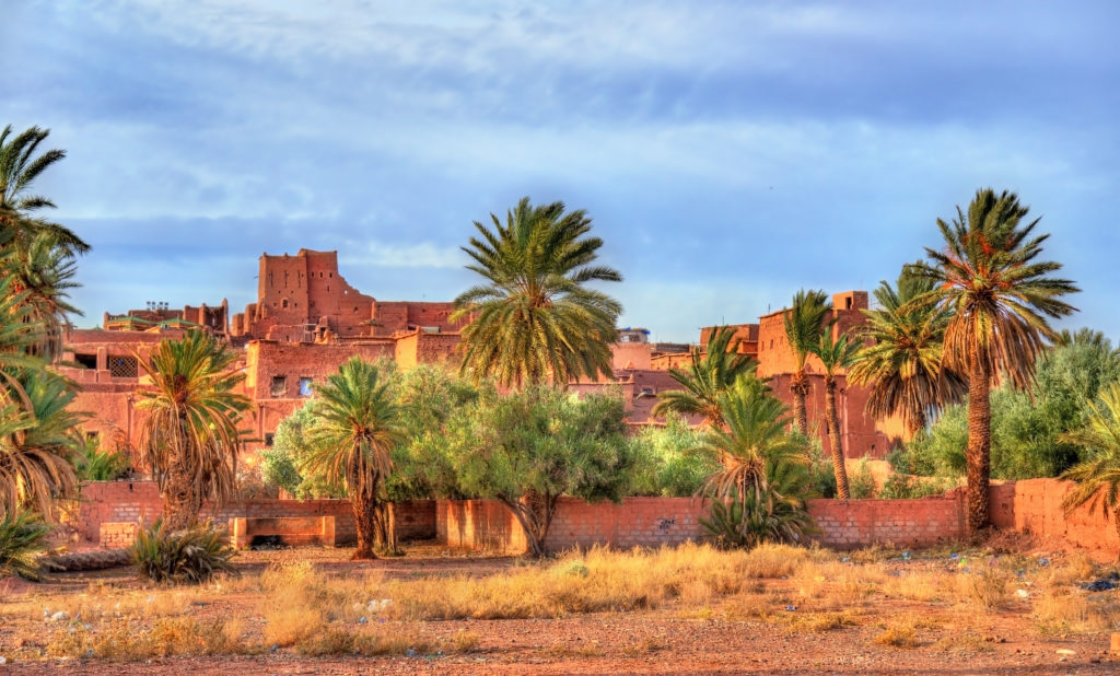
Ouarzazate and its surrounding valleys occupy a position of singular importance in the architectural and historical narrative of southern Morocco. Known historically as the "Door to the Desert," the region evolved at the strategic crossroads where trans-Saharan trade routes met the High Atlas mountain passes. This report provides an exhaustive analysis of Ouarzazate's monumental historical landscape—examining the engineering of its earthen fortresses, the legacy of the Glaoui dynasty, the UNESCO-designated Ksar Aït Benhaddou, Kasbah Taourirt, and the surrounding network of historic kasbahs.
1. Geopolitical Genesis & The Trans-Saharan Caravan Routes
To understand the historical monuments of Ouarzazate, one must examine the region's ancient role as a commercial and geopolitical bottleneck.
- The Oasis Crossroads: Situated at the confluence of the Draa, Dades, and Ounila valleys, Ouarzazate served as a crucial staging point for trans-Saharan merchant caravans traveling between Timbuktu and the imperial city of Marrakech. Caravans carrying gold, spices, salt, and textiles relied on these fortified oasis settlements to rest, resupply, and pay transit tolls before attempting the treacherous crossing of the High Atlas Mountains.
- Rise of the Glaoui Hegemony: In the 19th and early 20th centuries, the political landscape was dominated by the Glaoui family—most notably Thami El Glaoui, the Pasha of Marrakech. Through strategic alliances with regional caïds and later the French Protectorate, the Glaoui clan consolidated immense wealth and authority, constructing massive fortified strongholds (kasbahs) across southern Morocco to control trade routes and enforce taxation.
2. Structural Science of Earthen Architecture (Pisé & Adobe)
The historical monuments of the Ouarzazate region represent the pinnacle of pre-Saharan earthen engineering, designed for both military defense and environmental adaptation.
- Foundation & Load-Bearing Walls: Kasbahs and ksour in southern Morocco are constructed on solid bedrock foundations to protect against ground moisture and seismic movement. The primary load-bearing walls are built using rammed earth (tabia), where damp soil, clay, and straw are compressed into wooden formworks. These walls are often up to two feet (60 centimeters) thick at the base, offering exceptional thermal mass that keeps interiors cool during intense desert days and retains warmth during cold nights.
- Upper Decor & Adobe Bricks: While rammed earth forms the heavy lower stories, lighter sun-dried mud bricks (adobe) are used for the upper floors, corner towers, and ornamental motifs. This reduces structural weight on the base while allowing builders to press intricate geometric patterns into the clay facades.
- Interior Ceilings (Tataoui): Structural ceilings are constructed using cedar or palm wood beams overlaid with woven oleander stems (tataoui), often painted with natural organic pigments in geometric Amazigh patterns.
3. Masterpiece Landmark 1: Ksar Aït Benhaddou (UNESCO World Heritage Site)
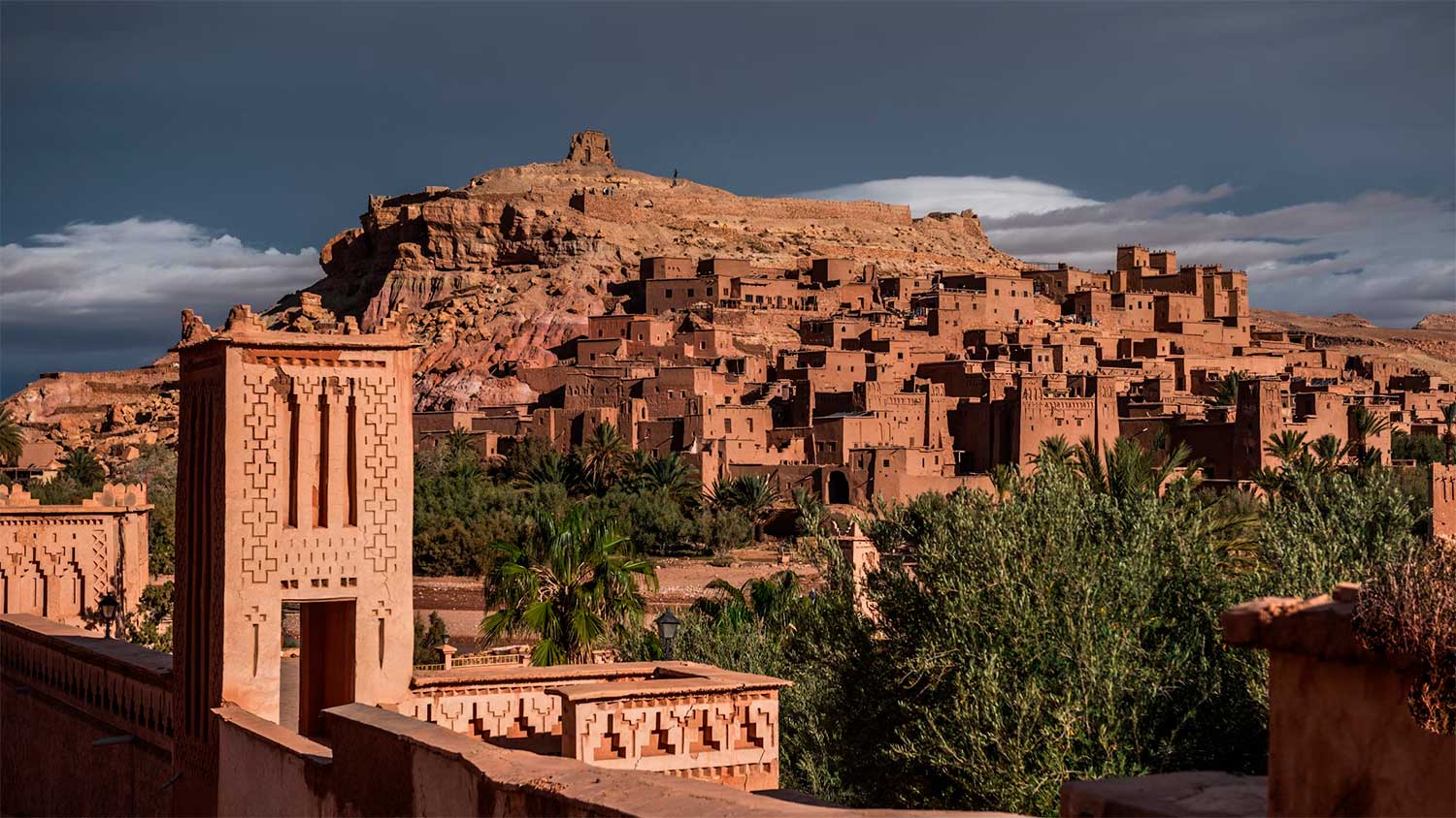
Located approximately 30 kilometers northwest of Ouarzazate along the Ounila Valley, Ksar Aït Benhaddou is widely recognized as the most complete and spectacular example of southern Moroccan earthen architecture.
- History & Layout - Origins: Founded in the 11th century by the prominent Berber chief Ben-Haddou, the site originally developed as a fortified caravanserai along the Marrakech-Timbuktu trade route. Over centuries, it expanded into a densely packed, permanent earthen village (ksar).
- Defensive Structure: The entire settlement is enclosed within high defensive walls reinforced by square corner towers. Individual clay dwellings crowd together up the hillside, linked by narrow, covered alleyways designed to confuse invaders. Aït the highest peak sits the fortified collective granary (agadir), offering a commanding view of the river valley.
- Preservation & Modern Life - UNESCO Inscription: Recognized as a UNESCO World Heritage Site in 1987, Aït Benhaddou stands as an authentic pre-Saharan habitat.
- CERKAS Oversight: The Center for Conservation, Restoration, and Rehabilitation of Ksours and Kasbahs (CERKAS), headquartered in Ouarzazate, oversees all structural maintenance to ensure traditional mud-brick and clay methods are strictly maintained without the introduction of modern concrete.
- Cinematic Legacy: Aït Benhaddou has served as an iconic filming location for legendary historical and cinematic productions, including Lawrence of Arabia, Gladiator, The Mummy, and Game of Thrones.
4. Masterpiece Landmark 2: Kasbah Taourirt
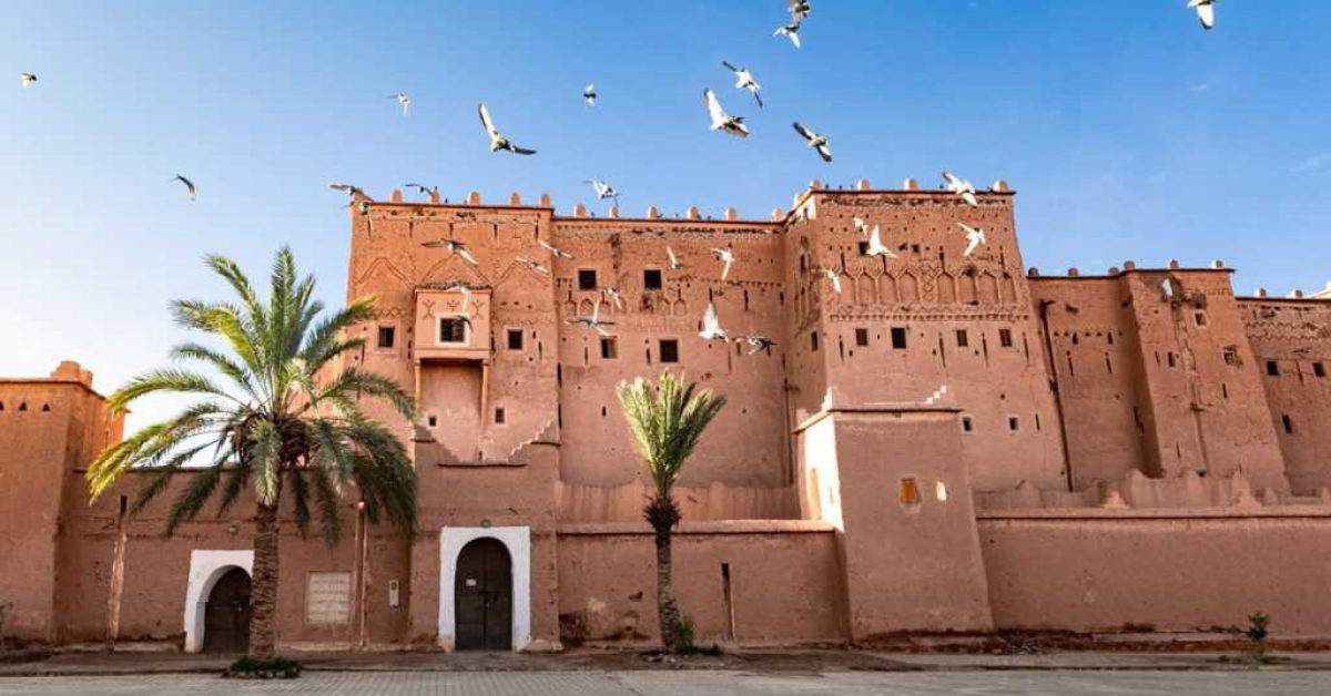
Situated in the heart of Ouarzazate, Kasbah Taourirt is one of the largest and best-preserved palatial kasbahs in Morocco.
- History & Scale - Construction: Originally built in the 17th century out of adobe and rammed earth, the complex was massively expanded in the 19th century by the Glaoui family, eventually containing nearly 300 rooms.
- National Heritage Distinction: Unlike popular belief, Kasbah Taourirt is not a UNESCO World Heritage Site (a distinction held solely by Aït Benhaddou in the immediate area), but it has been officially classified as a Moroccan National Heritage site since 1954.
- Architectural Highlights - Ahwach Courtyard: The main entrance opens onto a vast interior courtyard historically used for royal receptions, celebrations, and traditional Ahwach music and dance performances.
- Interior Craftsmanship: The restored private apartments of the Glaoui pashas showcase refined city-style craftsmanship imported from Marrakech and Fez—including sculpted painted plaster, geometric zellige tilework, and painted wood ceilings.
- Candle Ledges: Throughout the winding corridors, visitors can observe specialized candle ledges built about one meter high into the earthen walls, which functioned as early lighting fixtures.
- Post-Earthquake Restoration: The earthquake of September 2023 caused structural damage to sections of the kasbah, prompting ongoing consolidation and scientific restoration projects to secure the ancient walls.
5. Other Key Historical Monuments of the Region
- Kasbah Telouet: Located further up the Ounila Valley near the Tizi n'Tichka pass, this was the primary mountain seat of the Glaoui pashas. While its exterior is in a state of partial ruin, its interior reception halls feature some of the most opulent zellige tilework and carved stuccowork in North Africa.
- Kasbah Amridil (Skoura): Situated in the nearby Skoura palm grove, this 17th-century fortified kasbah is famous for its exceptionally preserved defensive towers and traditional agricultural olive presses.
- Kasbah Tifoultoute: Located a few kilometers west of Ouarzazate, this elevated kasbah served as a strategic outpost guarding the river entry to the city.
6. Comparative Matrix of Major Historical Monuments
| Monument Name | Typology & Classification | Founding Era | Historical Significance & Characteristics |
|---|---|---|---|
| Ksar Aït Benhaddou | Fortified Earthen Village (Ksar) | 11th Century (UNESCO World Heritage Site since 1987) | Pre-Saharan caravanserai settlement; defensive corner towers; hilltop granary; famous cinema set. |
| Kasbah Taourirt | Palatial Fortress (Kasbah) | 17th Century (Expanded 19th C.; Moroccan National Heritage) | Administrative seat of the Glaoui family; nearly 300 rooms; tataoui ceilings, zellige, and Ahwach courtyard. |
| Kasbah Telouet | Mountain Stronghold | 18th–19th Century | High-Atlas stronghold of Pasha Thami El Glaoui; opulent Andalusian-style interior decor hidden within earthen walls. |
| Kasbah Amridil | Oasis Kasbah | 17th Century | Located in the Skoura palmeraie; classic example of a self-sustaining family fortification with olive presses and grain storage. |
7. Cinematic Landmarks & Modern Heritage
Ouarzazate's historical architecture laid the foundation for its modern identity as "Africa's Hollywood".
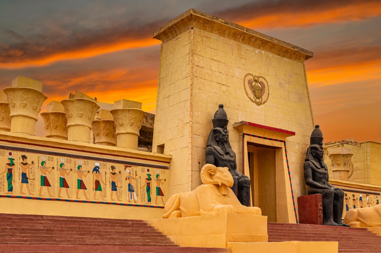
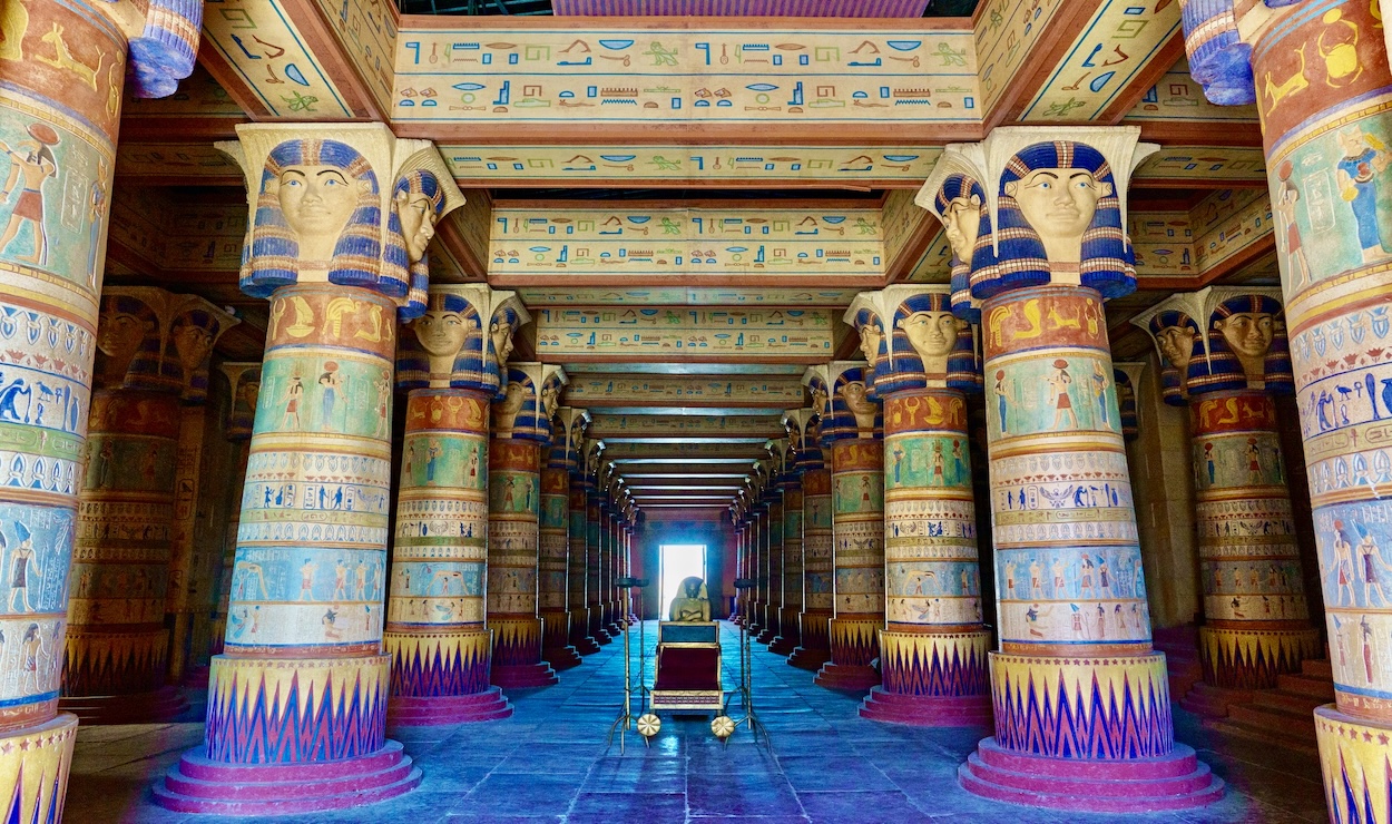
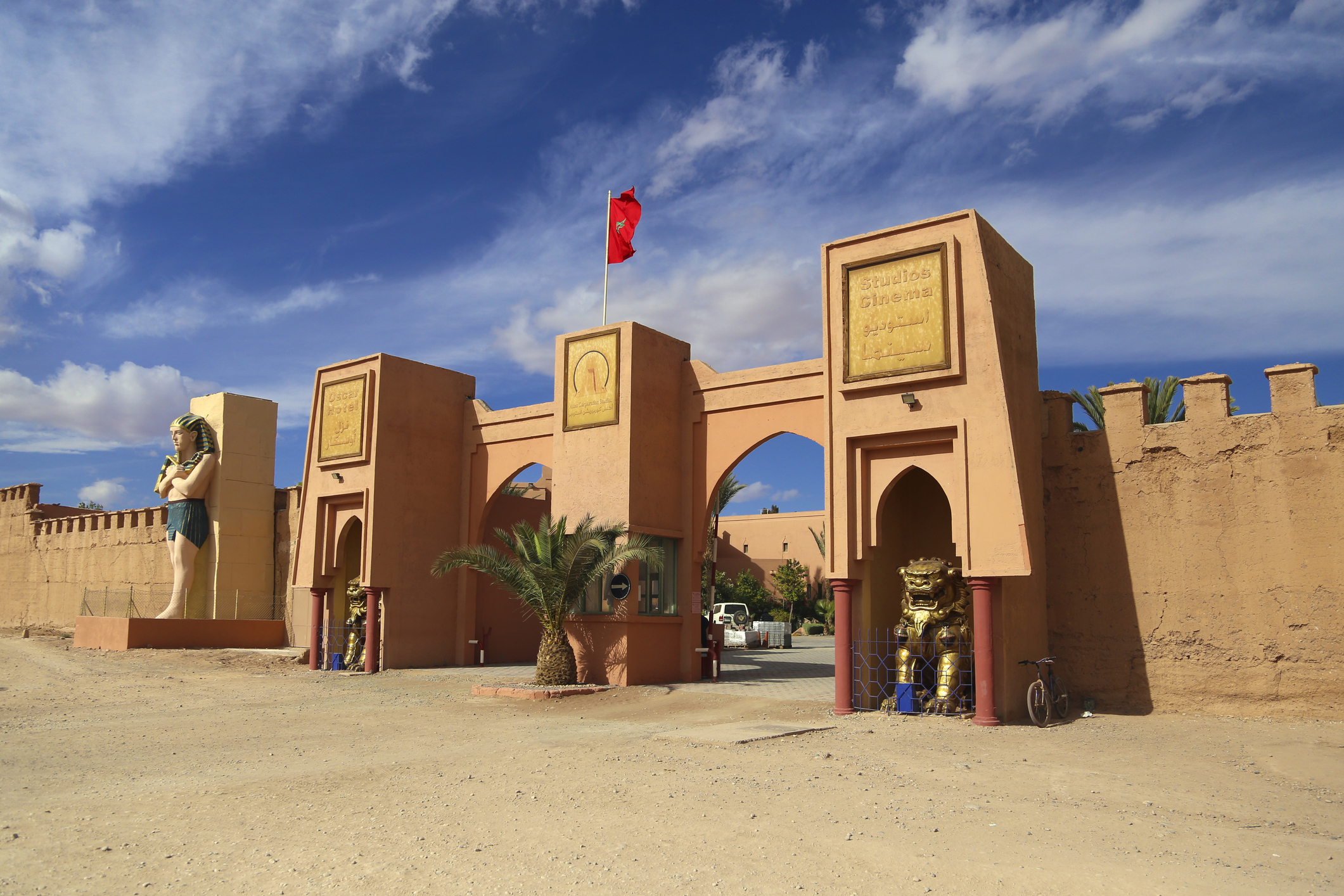
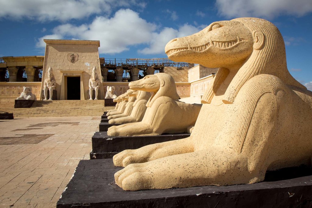
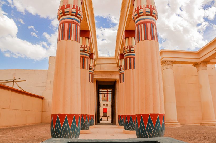
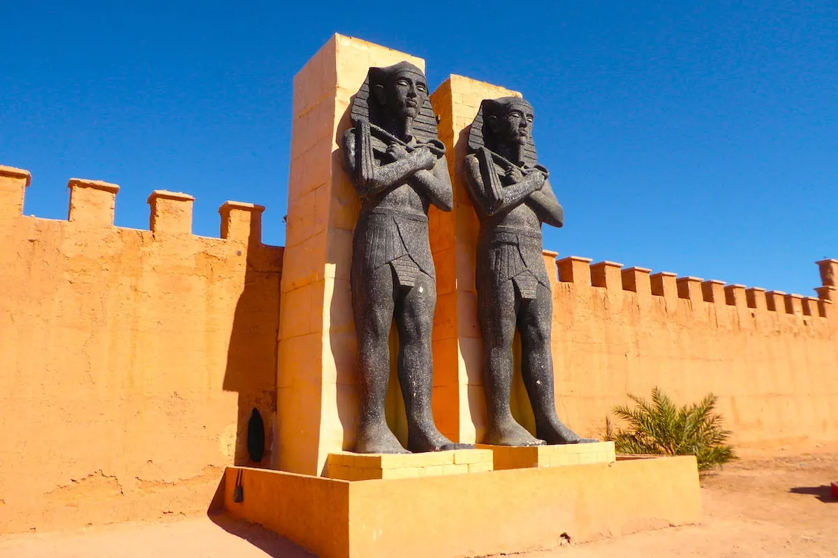
- Atlas Film Studios: Founded in 1983, it stands as one of the largest film studios in the world, containing massive preserved sets of Egyptian temples, Roman arenas, and desert fortresses used in international blockbusters.
- Cinema Museum: Located directly across from Kasbah Taourirt, this museum houses historic cameras, props, and backdrops from famous productions shot in the region over the past century.
8. Visitor Logistics & Practical Guidance
- Access via Tizi n'Tichka: Reaching Ouarzazate from Marrakech involves crossing the High Atlas Mountains via the Tizi n'Tichka pass (2,260 meters elevation) along the N9 national road—a scenic journey featuring panoramic viewpoints such as Aït Barka and Toufliht.
- Flight Infrastructure: Ouarzazate Menara Airport (OZZ) is located just 2 kilometers from Kasbah Taourirt and the city center, receiving domestic flights from Casablanca and select regional connections.
- Local Transit: Visitors traveling to Aït Benhaddou via public transport can take a bus along the N9 road to Tabouraht village (30 km before Ouarzazate) and transfer to a local taxi or minibus.
- Best Seasons to Visit: The ideal visiting windows are Spring (March to May) and Autumn (October to November), when daylight temperatures are mild and the low-angled sunlight enhances the warm, reddish textures of the earthen facades for photography.
Detailed Itinerary
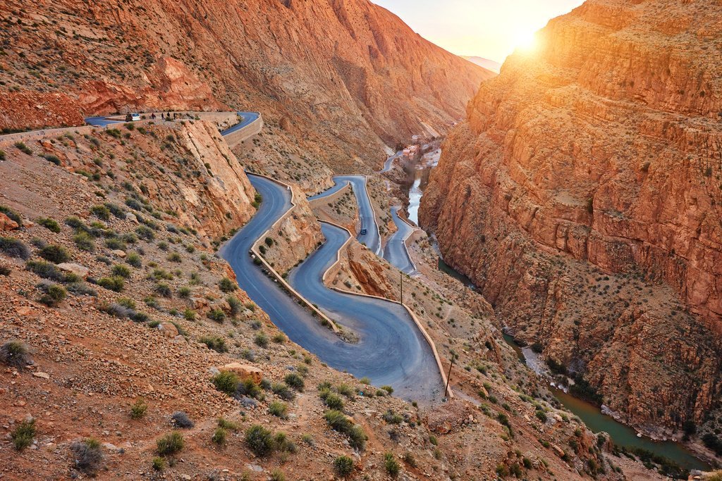
Day 1: Ouarzazate – Ait Ben Haddou – Dades Valley
- Your trip begins in Ouarzazate with a visit to the legendary Ait Ben Haddou Kasbah, a fortified village famous for its historical architecture and appearances in international films and series.
- After exploring the kasbah and enjoying lunch nearby, continue through beautiful desert landscapes and traditional Berber villages along the Road of the Thousand Kasbahs.
- Arrive in the Dades Valley in the evening, where you will check in to a comfortable hotel or riad. Dinner and overnight stay included.
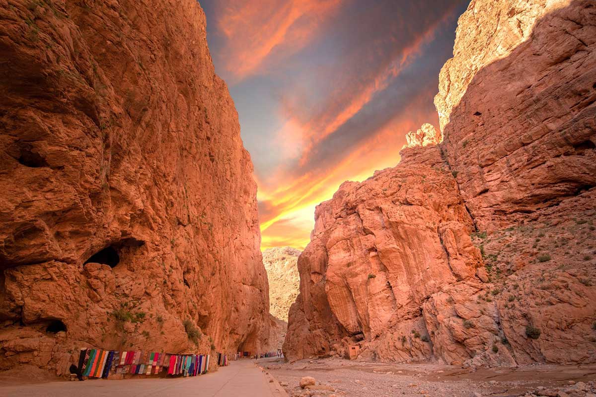
Day 2: Dades Valley – Todra Gorges – Merzouga Desert
- After breakfast, head toward the spectacular Todra Gorges. Take time to walk between the dramatic cliffs rising up to 300 meters high.
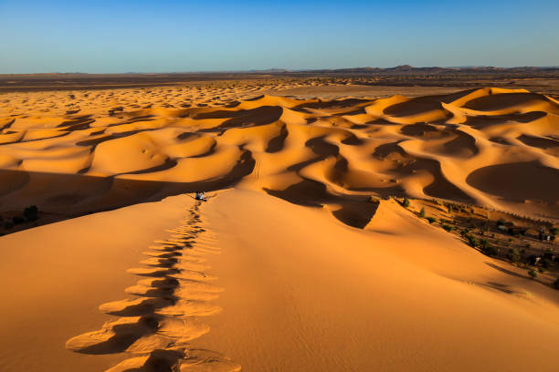
- Later, continue to Merzouga where your camel guide will be waiting. Ride your camel across the golden dunes of Erg Chebbi while enjoying a breathtaking sunset.
- Arrive at your desert camp where you’ll enjoy dinner, traditional Berber music, and a peaceful night beneath the stars.
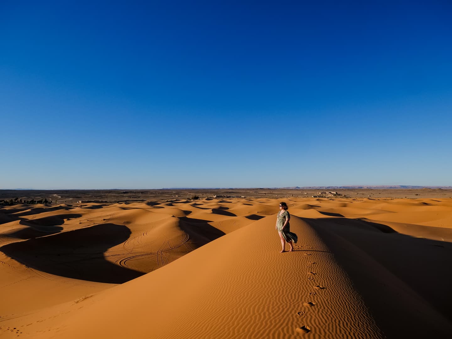
Day 3: Merzouga – Ouarzazate – Marrakech
- Wake up early to admire the sunrise over the dunes. After breakfast at the camp, begin the return journey through ever-changing desert and mountain scenery.
- Pass through Ouarzazate and continue toward Marrakech. Arrival in the evening, marking the end of your unforgettable Sahara adventure.
Frequently Asked Questions
Is this a private or shared tour?
This is a shared small-group experience with travelers from different countries.
How long is the camel ride?
The camel trek usually lasts about 1 to 1.5 hours (depending on the season and camp location).
Can I skip the camel ride?
Yes, 4x4 transfer to the camp can be arranged if preferred.
Is sandboarding included?
Yes, sandboarding is available at the camp and included in the experience.
Are the bathrooms private at the camp?
Depending on the camp category (standard or luxury), bathrooms may be shared or private.
What should I bring?
Comfortable clothes, sunglasses, sunscreen, scarf for the desert wind, comfortable shoes, and a small overnight bag.
 o Bucket List
Merzouga
Experience pure magic among golden dunes. Ride camels at sunset and sleep under starry skies.
o The Sea of DunesMerzouga
Comprehensive Geographical, Cultural, and Logistical Guide to Merzouga and Erg Chebbi, Morocco
Geographical Synthesis and Spatial Infrastructure of Merzouga and Erg Chebbi
Geological Formation and Physical Geography
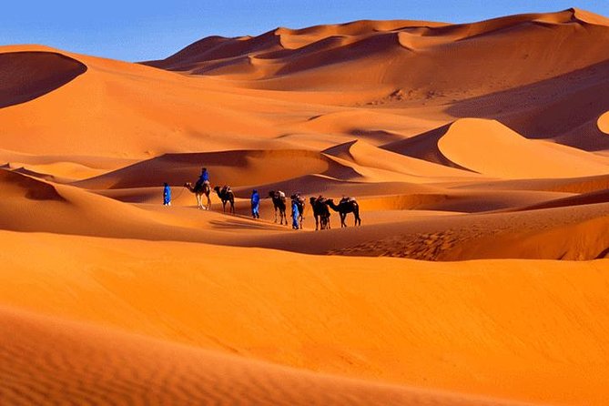
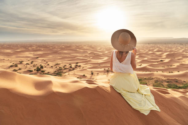
The desert landscape of southeastern Morocco within the Tafilalet region is defined by a fundamental geomorphological distinction between two primary arid terrain types: the hamada and the erg. The vast majority of the Saharan landscape comprises the hamada, a hyper-arid plateau consisting of exposed bedrock, gravel, and dark volcanic pavement. Resting directly atop this crystalline basement is Erg Chebbi, a massive sand dune field characterized by aeolian accumulations that reach heights of up to 150 meters.
Geological and paleoclimatic evidence indicates that this region was not historically arid. Approximately 9,000 to 10,000 years ago, during the African Humid Period, the area contained a lush tropical ecosystem supported by perennial river systems, lake basins, and dense vegetation. Subsequent macro-climatic shifts drove severe desertification, transforming these ancient hydrological networks into hyper-arid expanses. Over millennia, wind-driven sand aggregation formed Erg Chebbi’s dune ridges. The sand shifts visually under changing angles of solar incidence, transitioning from soft pale yellow during midday to ochre, orange, and deep crimson during sunrise and sunset.
Gateway Settlements and Spatial Infrastructure
Understanding the spatial distinction between permanent frontier settlements and the dune field is essential for regional logistics. Merzouga is not itself a dune formation, but a permanent border settlement and administrative hub situated along the western edge of Erg Chebbi. A chain of peripheral oasis settlements—including Hassi-Labiad, Tanamoust, Takoujt, and Merzouga proper—forms an infrastructural border running parallel to the dune sea.
This spatial configuration establishes an accessible desert gateway. Paved regional highways, notably the N13, extend directly to the margin of the sand mass, allowing standard passenger vehicles to reach the periphery of the Sahara. Beyond this paved road, asphalt gives way to unpaved sand tracks (pistes) and open dunes, requiring four-wheel-drive (4x4) vehicles, specialized desert transport, or camel caravans to navigate to bivouac camps situated deeper within Erg Chebbi.
Cultural Heritage, Ethno-Tourism, and Historical Dynamics
The Gnawa Musical Tradition of Khamlia
Located seven kilometers south of Merzouga on a paved road lies Khamlia, a small settlement that serves as a center for the region's sub-Saharan African heritage. The inhabitants of Khamlia are descendants of formerly enslaved sub-Saharan Africans and trade caravan workers brought northward along trans-Saharan routes from Central and West Africa. Following emancipation and periods of semi-nomadic pastoralism, this community formed permanent settlements along the desert margin, preserving their heritage through Gnawa music.
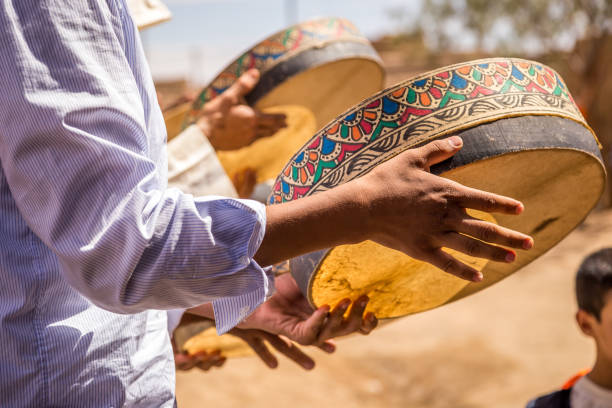
Gnawa is a sacred musical and spiritual tradition recognized by UNESCO as Intangible Cultural Heritage of Humanity. Originally developed as a trance-inducing healing ritual (lila), the music combines West African rhythmic structures with Islamic Sufi spiritual invocations. The primary instrumentation includes the guembri (a three-stringed, camel-neck lute with a leather-covered wooden resonator), heavy iron castanets known as qraqeb, and large hand-played drums called tbel.
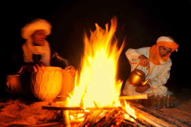
In Khamlia, musical groups such as Les Pigeons du Sable maintain communal performance spaces where visitors are welcomed with traditional mint tea to experience live acoustic sessions. These performances provide direct socio-economic support to the community through voluntary financial contributions (gratuité) and media sales, establishing a sustainable ethno-tourism model that preserves historical memory.
Trans-Saharan Trade Routes, Nomadic Pastoralism, and Archaeological Heritage
Merzouga’s cultural ecosystem is historically linked to trans-Saharan trade networks. For centuries, merchant caravans carrying gold, salt, spices, and slaves crossed the Sahara, utilizing the Tafilalet oasis network—anchored by the historic market town of Rissani—as their primary northern destination. Rissani continues to host one of southern Morocco’s most authentic working souks, serving as an active regional market for dates, livestock, spices, and artisan crafts rather than a staged tourist site.
Beyond the oasis towns, the surrounding stone desert (hamada) retains traces of nomadic Berber pastoralism, where semi-nomadic families maintain seasonal tent encampments across the arid terrain. Regional off-road excursions routinely visit these communities, demonstrating desert adaptation and the formal three-glass tea ritual, which forms the cornerstone of Saharan hospitality.
The surrounding landscape contains significant archaeological and industrial sites:
- Mifis Mines: Located on the nearby desert plateau, these open-pit mining sites were developed during the French colonial era for lead sulfide, galena, and kohl mineral extraction.
- Marha Plateau: Features contemporary geometric land art installations, including large-scale stone sculptures integrated into the desert plain.
- Taouz Outskirts: Houses prehistoric necropolises featuring vertical flagstone burial structures, alongside rock art sites (petroglyphs) displaying ancient hunting scenes carved into rock faces.
Regional Architectural Context: The Kasbah and Ksar Ecosystem
The architectural identity of the transport corridors leading to Merzouga is defined by earthen structural traditions. As trans-Saharan trade expanded, fortified village settlements known as ksour (singular ksar) and individual castles known as kasbahs were built along river valleys such as the Ounila, Draa, and Ziz.
These structures utilize rammed earth (pisé)—a dense mix of local clay, straw, gravel, and water compacted within temporary wooden formworks to construct load-bearing exterior walls up to two feet (60 cm) thick. Lighter sun-dried adobe bricks are used for upper decorative towers, parapets, and geometric friezes. This construction offers high thermal mass, keeping interior spaces cool during extreme summer heat and retaining warmth during cold desert nights.
Two regional landmarks illustrate this architectural heritage:
- Ksar Aït Ben Haddou: A UNESCO World Heritage site since 1987 located in the Ounila Valley. Dating to the 11th century as a key caravanserai on the Marrakech-Timbuktu trade route, it features perimeter defensive walls reinforced by corner watchtowers surrounding grouped earthen dwellings.
- Kasbah de Taourirt: Located in Ouarzazate, this massive 17th-century structure was expanded in the 19th century under the Glaoui clan. Containing nearly 300 rooms decorated with painted cedar ceilings, carved stucco panels, and woven palm-stalk (tataoui) ceilings, it served as a primary regional administrative center.
Desert Activity Dynamics and Ecotourism Framework
Camel Caravan Trekking and Microclimatic Dynamics
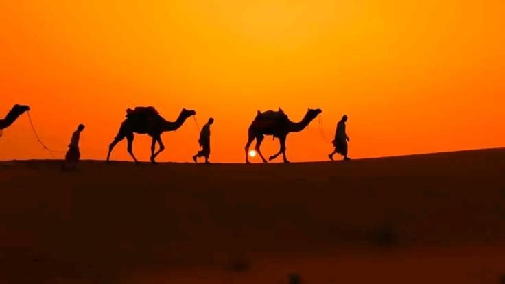
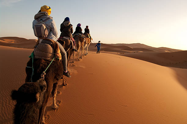
Camel trekking remains a primary method for crossing the sand mass. Dromedaries are naturally adapted for dune navigation due to broad, padded feet that distribute weight across loose sand. Their rhythmic gait provides steady movement across steep dune slopes.
Excursions are planned around daily solar cycles to avoid extreme mid-day heat and capture optimal lighting. Late afternoon caravans depart edge accommodations approximately one to two hours before sunset, allowing travelers to navigate the dunes as low solar angles create dramatic shadow contrasts across the sand ridges. Early morning treks depart prior to dawn to reach high dune crests before sunrise, witnessing the sand change colors from dark purple to warm gold as daylight emerges.
Practical precautions are important for participant comfort and safety during treks. Riders are advised to wear loose, breathable, long-sleeved clothing to mitigate solar radiation while preventing skin friction against saddles. Closed footwear is recommended for walking up sand inclines, and traditional cotton headscarves (shemaghs) protect against windblown sand.
Motorized Excursions, Sandboarding, and Accessibility
For travelers seeking faster transit or deeper exploration of the surrounding stone plateau (hamada), motorized 4x4 tours using four-wheel-drive vehicles provide an efficient alternative. Experienced drivers navigate unpaved desert tracks to reach isolated nomad encampments, fossil beds near Erfoud, the abandoned Mifis mines, and seasonal wetlands such as Dayet Srji—which attracts wild flamingo populations during wet spring months. These motorized circuits also allow elderly visitors or those with limited physical mobility to experience high-dune vantage points without climbing steep sand slopes.
Sandboarding is commonly integrated into both camel and 4x4 itineraries. Participants use modified snowboards to slide down steep dune slopes reaching heights of 150 meters. Because dry sand creates more friction than snow, speeds remain manageable, making the activity suitable for various skill levels.
Comparative Analysis of Moroccan Desert Destinations
| Destination | Primary Landscape Typology | Accessibility & Transport Infrastructure | Accommodation Ecosystem | Ideal Visitor Profile |
|---|---|---|---|---|
| Erg Chebbi (Merzouga) | Massive sand dune field (erg) reaching heights of 150m. | Direct paved road access to the dune edge; short 4x4 or camel transfers. | Full spectrum: edge kasbahs, standard bivouacs, luxury tented camps. | First-time Saharan visitors, multi-stop tour itineraries, photographers. |
| Erg Chigaga (M'Hamid) | Broad, remote dune field mixed with wild stone desert (hamada). | Requires 2 to 3 hours of off-road 4x4 travel beyond M'Hamid. | Low-density wilderness bivouacs ranging from basic to luxury. | Expedition seekers, off-grid travelers, returning desert visitors. |
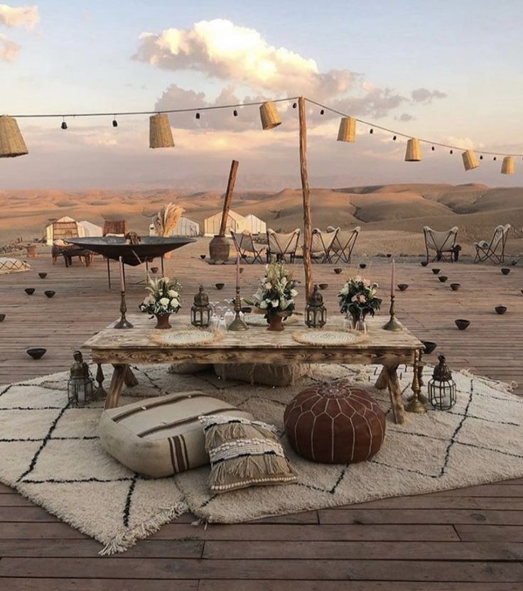
| Agafay Desert (Marrakech) | Arid, rocky plateau (hamada); contains no sand dunes. | Located 45 to 60 minutes from central Marrakech via paved highways. | High-end luxury day clubs, glamping retreats, eco-lodges. | Time-constrained travelers seeking a desert environment near Marrakech. |
Hospitality Ecosystem and Accommodation Architecture
Dune-Edge Kasbahs and Bivouac Desert Camps
The accommodation landscape in the Merzouga region is organized into two primary categories: permanent dune-edge hotels and kasbahs, and tented desert bivouacs situated directly within Erg Chebbi.
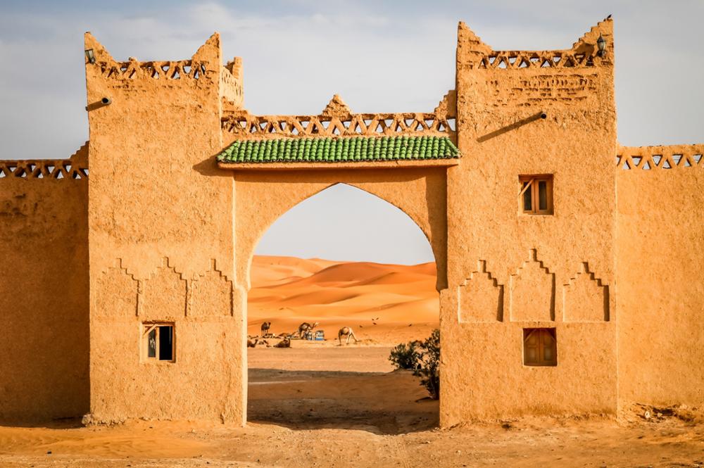
Dune-edge kasbahs and hotels are located along the paved perimeter road in Merzouga and Hassi-Labiad. Constructed from rammed earth or masonry, these permanent properties offer amenities such as swimming pools, air conditioning, private plumbed bathrooms, and dining facilities. They provide reliable shelter and cooling during extreme summer heat and serve as convenient bases before or after overnight desert stays.
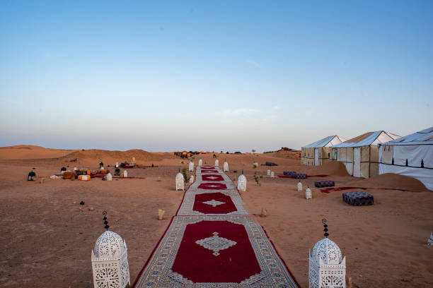
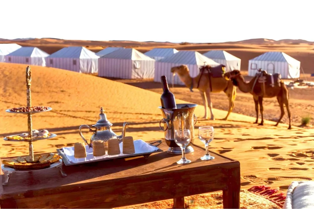
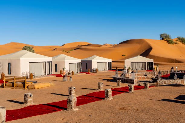
In contrast, tented desert camps (bivouacs) are located within the outer depressions of the dune field itself. These camps consist of woven camel-hair or canvas tents framed by wooden or metal supports. Category levels range from standard traditional bivouacs with shared facilities to high-end glamping camps. Luxury camps feature elevated king-sized beds, private en-suite bathrooms with hot running water, carpeted flooring, localized heating, and dedicated dining tents. Environmental regulations govern camp operations to manage waste, protect dune ecology, and preserve night-sky clarity for stargazing.
Comparative Matrix of Accommodation Models
| Accommodation Category | Location & Setting | Key Amenities & Infrastructure | Climatic Resilience & Thermal Performance | Operational Considerations |
|---|---|---|---|---|
| Dune-Edge Kasbahs / Hotels | Border settlements (Merzouga, Hassi-Labiad). | Swimming pools, grid electricity, Wi-Fi, full plumbing, air conditioning. | High; thick rammed-earth walls and active cooling resist high summer temperatures. | Direct vehicle access; no luggage weight or off-road transfer limitations. |
| Standard Desert Camps | Outer dune depressions inside Erg Chebbi. | Woven tents, real mattresses, shared bath facilities, central campfire. | Moderate; vulnerable to ambient temperature drops and windborne sand. | Requires camel or 4x4 transfer; relies on solar panels or generators for power. |
| Luxury Desert Glamping | Interior dune depressions inside Erg Chebbi. | Canvas suites, en-suite plumbed baths, private heating/AC, fine dining. | High; insulated tenting and heating buffer cold winter night temperatures. | Pre-arranged 4x4 transfer required; strict environmental waste management. |
Transit Logistics, Regional Connectivity, and Seasonal Climatology
Overland Access Routes and Regional Connectivity
Traveling to Merzouga requires crossing substantial distances across mountain ranges and high plateaus, as the region lies approximately 470 km from Fez and 560 km from Marrakech. Infrastructural upgrades have fully paved the main access corridors, enabling standard automobiles, passenger buses, and private transport vans to reach the dune boundary safely.
The Northern Corridor from Fez covers approximately 470 km and requires 7 to 8 hours of driving. The route follows the N13 highway south across the Middle Atlas mountains, passing through Ifrane and the cedar forests of Azrou—home to native Barbary macaques. It continues through Midelt, which serves as a standard lunch stop along the high plateau, before descending through the Ziz Valley oasis with its palm groves and earthen fortified villages. The road passes through Erfoud and Rissani before terminating at Merzouga. Public transport on this corridor includes overnight long-distance buses operated by Supratours and CTM, which depart Fez in the evening and arrive at Merzouga early the following morning.
The Western Corridor from Marrakech covers roughly 560 km and requires 9 to 10 hours of direct driving. The highway crosses the High Atlas range via the Tizi n'Tichka Pass at an elevation of 2,260 meters. It descends toward Ksar Aït Ben Haddou and Ouarzazate—the hub of Morocco’s film industry and home to Atlas Film Studios. The route then continues east along the "Road of a Thousand Kasbahs," traversing the Dades Valley and Todra Gorge before reaching Erfoud and Merzouga. Due to the mountain driving and long distance, tour operators typically break this route into a multi-day itinerary, scheduling overnight stops in Ouarzazate or the gorges to explore regional sights.
For travelers seeking air connections, Errachidia’s Moulay Ali Cherif Airport (ERH) is the primary regional hub. Located 130 km north of Merzouga—roughly a 2 to 2.5-hour drive via the paved N13 highway—the airport receives regular domestic flights from Casablanca. Onward transit from Errachidia to Merzouga is available via private transfers, taxis, or regional buses. Alternatively, Ouarzazate Airport (OZZ) serves as a secondary entry point for multi-day itineraries connecting the Atlas region and southern gorges to the desert.
Climatological Conditions and Seasonal Optimization
Merzouga features a hyper-arid desert climate characterized by significant diurnal temperature fluctuations and distinct seasonal contrasts.
Spring (March to May) and Autumn (September to November) offer the most comfortable weather for visitors. Daytime temperatures average between 22°C and 30°C, while night temperatures drop to a comfortable 10°C to 18°C. These conditions are well-suited for outdoor dune trekking, camel riding, and desert camping.
Winter (December to February) brings clear, sunlit daytime weather with mild temperatures ranging from 15°C to 20°C. However, because the dry desert air allows heat to escape rapidly after dark, nocturnal temperatures drop sharply, often approaching freezing levels (0°C to 5°C). Visitors traveling during winter need heavy insulating layers and accommodations equipped with active heating systems.
Summer (June to August) is characterized by severe heat, with daytime temperatures routinely exceeding 38°C to 45°C. Strenuous outdoor activities during peak daylight hours carry risks of heat exhaustion and dehydration. Summer itineraries adapt by scheduling camel treks and dune walks strictly during dawn and dusk hours, using air-conditioned kasbahs and pools during midday, and maintaining high fluid intake.
Analytical Conclusions and Strategic Recommendations
Merzouga and Erg Chebbi represent a well-developed gateway to the Sahara Desert, combining extreme physical geography with accessible transport infrastructure. The presence of paved access roads directly to the dune margin allows travelers to experience authentic desert landscapes while retaining access to modern accommodations and emergency services.
For optimal travel planning and cultural engagement, the following strategic practices are recommended:
- Itinerary Design: Avoid driving directly from Marrakech to Merzouga in a single day. Splitting the Western Corridor over two days allows travelers to explore mountain passes, gorge systems, and historical earthen sites such as Ksar Aït Ben Haddou and Kasbah Taourirt without fatigue. Travelers with tight schedules should consider flying into Errachidia Airport.
- Seasonal Adaptation: Plan visits during spring or autumn whenever possible. If traveling during winter, pack thermal clothing layers suitable for near-freezing nighttime temperatures. If traveling in summer, confine physical dune activities to early morning or late evening hours and select lodging with active air conditioning.
- Cultural Sensitivity: Engage respectfully with local communities, particularly when attending Gnawa musical performances in Khamlia. Direct financial support through voluntary contributions helps sustain local cultural heritage. Visiting regional trade centers like the Rissani souk offers opportunities to support authentic local artisans and agricultural traders.
How to travel to Merzouga
Flight to Errachidia (ERH) + Transfer (2h)
Direct Supratours from Marrakech or Fes
Scenic route via Ouarzazate
Experiences in Merzouga
-
Camel Trekking
Cross the golden dunes at the slow pace of caravans for a magical sunset.
-
Night Under the Stars
Sleep in a luxury desert camp and admire the Milky Way like never before.
-
Sunrise over the Dunes
A unique spectacle where the sun sets the sand ablaze with indescribable light.
-
4x4 or Quad Adventure
Experience the thrill of exploring the wild desert trails.
 o Photogenic
Chefchaouen
Wander through world-famous cobalt blue alleyways nestled in the tranquil Rif Mountains.
o The Blue PearlChefchaouen
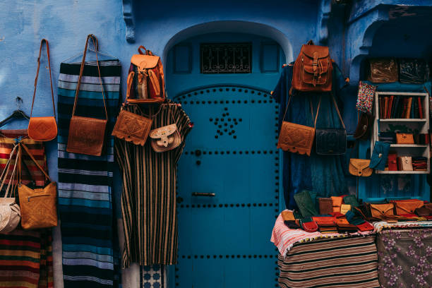
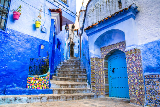
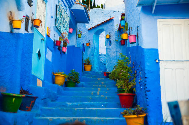
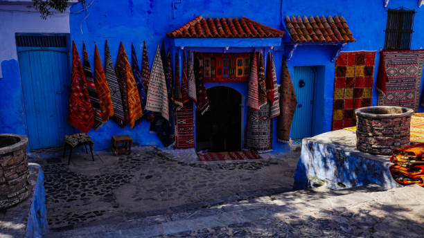
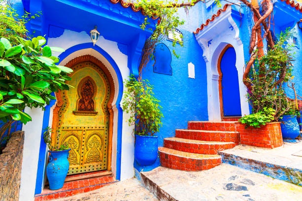
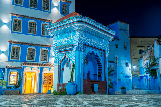
Historical, Architectural, and Socio-Economic Ecosystem of Chefchaouen: From the Rif Citadel to the Chromatic Medina
Chefchaouen, also known as Chaouen or Xaouen, constitutes a central subject of study in urban geography and the cultural history of the northern Maghreb. Established at an altitude of approximately 600 meters on the slopes of Mount Ka'ala, in the heart of the western Rif mountain range in northwestern Morocco, the city is characterized by a truly unique topographic and spatial integration. Globally recognized as the "Blue Pearl," the city transcends the simple status of an international tourist destination to establish itself as a living conservatory of Andalusian architectural traditions, mountain artisanal expertise, and complex historical layers shaped by the interactions between Berber, Arab-Muslim, Sephardic communities, and European colonial authorities.
1. Historical Genesis and Strategic Role in the Northern Rif
The foundation of Chefchaouen is directly inscribed in the geopolitical conjuncture of the 15th century, marked by the expansionist push of the Portuguese crown along the northern coasts of Morocco. In 1471, Moulay Ali Ben Rachid, a local political and religious leader, established a fortified military camp (kasbah) on the mountain slopes to organize armed resistance against foreign incursions. The choice of this site responded to a rigorous military logic: the natural enclosure offered by the steep mountain terrain guaranteed a strategic shelter, while the abundance of local hydraulic reserves ensured the self-sufficiency of a permanent garrison.
The city's evolution accelerated following the Alhambra Decree of 1492 and the fall of the Kingdom of Granada, events that provoked a massive exile of Muslim and Jewish populations from the Iberian Peninsula to North Africa. The arrival of these Andalusian and Sephardic refugees profoundly restructured the spatial and socio-economic organization of Chefchaouen. These new communities introduced advanced urban and architectural principles, characterized by the development of inner patio courtyards, winding inclined alleys, covered passages, and the creation of a dedicated Jewish quarter, the Mellah.
Over the centuries, sovereignty over the city reflected the political shifts of the Moroccan kingdom. In the 16th century, the city was marked by the reign of Sayyida al-Hurra, a major figure of political power in the region who governed the city before allying with the Wattasid sultan of Fez. In the 17th century, the Alaouite sultan Moulay Ismail undertook the structural reinforcement of the Kasbah to consolidate the central state's control over the region's mountain tribes.
During the 20th century, upon the establishment of the Spanish Protectorate in Morocco (1920-1956), the city passed under Iberian colonial administration and took the official name of Chaouen or Xaouen. This period was marked by intense local resistance, with the region actively participating in the Rif emancipation movements. With the advent of national independence in 1956, the city reintegrated into the Moroccan national territory, initiating a major socio-economic mutation from an isolated mountain citadel to a premier cultural and eco-tourism hub.
2. The Blue Chromatics: Theories, Metaphysics, and Urban Identity
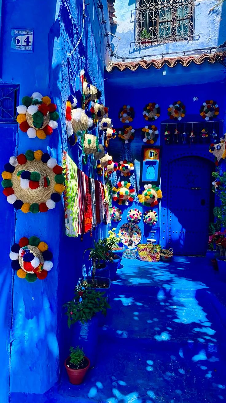
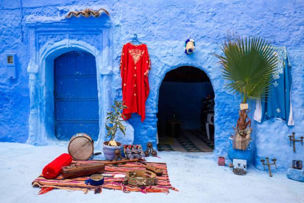
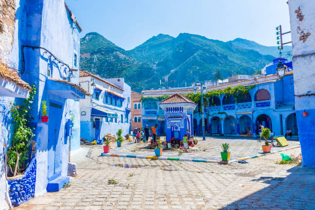
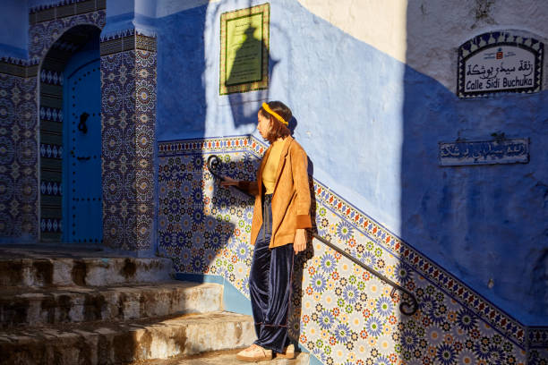
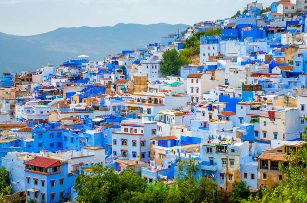
The most iconic visual element of Chefchaouen lies in the continuous application of blue shades on masonry facings, vaults, staircases, and medina doors. Scientific and historical analysis demonstrates that this aesthetic practice cannot be reduced to a single cause, but rather results from a superposition of cultural, religious, and environmental influences over the centuries.
| Origin Theory | Historical and Material Foundation | Cultural, Sanitary, and Pragmatic Scope |
|---|---|---|
| Sephardic Tradition | Introduced from the 15th to the 19th century by Jewish refugees within the Mellah quarter. | Use of blue pigment (tekhelet) symbolizing the sky, divinity, and a constant reminder of spirituality. |
| Metaphysical Symbolism | Integration into Sufi cosmology and Arab-Andalusian aesthetics. | Expression of the sacred, encouraging contemplative meditation and evoking the celestial vault. |
| Repellent and Thermal Properties | Application of a mixture based on lime, indigo pigments, and minerals. | Protection against insects (particularly mosquitoes) and reduction of heat absorbed by facades. |
| Contemporary Strategy | Decentralized community practice supported by tourism development. | Conservation of a harmonious visual identity where each household freely selects its shades (cobalt, turquoise, azure). |
These different explanations mutually complement each other from a historical standpoint. Initially restricted to a function of a cultural and spiritual marker specific to the Sephardic community within the Mellah, the use of blue whitewash progressively extended to all Muslim dwellings in the medina. The periodic maintenance of the lime-tinted surfaces has become a regular community ritual, guaranteeing the preservation of the urban fabric while offering natural thermal regulation adapted to the Mediterranean mountain climate.
3. Urban Morphology, Architectural Heritage, and Iconic Landmarks
The urban structure of Chefchaouen represents an exceptional model of adaptation to topographical constraints. Unlike imperial cities developed on flat terrain, the medina is structured around a complex network of slopes, stairs, and terraces.
- The Kasbah (15th Century): Forming the historical heart of the city, this military fortress features crenelated walls built with red rammed earth, contrasting sharply with the blue of the medina. It houses a vast Andalusian garden, the former prison, and an ethnographic museum detailing regional history.
- Place Uta el-Hammam: The central civic and commercial nerve of the city. Lined with cafes and craft shops, it serves as an architectural transition space between the Kasbah and the residential neighborhoods, dominated by the octagonal minaret of the Great Mosque (15th century), typical of northern Moroccan and Andalusian styles.
- The Ras El Maa Spring: The city's primary hydrological source, emerging directly from the mountain. Historically, it fueled the public fountains, hammams, and Andalusian gardens, and powered the watermills situated below. It remains a gathering place where traditional washing practices are still partially maintained.
- The Spanish Mosque: Built in the 1920s by colonial authorities on a hill overlooking the city, it was never used for worship. It now constitutes the main panoramic viewpoint over the valley, particularly favored at sunset.
4. Artisan Industries and Socio-Economic Sustainability
Chefchaouen constitutes a remarkable example of adapting a human settlement to the constraints of a steep mountain environment. The preservation of its blue urban texture, far from being reduced to a mere commercial argument, relies on maintaining community maintenance practices and valuing local artisan supply chains. Faced with the growing pressure of international tourism, the balanced conservation of its tangible and intangible heritage remains the essential condition for its socio-economic and cultural sustainability.
How to travel to Chefchaouen
CTM is the most popular and reliable option
Flight to Tangier (TNG) + Taxi/Bus (2h)
Mountain roads from Tangier or Fes
Morocco’s Grand Contrast
Experience the absolute best of Morocco on this epic 4-day journey that connects the red city of Marrakech to the blue pearl of Chefchaouen. This isn't just a transfer; it's a deep dive into the heart of the kingdom. Traverse the high peaks of the Atlas, ride through the golden dunes of the Sahara, and witness the ancient history of Fes before ending in the tranquility of the Rif Mountains.
Day 1: Marrakech › Ait Benhaddou › Ouarzazate › Valley of Roses
- Depart from Marrakech at 8:00 AM, ascending the winding roads of the Tizi n'Tichka pass (2,260m) in the High Atlas Mountains.
- Marvel at the Berber villages clinging to the hillsides before arriving at the world-famous Kasbah Ait Benhaddou.
- After a guided tour and lunch, we continue through Ouarzazate—the "Hollywood of Africa"—and follow the legendary "Road of a Thousand Kasbahs."
- We'll conclude our first day in the fragrant Valley of Roses. (Dinner included)
Day 2: Valley of Roses › Todra Gorges › Merzouga (Sahara)
- After breakfast, head to the Dades Valley to admire the unique "Monkey Toes" rock formations.
- Move toward the Todra Gorges, where you’ll walk beneath 300-meter-high limestone cliffs—a true natural wonder.
- After lunch in Rissani, arrive in Merzouga, where your camel caravan awaits.
- Trek into the heart of the Erg Chebbi dunes to witness a spectacular desert sunset. The night is spent in a traditional camp, filled with Moroccan hospitality, music, and a sky full of stars. (Breakfast, Dinner)
Day 3: Merzouga › Ziz Valley › Azrou › Ifrane › Fes
- Wake up early for a sunrise that will stay with you forever.
- After trekking back to Merzouga and enjoying a hot shower and breakfast, begin the drive north.
- Pass through the lush Ziz Valley and the Middle Atlas Mountains. Stop in Azrou to visit the ancient cedar forests and meet the local monkeys, followed by a coffee break in the alpine town of Ifrane.
- By early evening, arrive in the imperial city of Fes for your overnight stay. (Breakfast, Dinner)
Day 4: Fes Medina Exploration › Chefchaouen
- Spend your final morning diving into the rich history of Fes.
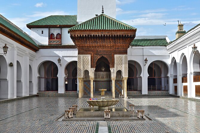
- With your guide (optional), explore the ancient tanneries, mosques, and artisan workshops of the world’s oldest medina.
- After a traditional lunch in the heart of the old city, head north into the Rif Mountains.
- The tour concludes with your arrival in the mesmerizing "Blue City" of Chefchaouen, where we’ll drop you off at your accommodation. (Breakfast)
 o Relaxing
Essaouira
Breathe in ocean breezes, historic sea ramparts, fresh grilled seafood, and bohemian galleries.
o MogadorEssaouira
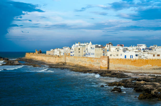
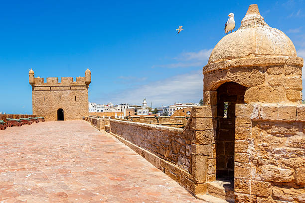
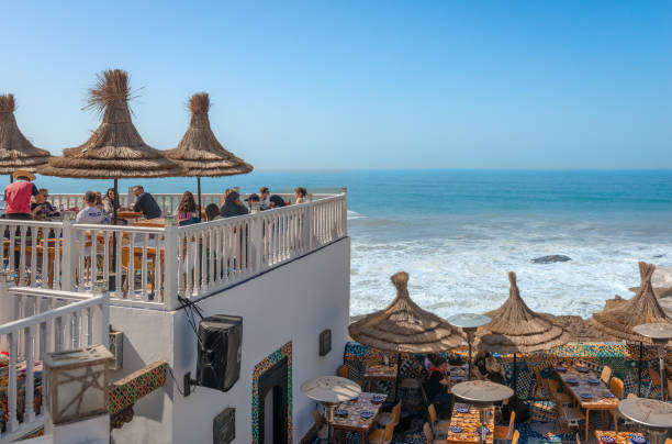
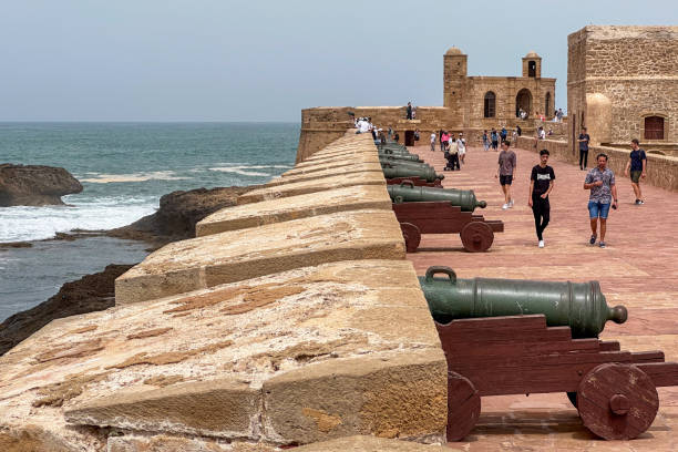
Essaouira: A Comprehensive Guide to the Citadel of Winds, Architectural Heritage, and Cultural Crossroads
Perched along Morocco’s windswept Aïtlantic coast, Essaouira stands as a monument to strategic urban planning, interfaith commerce, and vibrant artistic expression. Known historically as Mogador, the city presents a unique urban tapestry where 18th-century European military architecture seamlessly integrates with traditional North African Islamic design. Recognized as a UNESCO World Heritage site since 2001, Essaouira has evolved from an ancient Phoenician trading post and a royal fortress port into a global capital for music, craftsmanship, and coastal tourism.
1. Historical Evolution: From Ancient Enclave to Royal Seaport
Ancient Roots and Maritime Foundations
The geographic setting of Essaouira has attracted maritime civilizations since antiquity. Protected by the offshore Purple Islands (ÃŽles Purpuraires), the natural bay offered safe anchorage in a volatile stretch of the Aïtlantic coast. As early as the 7th century BC, Phoenician navigators established a strategic trading post on these shores, initiating a long history of trans-Mediterranean exchange. During the Roman era, the settlement gained elevated economic significance through the extraction of precious purple dye from native marine gastropods (Murex), a luxury commodity highly prized across classical antiquity.
For centuries, the settlement was identified by indigenous Amazigh populations as Amogdul or Tassourt—meaning "the well-guarded" or "little fortress"—terms that were later transliterated by European mariners into Mogador, Mogdura, and Mogadur. In 1506, the Portuguese monarchy constructed a brief military foothold known as the Castelo Real. However, local resistance and severe coastal conditions prevented permanent European territorial expansion into the interior, leaving the site largely ruinous until the 18th century.
The Grand Strategy of Sidi Mohammed ben Abdallah (1760–1765)
The modern foundation of Essaouira was initiated between 1760 and 1765 by the Alaouite Sultan Sidi Mohammed ben Abdallah (Mohammed III). Driven by a desire to consolidate sovereign power and modernize the kingdom's fiscal apparatus, the Sultan sought to centralize trans-Aïtlantic commerce under direct state control. Prior to this period, southern maritime trade was dispersed across autonomous regional ports like Agadir, which operated beyond the immediate administrative reach of the royal government (Makhzen).
By closing Agadir to foreign merchant vessels and directing international maritime traffic exclusively to his newly commissioned city, Sultan Mohammed III established a state-sanctioned trade monopoly. Positioned as the direct ocean outlet for the imperial capital of Marrakech, Essaouira was engineered to serve as Morocco's principal gateway to Europe, the Americas, and the trans-Saharan hinterland. This political maneuvering allowed the Sultan to generate vital customs revenues while enforcing diplomatic control over foreign trade representatives.
Théodore Cornut and the Vauban Synthesis
To realize his ambitious project, Sultan Mohammed III commissioned Théodore Cornut, an Avignon-born French military engineer who had studied the fortification techniques of Sébastien Le Prestre de Vauban, the legendary architect of Louis XIV. Cornut was tasked with designing a fortified port city capable of resisting naval bombardments while facilitating efficient urban administration and high-volume commercial throughput.
Cornut's master plan combined low-slung European artillery bastions, thick stone curtain walls, and a structured grid layout with classical Moroccan Islamic urban elements. This unique synthesis earned the city its modern Arabic name, Al-Suwayra (Essaouira), which translates as "the beautifully designed" or "the well-formed fortress".
The "Port of Timbuktu" and Cosmopolitan Legacy
Throughout the late 18th and 19th centuries, Essaouira flourished under its reputation as the "Port of Timbuktu". Long-distance trans-Saharan caravans traversed the desert for months to deliver gold, ivory, ostrich feathers, spices, and gum arabic directly to the port. There, these goods were exchanged for European textiles, tea, sugar, and hardware.
To stimulate international commerce, the Sultan actively invited foreign merchants and elite Moroccan Jewish families to settle in the city. Known as Tujjar al-Sultan ("the Sultan's Merchants"), these Jewish commercial dynasties enjoyed royal protection and special economic privileges, managing foreign diplomacy and international trade networks. Muslim, Jewish, and European Christian communities coexisted peacefully within the city walls, establishing a legacy of interfaith tolerance and cross-cultural exchange that continues to define Essaouira's social identity.
By the late 19th century, the advent of large steamships with deeper drafts led to the decline of Essaouira's relatively shallow harbor, shifting Morocco's shipping traffic toward modern deep-water ports at Casablanca, Tanger Med, and Agadir. This economic shift sheltered Essaouira from aggressive 20th-century industrial redevelopment, effectively preserving its 18th-century architectural core intact.
2. Architectural Urbanism and Landmark Fortifications
The Gridiron Urban Plan
Unlike the organic, labyrinthine street networks that characterize older Moroccan medinas such as Fez or Marrakech, Essaouira’s medina features broad, straight avenues laid out on a rational grid plan. This spatial layout, engineered by Théodore Cornut, allowed for rapid military movement between garrisons, clear administrative zoning, and effective cross-ventilation that mitigated humidity throughout the urban center.
The urban layout is organized into primary commercial arteries—most notably Avenue Istiqlal and Avenue Mohamed Zerktouni—which bisect the medina and connect the inland land gates with the sea walls and harbor platforms. Secondary residential lanes branch off orthogonally from these primary avenues, creating covered arcades and stone arches that shield pedestrians from the persistent Aïtlantic winds.
Local Sandstone and the "Blue Mogador" Palette
The architectural cohesion of Essaouira relies heavily on Pierre de Mogador, a locally quarried marine sandstone whose color ranges from warm ochre-yellow to weathered coastal grey. This structural stone forms the foundation of the city walls, monumental gateways, public fountains, and decorative doorframes.
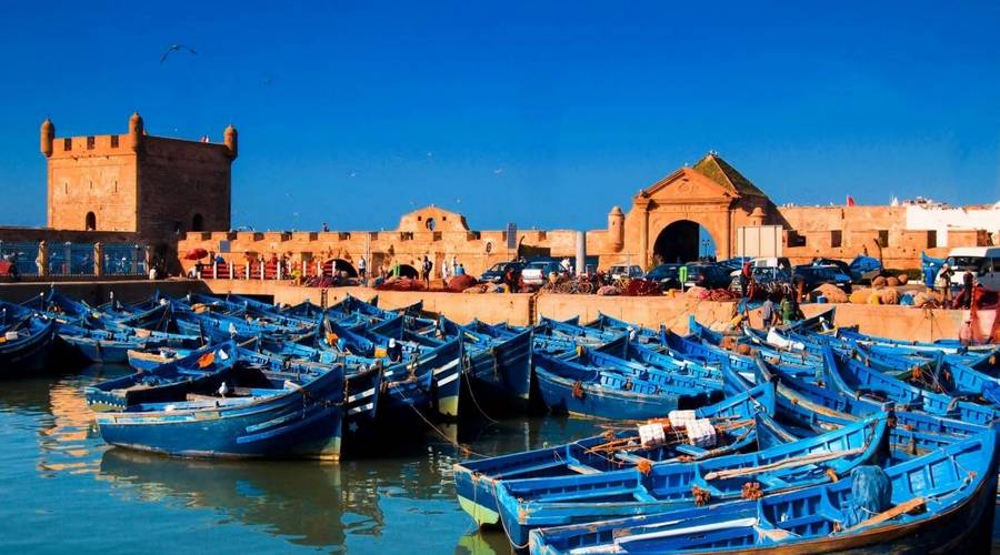
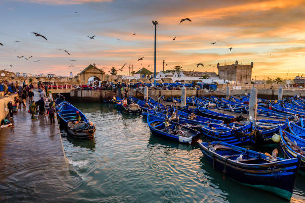
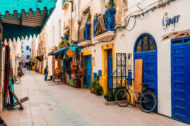
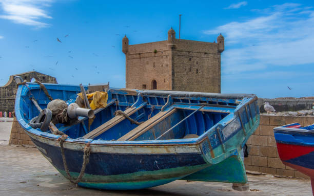
Complementing this yellow sandstone masonry is the iconic "Blue Mogador" color scheme. Cobalt-blue doors, window shutters, and wooden fishing trawlers create a striking contrast against lime-washed, snow-white facade walls. This color choice serves both functional and aesthetic purposes: the lime wash reflects intense solar radiation and acts as a natural disinfectant, while the bright blue pigment helps reduce glare, deters insects, and creates the coastal visual identity that has long drawn painters, photographers, and travelers.
Key Spatial Zones and Fortified Monuments
The historical urban fabric of Essaouira is divided into distinct, purpose-built districts that reflect the administrative, commercial, and residential functions established during the Alaouite period.
- The Kasbah: The Kasbah represents the oldest administrative citadel of the city. Originally built to accommodate the Makhzen garrison, royal administrative offices, and foreign diplomatic consulates, it features grand stone mansions built with neoclassical European architectural flourishes adaptively integrated into traditional Islamic domestic designs.
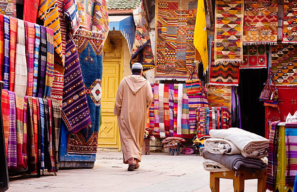
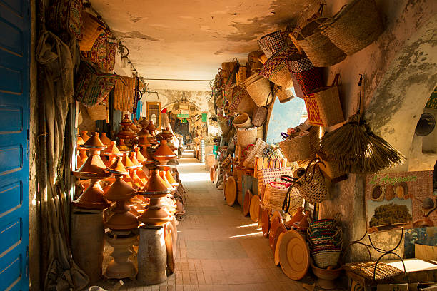
- The Medina and Souks: Surrounding the primary thoroughfares, the residential medina contains traditional courtyard homes (riads), artisan workshops, and specialized market quarters. The market zones are organized by trade, including dedicated sections for spices, textiles, fish, and thuya wood craft.
- The Mellah: Situated in the northeastern sector of the medina, the historic Jewish quarter (Mellah) exhibits a distinct urban density marked by multi-story residences, external wooden balconies, and narrow streets. While sections of the quarter suffered structural deterioration during the mid-20th century, targeted urban rehabilitation programs have successfully restored key cultural landmarks, including the Slat Lkahal Synagogue and the Bayt Dakira museum.
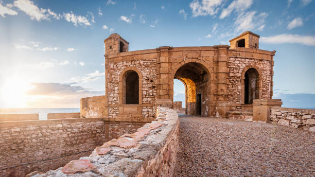
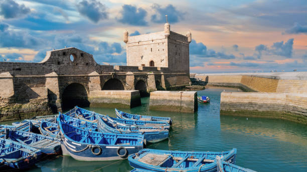
- Skala de la Ville and Skala du Port: The sea-facing defense platforms represent the pinnacle of 18th-century military engineering in North Africa. The Skala de la Ville is a monumental 200-meter-long stone artillery platform constructed along the northern sea wall. Equipped with two-tiered watchtowers (échauguettes), it houses a preserved collection of 18th-century European bronze cannons cast in Seville and Barcelona. The Skala du Port, situated at the harbor entrance, provides defensive overwatch for the fishing port and connects directly to Bab el-Marsa ("Gate of the Port"), a monumental stone gateway decorated with classical European columns and Islamic arches.
| Architectural Site / Zone | Era / Construction Date | Architectural Style | Key Features & Historical Function |
|---|---|---|---|
| Skala de la Ville | Constructed 1760s | Franco-Moroccan Vauban Military | Ramparts, watchtowers, 18th-century Spanish bronze cannons. |
| Skala du Port & Bab el-Marsa | Commissioned 1769 | Vauban Fortification with Classical Trim | Maritime defense platform and monumental gateway to the port. |
| Kasbah District | Established 1760s | Neoclassical-Moroccan Fusion | Former diplomatic quarter, stone mansions, administrative core. |
| The Mellah | Developed Late 18th C. | High-Density Multi-Story Urbanism | Historic Jewish quarter, external balconies, preserved synagogues. |
| Ben Youssef Mosque | Erected 1773 | Classical Alaouite Islamic | Dominant minaret, principal spiritual sanctuary of the medina. |
| Bayt Dakira (House of Memory) | Opened 2020 | Restored Traditional Riad / Museum | Center for Judeo-Muslim history and spiritual coexistence. |
| Landward Ramparts & Gates | 1760–1770 | Alaouite Fortification Masonry | Includes Bab Marrakech, Bab Doukkala, and Bab el-Mechouar. |
3. Cultural Tapestry: Music, Crafts, and Shared Heritage
The Gnaoua Tradition and the World Music Festival
Essaouira is celebrated internationally as the spiritual capital of Gnaoua culture, a ritual art form brought to North Africa by enslaved Sub-Saharan Africans over several centuries of trans-Saharan trade. Combining West African spiritual traditions, Islamic Sufism, and indigenous Amazigh cultural elements, Gnaoua music centers on therapeutic trance rhythms performed during sacred night ceremonies known as lilas.
The music relies on three primary elements: the guembri (a three-stringed bass lute carved from a single block of wood and covered with camel neck leather), the qraqeb (heavy iron castanets that produce a clack-clack sound), and call-and-response vocal chants invoking spiritual protection and ancestral memory. Inscribed on the UNESCO Representative List of the Intangible Cultural Heritage of Humanity, Gnaoua culture was long practiced in marginalized private settings before experiencing a public revival in Essaouira.
Established in 1998, the annual Gnaoua and World Music Festival—held every June—has elevated this ancestral tradition into a globally recognized musical gathering. The festival draws hundreds of thousands of visitors to open-air stages at Place Moulay Hassan and along the beach. Master musicians (Maâlems), such as Maâlem Hamid El Kasri, Maâlem Houssam Gania, and Maâlem Mohamed Boumezzough, perform alongside international jazz, rock, blues, and funk artists. This collaborative format encourages musical improvisation while preserving the integrity of the core tradition. Concurrently, the festival hosts the Forum des Droits de l'Homme (Human Rights Forum), bringing together global scholars, activists, and cultural leaders to discuss pressing societal issues, including youth empowerment, cultural identity, and human rights.
Artisanal Craft Traditions
- Thuya Wood Marquetry: Essaouira is Morocco's primary center for Thuya wood craftsmanship (Tetraclinis articulata), an aromatic conifer native to the nearby Atlas foothills. Local woodworkers carve the tree's burled root systems, producing intricate marquetry inlaid with lemonwood, mother-of-pearl, ebony, and silver wire. The city's vaulted workshops, located within the rampart arcades, continue to produce handcrafted jewelry boxes, furniture, and decorative chess sets.
- Silversmithing and Filigree: Originating from the city's historical Jewish artisan guilds, Essaouira’s silversmithing tradition is noted for delicate filigree work. Master artisans craft traditional Amazigh fibulas, elaborate bracelets, and protective talismans using hand-drawn silver wire, preserving techniques passed down through generations.
- Argan Oil Cooperatives: The semi-arid countryside surrounding Essaouira forms part of the UNESCO-designated Arganeraie Biosphere Reserve. The native Argan tree (Argania spinosa) produces oil-rich nuts harvested primarily by local women's cooperatives. Using traditional cold-pressing methods alongside modern quality control, these cooperatives extract culinary argan oil from roasted kernels and unroasted cosmetic oil valued for its moisturizing properties.
Interfaith Memory: Bayt Dakira
Inaugurated in 2020 within the historic Mellah, Bayt Dakira ("House of Memory") serves as a research institution and museum dedicated to preserving the co-existence between Morocco's Jewish and Muslim communities. Located within the restored Simon Aïttias Synagogue, the center displays historical photographs, ceremonial artifacts, trade ledgers, and audio recordings documenting the cultural history of Mogador. Bayt Dakira houses the Chaim Zafrani International Research Center, named after the renowned Essaouira-born scholar of Moroccan Jewish heritage, emphasizing education and interfaith dialogue.
4. Practical Travel Logistics and Visitor Insights
Climate and Microclimate Dynamics
Essaouira experiences a cool Mediterranean climate significantly tempered by the Aïtlantic Ocean and persistent trade winds known locally as the Alizés. These winds maintain summer temperatures far cooler than those of inland locations like Marrakech, making Essaouira a popular retreat during peak summer heat. However, the strong coastal winds generate sea mist (taros) and cool evening breezes, making warm layered clothing necessary year-round. The constant wind conditions also make the main bay an internationally recognized center for windsurfing, kitesurfing, and sailing.
| Season | Climatic Conditions | Trade Wind Intensity | Traveler Considerations |
|---|---|---|---|
| Spring (Mar-May) | Mild, sunny; daytime temps 18°C to 22°C | Moderate breezes | Excellent period for sightseeing, medina walks, and regional tours. |
| Summer (Jun–Aug) | Cool, dry; daytime temps 20°C to 25°C | Peak Alizés trade winds | High festival season; ideal for kitesurfing; evening layers needed. |
| Autumn (Sep–Nov) | Warm, clear; daytime temps 21°C to 24°C | Moderate to light winds | Ocean waters remain warm; ideal balance of calm weather and lower crowds. |
| Winter (Dec–Feb) | Cool, occasional rain; temps 12°C to 18°C | Light to strong coastal gusts | Peaceful atmosphere; ideal for cultural exploration and cozy riad stays. |
Transport and Accessibility
- By Air: Essaouira-Mogador Airport (EGU) is located roughly 16 kilometers south of the city center. It offers direct international flights from major European cities, as well as domestic routes connecting through Casablanca and Marrakech. Taxis and airport shuttles connect the terminal directly to the medina gates.
- By Bus from Marrakech: The 170-kilometer route between Marrakech and Essaouira is served by express bus operators, including Supratours and CTM, with transit times averaging 2.5 to 3 hours. Supratours buses drop passengers directly at the Bab Marrakech gate, adjacent to the pedestrianized medina.
- By Highway from Agadir: Connected via the coastal N1 highway (175 km south), the route offers scenic ocean views through coastal argan groves and surf settlements such as Taghazout and Imsouane.
Accommodation and Gastronomy
- Riads and Lodges: Accommodation choices inside the pedestrian medina focus on restored historic courtyard homes (riads), such as Riad Lyon Mogador, offering traditional tilework, rooftop views, and quiet courtyards. Outside the walls, eco-lodges situated in surrounding olive groves provide quiet retreats with garden spaces.
- Port-Side Seafood: Near the harbor basin, open-air grills prepare fresh catches brought in daily by the blue wooden fishing boats. Diners can select fresh sardines, sea bass, sea bream, octopus, and red mullet grilled over hardwood embers.
- Regional Cuisine: Local menus feature seafood tagines cooked with preserved lemons, capers, wild thyme, and organic argan oil. Traditional bakeries produce semolina breads and pastries flavored with orange blossom water and local honey.
| Travel Planning Category | Practical Guidance & Operational Details |
|---|---|
| Optimal Stay Duration | 2 to 4 days for thorough exploration of historical, artistic, and coastal sites. |
| Medina Luggage Transport | The medina is car-free; licensed porters with blue handcarts (krossa) transport luggage. |
| Gnaoua Festival Booking | Book accommodations 4 to 6 months in advance for the June event. |
| Local Craft Shopping | Buy certified Thuya wood from rampart artisans; buy argan oil directly from verified women's co-ops. |
| Coastal Photography | Sunset at the Skala de la Ville provides optimal lighting across the ocean ramparts. |
5. Strategic Outlook and Cultural Preservation
Essaouira’s development trajectory serves as an example of balanced cultural preservation and sustainable tourism growth. Rather than allowing rapid modernization to disrupt its historic core, the city has leveraged its heritage status to encourage community-focused tourism and artistic preservation. Ongoing restoration initiatives led by the Moroccan Ministry of Culture, UNESCO, and local heritage trusts continue to repair coastal masonry, restore historic synagogues, and update infrastructure across the medina's public plazas.
By hosting world-class cultural events, maintaining traditional craftsmanship, and protecting its unique physical heritage, Essaouira reinforces its role as an international gathering place for artists, researchers, and travelers. The city stands as a preserved 18th-century fortress town that continues to thrive as a dynamic cultural crossroads linking North Africa to the world.
How to travel to Essaouira
Frequent departures CTM/Supratours (3h)
Expressway R207 from Marrakech (2h30)
Essaouira-Mogador Airport (ESU)
Tour Highlights
-
Coastal Charm
Discover the soothing, laid-back atmosphere of this beautiful port city and the warm hospitality of its locals.
-
History & Ramparts
Stroll along the impressive 18th-century Skala ramparts and admire the historic brass cannons pointing out toward the ocean.
-
Art & Culture
Explore the labyrinth of the old medina, its vibrant souks, artisan galleries, and the fascinating history of the ancient Jewish Quarter (Mellah).
-
Flavors of the Sea
Treat yourself to excellent, freshly caught seafood at the traditional restaurants lining the bustling port.
-
Sand Adventure
Enjoy an unforgettable camel ride along the sandy beach to the rhythmic sound of the Aïtlantic waves.
Detailed Itinerary
Morning: Departure & Scenic Landscapes
- Your journey begins smoothly with a pick-up from your Marrakech accommodation between 08:00 AM and 09:00 AM.
- The drive toward the coast is an experience in itself, offering spectacular, picturesque landscapes perfect for capturing unforgettable photos.
- You will arrive in Essaouira around 11:00 AM, ready to explore this town of timeless charm.
Midday: Medina Exploration & Ocean Views
- Immerse yourself in the enchanting atmosphere of the Medina, a UNESCO World Heritage site.
- Let the narrow, winding alleys guide you through a place where history is etched into every stone.
- The well-preserved architecture and numerous art galleries stand as a testament to the city's cultural wealth.
- Be sure to visit the Skala for breathtaking panoramic views of the Aïtlantic coast before indulging in a delicious local seafood lunch.
Afternoon: Beach, History, and Return
- After savoring your meal, head down to the beach for a relaxing camel ride—a delightful experience for all ages.
- Take time to wander through the ancient Jewish Quarter and visit its historic synagogues before hitting the road.
- With a mind full of beautiful memories, you will arrive back in Marrakech around 8:00 PM.
What's Included
- Round-trip pick-up and drop-off from your hotel or Riad in Marrakech. (If your Riad is inside the medina, the meeting point will be at the closest accessible car park).
- Comfortable transportation with a professional driver.
- Free time to explore the city, its monuments, and the beach at your own pace.
Not Included
- Lunch and beverages.
- Optional activities (such as the camel ride or hiring a private local guide).
- Personal expenses.
 o Heritage
Fes
Journey back in time in the world's largest car-free medina. Tanneries, tilework & culture.
o Imperial CapitalFès
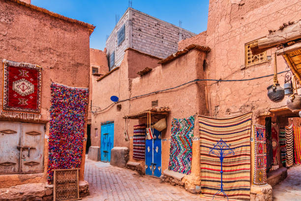
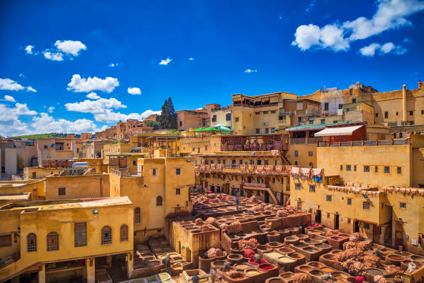
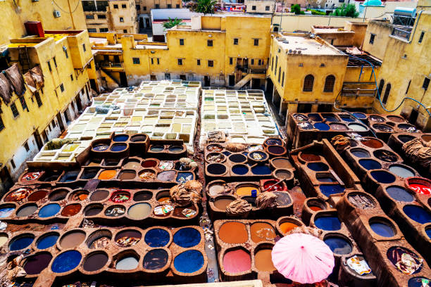
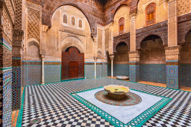
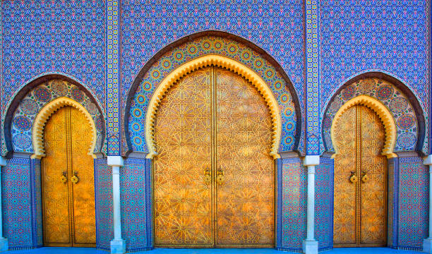
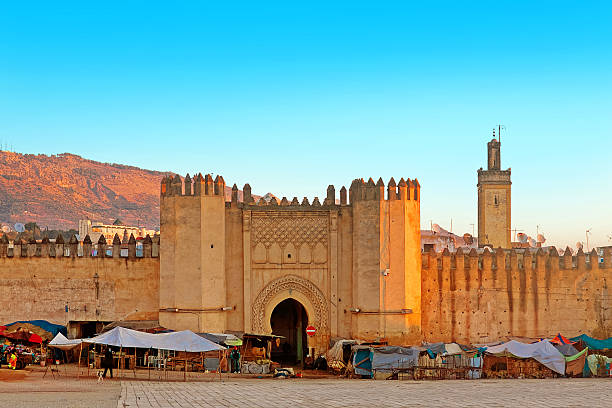
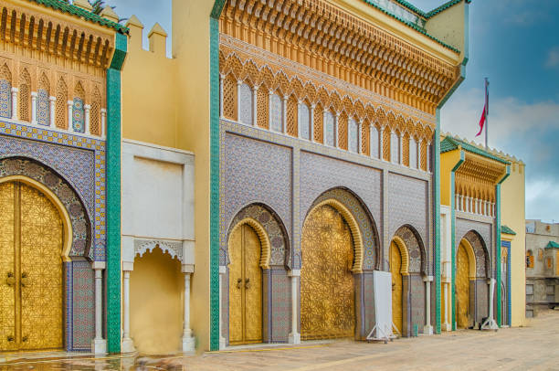
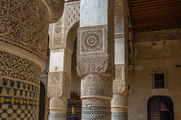
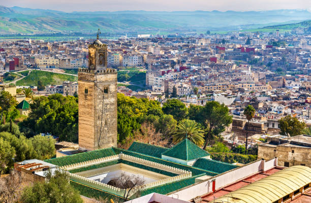
Fez: The Spiritual Capital of Morocco — Historical Landmarks, Architectural Wonders, and Visitor Guide
Fez (Fès) stands as the spiritual, cultural, and intellectual heart of Morocco. Founded between 789 and 808 AD under the Idrisid dynasty, Fez is the oldest of the kingdom's four imperial cities. Its historic core, Fes el-Bali (Old Fez), was designated a UNESCO World Heritage Site in 1981 and represents the world's largest and most complete medieval car-free urban environment. Containing more than 9,000 winding alleys and 700 dead-ends, Fez is not a static open-air museum, but a living urban ecosystem where tens of thousands of residents, scholars, and traditional master artisans continue century-old ways of life.
1. Historical Foundations and Urban Evolution
The Idrisid Legacy and Cultural Crucible: Fez was established along the banks of the Fez River by Idris I and further developed by his son, Idris II. In the early 9th century, two waves of refugees transformed the city: Arab families fleeing political unrest in Kairouan (modern Tunisia) settled on the river's east bank (Adwat al-Qarayiyyin), while Andalusian families expelled from Cordoba settled on the west bank (Adwat al-Andalous). This fusion of Kairouanese intellectual rigor and Andalusian artistic refinement laid the foundation for Fez's golden age.
Urban Architecture of Fes el-Bali: Fes el-Bali is structured around two primary commercial arteries: Tala'a Kebira (the Grand Slope) and Tala'a Seghira (the Little Slope). These thoroughfares descend from the main western entrance gate toward the spiritual core centered around the Al-Qarawiyyin Mosque. The city's residential architecture is introspective (inward-facing); blank, windowless exterior clay walls conceal interior courtyards (riads) decorated with colorful zellij tilework, carved stucco, and aromatic cedarwood.
2. World-Famous Historical Landmarks
Fez houses a remarkable density of Islamic monuments, madrasas, and traditional artisan complexes:
Al-Qarawiyyin Mosque and University:
Historical Significance: Founded in 859 AD by Fatima al-Fihri, a wealthy female scholar from Kairouan, Al-Qarawiyyin is recognized by UNESCO and the Guinness World Records as the world's oldest continuously operating university. For over a millennium, it served as a premier center for Islamic theology, astronomy, mathematics, and law.
Architectural Marvels: The complex features green-tiled roofs, horse-shoe arches, marble fountains, and bronze-plated gates. Its historic library houses priceless medieval manuscripts dating back to the 9th century.
Visitor Access: Non-Muslim travelers cannot enter the prayer hall, but visitors can view the courtyard, carved portals, and Andalusian-style fountains from the monumental entryways.
Bou Inania Madrasa:
Marinid Masterpiece: Constructed between 1350 and 1355 AD by Marinid Sultan Abu Inan, Bou Inania is widely considered the pinnacle of Marinid architecture in Morocco. It is one of the few theological colleges in the country that also functions as a congregational Friday mosque, complete with its own green-tiled minaret.
Interior Detail: The central courtyard displays geometric zellij tilework along the lower walls, deeply carved Arabic calligraphy in stucco across the middle band, and sculpted Atlantic cedarwood ceilings above.
Al-Attarine Madrasa:
Intimate Proportions: Built between 1323 and 1325 AD by Marinid Sultan Abu Said Uthman near the spice market, Al-Attarine is celebrated for its harmonious layout. Its central courtyard features white marble columns, delicate tilework, and views over the surrounding souk.
Chouara Tanneries:
Living Medieval Tradition: Operating continuously since the 11th century, Chouara is the largest and most famous of Fez's traditional leather tanneries.
The Process: Master leatherworkers stand knee-deep in stone dye pits, treating hides of sheep, goats, cows, and camels using traditional methods. Natural materials such as lime, pigeon droppings, saffron (yellow), indigo (blue), and poppy (red) are used to tan and color the leather.
Viewing Experience: Visitors observe the colorful dye pits from panoramic terraces of surrounding leather shops, where staff offer fresh mint leaves to help offset the strong natural aromas of the tanning process.
Place Nejjarine and Museum of Wooden Arts & Crafts:
Nejjarine Fountain: An 18th-century wall fountain coated in geometric zellij tiles, located in the traditional carpenters' square.
Fondouk Nejjarine: A restored 18th-century merchant caravanserai (funduq) that housed traveling merchants and their goods. Today, it functions as the Museum of Wooden Arts & Crafts, exhibiting historic woodworking tools, carved doors, and locks, topped by a rooftop cafe with views over the medina rooftops.
Bab Bou Jeloud (The Blue Gate):
Monuemental Entrance: Originally built in the 12th century and reconstructed in 1913, Bab Bou Jeloud serves as the main western gateway into Fes el-Bali. The triple-arched gate is decorated with iconic blue zellij tiles on its outer facade (representing the color of Fez) and green zellij tiles on its inner facade (representing Islam).
The Mellah and Fes el-Jdid:
Morocco's First Jewish Quarter: Established in 1438 near the Royal Palace, the Mellah of Fez features distinct urban architecture characterized by outward-facing wooden balconies and open street windows. Key historic sites include the 17th-century Ibn Danan Synagogue and the whitewashed Jewish cemetery.
Royal Palace Gates (Dar al-Makhzen): Located at Place des Alaouites, the Royal Palace facade features copper and brass doors, carved cedar wood, and colorful zellij tilework.
3. Comparative Overview of Major Monuments
| Landmark | Historic Era | Architectural & Cultural Highlights | Visitor Guidelines |
|---|---|---|---|
| Al-Qarawiyyin Mosque & University | 859 AD (Idrisid Era) | World's oldest degree-granting university; green tile roofs; historic library. | Interior reserved for Muslims; courtyard viewed from exterior portals. |
| Bou Inania Madrasa | 1350–1355 AD (Marinid Era) | Marinid zellij tilework, carved stucco, Atlantic cedar, unique minaret. | Open to all international visitors; active prayer times respected. |
| Al-Attarine Madrasa | 1323–1325 AD (Marinid Era) | Intimate Marinid courtyard, marble columns, Arabic calligraphy. | Open to all visitors; located near Souk el-Attarine. |
| Chouara Tanneries | 11th Century | Stone dye pits, natural organic dyes, hand-treated leather. | Viewed from elevated shop terraces; fresh mint provided. |
| Fondouk & Fountain Nejjarine | 18th Century (Alaouite Era) | Restored caravanserai, zellij wall fountain, Museum of Wooden Arts. | Open to the public; includes rooftop terrace access. |
| Bab Bou Jeloud | 1913 Reconstruction | Triple-arch gate with exterior blue zellij and interior green zellij. | Open public thoroughfare; ideal starting point for medina tours. |
4. Artisanal Heritage and Specialized Souks
The medina's economy is driven by artisan guilds organized into specialized market quarters:
- Place Seffarine: The coppersmiths' square, where metalworkers hammer brass and copper into traditional cauldrons, teapots, and serving trays.
- Souk El Attarine: The spice market quarter, scented with cumin, saffron, cinnamon, herbal remedies, and traditional perfumes.
- Souk Sabaghine: The dyers' market, where skeins of wool and silk teemed in vibrant dyes hang overhead to dry.
- Pottery and Zellij Workshops: Located on the outskirts of the medina, master potters shape local grey clay, hand-paint iconic cobalt-blue ceramics, and chisel mosaic tiles (zellij) for palaces and fountains across Morocco.
5. Accommodations: Medina Riads vs. Ville Nouvelle
Travelers to Fez can choose between two distinct accommodation styles:
- Traditional Riads (Inside Fes el-Bali): Restored historic mansions built around central courtyards featuring zellij tilework, fountains, and rooftop terraces overlooking the medina skyline. Riads offer an authentic cultural experience surrounded by history.
- Modern Hotels (Ville Nouvelle): Located in the modern quarter constructed during the French Protectorate era, modern hotels offer contemporary rooms, swimming pools, air conditioning, and direct vehicle parking.
6. Logistics, Navigation, and Visitor Guidelines
- Navigation Within the Medina: Fes el-Bali is completely car-free; goods are transported using handcarts (krossa) or pack animals. Because narrow covered streets frequently disrupt GPS signals, hiring an official licensed tour guide through your accommodation or the local tourism office is highly recommended for first-time visitors. Official guides ensure efficient routes through the maze, entry to historic courtyards, and contextual history. Self-guided travelers can use the main arteries—Tala'a Kebira and Tala'a Seghira—as primary navigational axes.
- Best Time to Visit:
Spring (March to May) & Autumn (September to November): Ideal travel conditions with warm, pleasant daytime temperatures ranging from 18°C to 25°C.
Summer (June to August): Temperatures in the medina can exceed 38°C, making early morning or late afternoon sightseeing preferable.
Winter (December to February): Crisp, cool weather with quiet streets; warm layers are recommended for evening riad stays. - Connections and Day Trips: Fez is connected nationally via Fez-Saïss Airport (FEZ) and the ONCF rail network, providing direct train routes to Casablanca, Rabat, Marrakech, and Tangier. Popular day trips from Fez include the imperial city of Meknes (1 hour) and the ancient Roman ruins of Volubilis (1.5 hours).
How to travel to Fes
ONCF station connected to Casablanca, Rabat, Tangier
Fes-Saïss Airport (FEZ)
Highway A2 from Rabat/Oujda
The Grand Moroccan Traverse
Transform your transit between Morocco's most iconic imperial cities into the adventure of a lifetime. Instead of a simple transfer, embark on a captivating 4-day overland journey from Fes to Marrakech, taking you deep into the heart of the Sahara Desert.
Day 1: Fes › Ifrane › Azrou › Midelt › Erfoud › Merzouga
- Your expedition begins with an 8:00 AM pickup from your Fes accommodation. We head south into the Middle Atlas Mountains.
- First stop in the picturesque, alpine-style town of Ifrane, the "Switzerland of Morocco."
- Dive into the lush cedar forests of Azrou to greet the friendly local Barbary macaques.
- After descending through Midelt and enjoying lunch, cruise along the spectacular Ziz Valley, a lush ribbon of palm groves and ancient kasbahs.
- By late afternoon, arrive in Merzouga. Check into your hotel for a relaxing dinner and overnight stay.
Day 2: Merzouga › Rissani › Khamlia › Erg Chebbi Dunes
- After breakfast, explore the magic of the Saharan region. Visit the historic city of Rissani, the birthplace of the ruling Alawite dynasty, known for its traditional markets and beautiful architectural monuments.
- Visit the village of Khamlia to experience the hypnotic, rhythmic sounds of traditional Gnaoua music.
- As late afternoon approaches, meet your camel caravan. Embark on a scenic ride across the golden waves of Erg Chebbi as the sun sets.
- Arrive at your nomad desert camp. Enjoy a magical night of Berber drumming, a hearty dinner, and stargazing in the pristine desert silence.
Day 3: Erg Chebbi › Merzouga › Todra Gorges › Dades Valley
- Wake up early to witness a majestic desert sunrise painting the dunes in vibrant colors—a true highlight of the trip.
- After trekking back to the Merzouga edge on your camel, depart toward Erfoud and the dramatic landscapes of the southeast.
- Visit the spectacular Todra Gorges, where you can take a peaceful walk beside the river, flanked by massive 600-foot canyon walls.
- Continue to the Dades Valley, passing the fascinating rock formations known as the "Monkey Fingers" (Tamnalt Hills). Overnight in the heart of the Dades Gorges, complete with dinner and breakfast.
Day 4: Dades Valley › Skoura › Ouarzazate › Ait Benhaddou › Marrakech
- Drive through the fragrant Valley of the Roses and the palm-rich Skoura Oasis before reaching Ouarzazate, the "Gateway to the Desert."
- Explore the magnificent Kasbah Ait Benhaddou, a UNESCO World Heritage site famous for Hollywood blockbusters like Gladiator and Lawrence of Arabia.
- After enjoying lunch near the Kasbah, begin the scenic ascent over the High Atlas Mountains via the famous Tizi N'Tichka pass.
- Enjoy sweeping views before descending into the vibrant city of Marrakech, dropping you off safely at your Riad or Hotel.
Frequently Asked Questions
Is this a private or shared tour?
This is a fully private tour. Your 4x4 or minivan and driver/guide are exclusively yours for the entire 4-day journey.
What time does the tour depart?
The tour departs at 07:30 AM with a pick-up directly from your Fes accommodation.
Can I upgrade the desert camp?
Yes! You can elevate your Sahara experience to a Deluxe Desert Camp (featuring an ensuite tent with a private bathroom) upon request during booking.
How long is the camel ride?
The camel trek usually lasts about 1 to 1.5 hours (depending on the season and camp location).
Can I skip the camel ride?
Yes. If you prefer not to ride a camel, we will arrange for a comfortable 4x4 transfer to reach your desert camp.
What should I bring?
Comfortable clothes, sunglasses, sunscreen, scarf for the desert wind, comfortable shoes, and a small overnight bag.
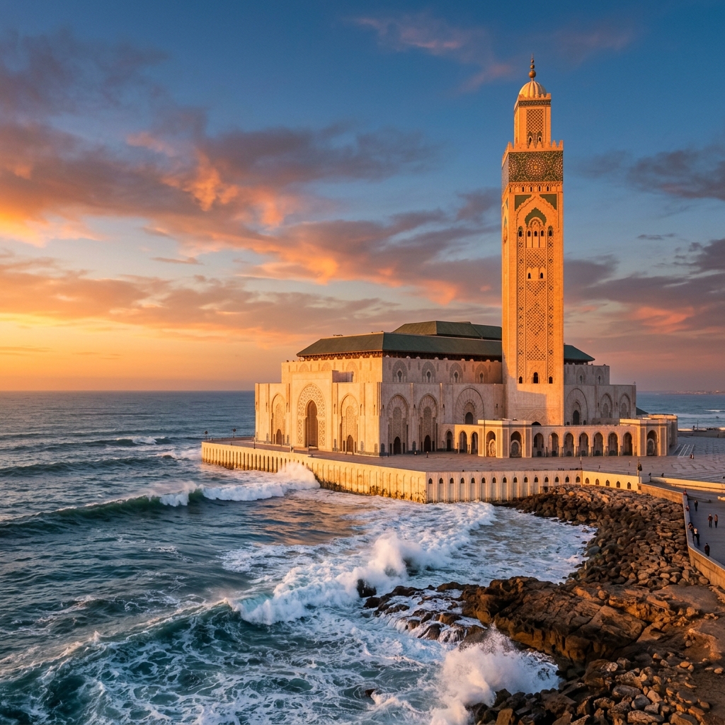 o Ocean Hub
Casablanca
Morocco's economic capital by the sea featuring the magnificent oceanfront Hassan II Mosque.
o The White CityCasablanca
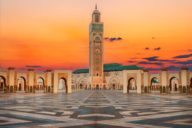
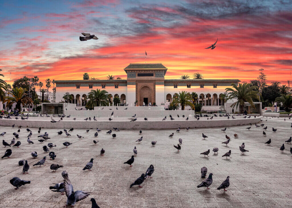
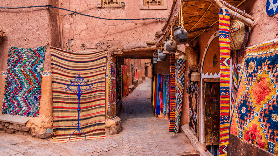
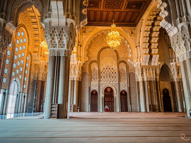
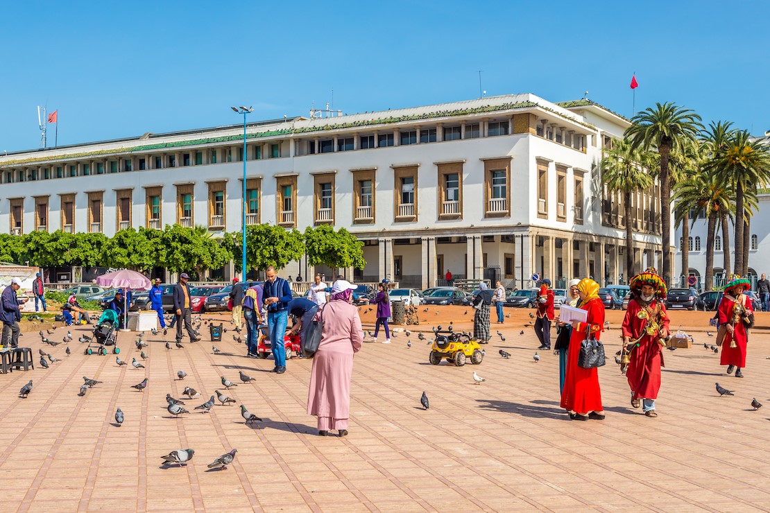
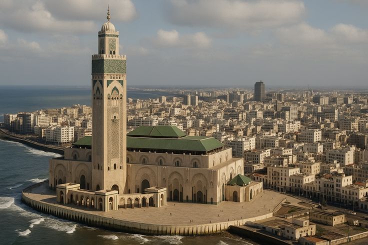
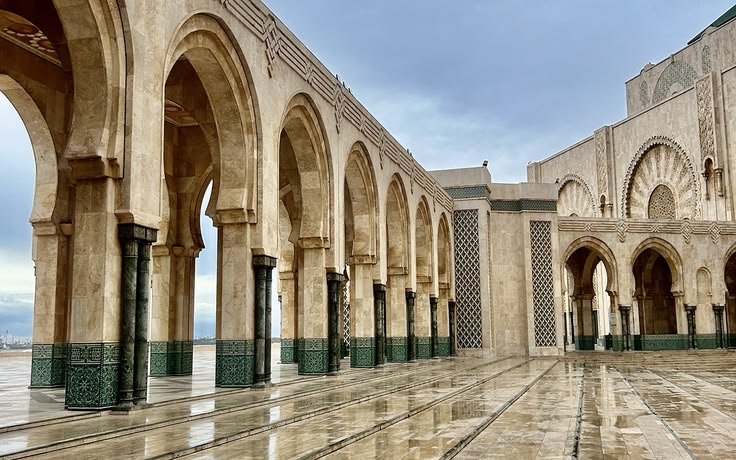
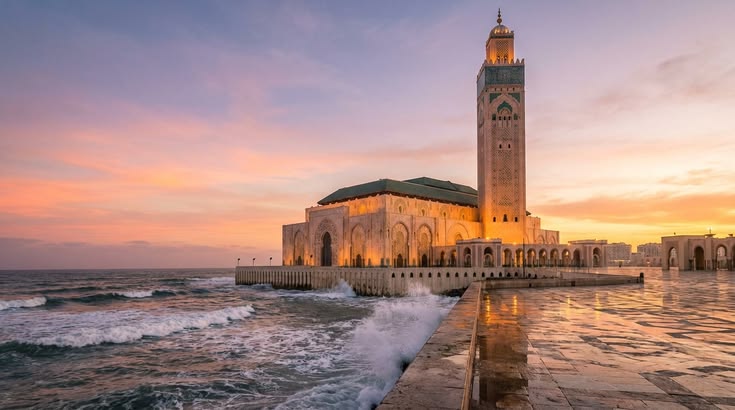
Casablanca: The Imperial Gateway of Modernity — Historical Landmarks, Architectural Wonders, and Visitor Guide
While Morocco's ancient imperial cities of Fez and Marrakech transport travelers into the medieval era, Casablanca (Dar al-Baida) offers a captivating journey through the kingdom's entry into the modern world. As Morocco's economic engine and largest metropolis, Casablanca represents an architectural playground where 18th-century coastal bastions, early 20th-century French Art Deco and "Mauresque" arcades, and grand modern Islamic monuments coexist along the Atlantic oceanfront.
Far from being just a business hub, Casablanca is a premier destination for travelers seeking deep cultural history, monumental architecture, world-class culinary stops, and seaside leisure.
1. Historical Foundations and Urban Evolution
From Ancient Anfa to Sultan Sidi Mohammed ben Abdallah
Casablanca's roots trace back to the ancient Berber settlement of Anfa. Destroyed by earthquakes and Portuguese naval raids in the 15th and 16th centuries, the coastal settlement lay in ruins until Sultan Sidi Mohammed ben Abdallah ordered its complete reconstruction around 1770. The Sultan rebuilt the city's defensive stone walls, erected coastal artillery bastions, and named the town Dar al-Baida ("The White House").
The French Protectorate and the Neo-Mauresque Laboratory
In 1912, under the French Protectorate, urban planner Henri Prost was commissioned to design a modern city (Ville Nouvelle) adjacent to the ancient medina. Prost and his team created an urban design laboratory, developing the Style Mauresque (Neo-Moorish). French architects grafted traditional Moroccan decorative crafts—such as hand-cut zellige mosaic tiles, carved cedarwood eaves, horseshoe arches, and sculpted plaster—onto modern reinforced concrete Art Deco structures. This era turned downtown Casablanca into one of the world's most concentrated centers of Art Deco architecture.
2. World-Famous Historical Landmarks
Casablanca is home to some of North Africa's most visually striking religious, administrative, and cultural monuments:
The Hassan II Mosque Complex
- Architectural Marvel: Built on a rocky peninsula jutting directly over the Atlantic Ocean, the Hassan II Mosque (Mosquée Hassan II) is a masterpiece of Arab-Islamic civil engineering and traditional Moroccan craftsmanship. Designed by French architect Michel Pinseau and inaugurated in 1993, its soaring minaret stands at 200–210 meters tall, making it one of the tallest minarets on earth. At night, a high-power laser beam shines from the top of the minaret toward Mecca.
- Interior Splendor: The main prayer hall accommodates up to 25,000 worshippers inside, with space for an additional 80,000 on the outdoor granite plaza. The hall features hand-carved Middle Atlas cedarwood ceilings, Murano glass chandeliers, heated floors, and a 3,400-ton automated retractable roof that opens to the sky in just three minutes. Below the main floor lies a subterranean ablution hall containing 41 marble lotus-shaped fountains.
- Visitor Access: Unlike almost all other active places of worship in Morocco, the Hassan II Mosque welcomes non-Muslim travelers through official, structured guided tours conducted outside of daily prayer times.
Quartier des Habous (The New Medina) & Mahkama du Pacha
- An Idealized Medina: Designed starting in 1916 by French architects Henri Prost, Auguste Cadet, and Edmond Brion, the Habous quarter was built to house rural Moroccans moving to the city. It offers a clean, harmonious interpretation of a traditional medina, featuring wide stone-paved arcades, quiet residential courtyards, and artisan shops.
- Mahkama du Pacha: The architectural jewel of the Habous quarter, this Neo-Mauresque complex was constructed between 1948 and 1952. Historically functioning as a civil court and royal reception hall, it houses over 60 rooms adorned with hand-carved cedar ceilings, Andalusian-style marble courtyards, and elaborate zellige tilework.
- Royal Palace Gates & Local Flavors: The Habous district also houses the grand entrance gates to the Royal Palace (Palais Royal) on Place des Alaouites, the Mosquée Al Mohammadi, the specialized Marché des Olives (Olive Market) filled with barrels of spiced olives, and the legendary Pâtisserie Bennis, serving traditional Moroccan pastries since 1930.
Place Mohammed V & The Administrative Core
The Civic Heart: Place Mohammed V serves as the centerpiece of Casablanca's colonial urban design. The grand public square is surrounded by major Neo-Mauresque administrative monuments constructed in the 1920s:
- The Wilaya: Featuring a clock tower and arcaded halls.
- The Main Post Office (Bureau de Poste): Adorned with ceramic tile mosaics and sweeping archways.
- The Palace of Justice (Palais de Justice): Designed with monumental arches inspired by Marrakechi architecture.
- Bank Al-Maghrib: The central bank headquarters featuring heavy stone facades and elaborate woodwork.
Boulevard Mohammed V & Rialto Cinema: Strolling along Boulevard Mohammed V reveals Art Deco apartment blocks with curved balconies, as well as the historic Cinéma Rialto (built in 1929).
The Old Medina, La Sqala & Rick's Café
- The Historic Medina: Enclosed by crenellated stone walls, Casablanca's Old Medina was rebuilt in the late 18th century.
- La Sqala Bastion: Built into the 18th-century ramparts by Sultan Sidi Mohammed ben Abdallah, this fortified stone bastion housed original bronze cannons pointing out to the ocean. Today, it functions as a charming garden restaurant specializing in traditional Moroccan gastronomy.
- Bab Marrakech & Clock Tower: Bab Marrakech is the main southern entrance gate to the old city, flanked by the civic Clock Tower built in 1910.
- Rick's Café: Although Michael Curtiz's 1942 classic film Casablanca was shot entirely on Hollywood soundstages, a former American diplomat converted a 1930s traditional riad set against the medina walls into a real-life Rick's Café. Complete with curved arches, brass lamps, a 1930s Pleyel piano, and vintage decor, it offers a nostalgic experience for film enthusiasts.
Sacred Heart Cathedral & Notre-Dame de Lourdes
- Cathedral of the Sacred Heart (Cathédrale Sacré-Cœur): Built in the 1930s by French architect Paul Tournon near Ligue Arabe Park, this deconsecrated church blends Neo-Gothic verticality with reinforced concrete and Moroccan decorative details. It now serves as a municipal cultural and art exhibition center.
- Notre-Dame de Lourdes: Constructed in 1954, this mid-century modern Catholic church is famous for its soaring concrete vaulting and massive stained-glass windows created by French artist Gabriel Loire.
Musée du Judaïsme Marocain (Museum of Moroccan Judaism)
Located in the quiet residential Oasis neighborhood, this unique institution is the only museum dedicated to Jewish culture in the Arab world. It preserves the multi-millennial history, ceremonial art, traditional clothing, and heritage of Morocco's Jewish community, featuring reconstructed interiors of historic synagogues from across the kingdom.
3. Comparative Overview of Major Monuments
| Monument Name | Historic Era / Style | Architectural & Cultural Highlights | Visitor Guidelines |
|---|---|---|---|
| Hassan II Mosque | 1993 (Modern Islamic) | 200m minaret; retractable roof; laser to Mecca; marble lotus fountains. | Non-Muslim access permitted via official guided tours outside prayer hours. |
| Mahkama du Pacha | 1948–1952 (Neo-Mauresque) | Over 60 rooms; hand-carved cedar ceilings; zellige wainscoting; Andalusian courtyards. | Active civic building; interior visits require guided tour coordination. |
| Place Mohammed V Core | 1920s (Style Mauresque) | Wilaya clock tower; Post Office mosaics; Bank Al-Maghrib; public central fountain. | Open public square; ideal starting point for Art Deco architectural walking tours. |
| La Sqala Bastion | 1770 (Alaouite Military) | 18th-century ocean ramparts; historical bronze cannons; Andalusian garden. | Open to the public; houses a famous traditional Moroccan restaurant. |
| Cathédrale Sacré-Cœur | 1930s (Neo-Gothic Concrete) | Reinforced concrete structure; Moroccan decorative accents; Ligue Arabe Park location. | Deconsecrated church functioning as a public cultural and art exhibition center. |
| Museum of Moroccan Judaism | Modern Cultural Institution | Reconstructed historic synagogues; ceremonial silver Torah cases; traditional clothing. | Located in Oasis district; closed on Saturdays and major Jewish holidays. |
4. Coastal Leisure and Modern Attractions
- Aïn Diab Corniche: Casablanca's oceanfront boulevard extends southwest from the Hassan II Mosque. Lined with palm trees, beach clubs, seafood restaurants, and panoramic walking paths, it is the city's premier destination for sunset strolls and Atlantic views.
- Morocco Mall: Situated at the southern end of the Corniche, this is one of Africa's largest shopping and entertainment destinations, featuring an oceanfront setting, luxury boutiques, and a massive three-story cylindrical aquarium (Aquadream).
- Les Abattoirs de Casablanca: Constructed in 1922 in an industrial Neo-Mauresque style, these former municipal slaughterhouses in Hay Mohammadi have been repurposed into an urban cultural center hosting street art exhibitions and live music performances.
5. Accommodations: Heritage Properties vs. Modern Coastal Resorts
Travelers to Casablanca can choose between two distinct accommodation styles:
- Heritage & Art Deco Boutique Hotels (City Center & Habous): Restored 1930s Art Deco properties and historic townhouse riads situated in the downtown core or near the medina ramparts. These stay options place guests within walking distance of Place Mohammed V, architectural arcades, and historic dining spots.
- Modern Oceanfront Resorts (Aïn Diab & Anfa): Luxury international hotels situated along the Atlantic Corniche. These properties offer expansive swimming pools, private ocean access, full-service spas, and direct proximity to beach clubs and coastal dining.
6. Logistics, Navigation, and Visitor Guidelines
Transport & Connections
- Mohammed V International Airport (CMN): Located 30 kilometers south of the city, the airport is directly connected to central Casablanca via regular suburban trains (TNB) running directly into Casa-Voyageurs railway station.
- High-Speed Rail (Al Boraq): From Gare de Casa-Voyageurs, travelers can board Morocco's flagship Al Boraq high-speed train, which connects Casablanca to Tangier in approximately two hours. Regional coastal trains to Rabat depart frequently from Gare de Casa-Port.
- Casablanca Tramway Network: Modern light-rail tramways (Lines T1–T4) provide clean, safe, and efficient transit connecting train stations with Place Mohammed V, the Habous quarter, the Central Market (Marché Central), and the Aïn Diab beachfront. Red Petits Taxis are also readily available throughout the city for short urban rides.
Best Time to Visit
- Spring (March to May) & Autumn (September to November): Warm, sunny coastal weather with daytime temperatures ranging from 20°C to 25°C—ideal for architectural walking tours.
- Summer (June to August): Mild coastal temperatures moderated by Atlantic ocean breezes, making Casablanca significantly cooler than inland cities like Marrakech.
- Winter (December to February): Mild coastal weather with occasional rain; ideal for uncrowded museum visits and cultural exploring.
Strategic Single-Day Tour Itinerary
To optimize time and avoid traffic, organize your day logically:
- 08:30 AM – 10:30 AM: Start with the morning guided tour at the Hassan II Mosque for clear light and smaller crowds.
- 11:00 AM – 01:00 PM: Take an Art Deco architectural walking tour along Boulevard Mohammed V and Place Mohammed V.
- 01:00 PM – 02:30 PM: Enjoy a traditional Moroccan lunch set inside the 18th-century stone ramparts at La Sqala.
- 03:00 PM – 05:00 PM: Explore the Quartier des Habous, visit the Mahkama du Pacha, and sample pastries at Pâtisserie Bennis.
- 05:30 PM – 08:00 PM: Watch the sunset over the Atlantic Ocean along the Aïn Diab Corniche or enjoy an evening at Rick's Café.
How to travel to Casablanca
Mohammed V International Airport (CMN) – Africa's busiest hub
ONCF Al Boraq high-speed from Tangier, direct to Rabat, Marrakech & Fes
CTM & Supratours – comfortable nationwide connections
Highway hub connecting all major Moroccan cities
The Blue Pearl Escape
A tranquil, private 2-day getaway from Casablanca to the enchanting Blue City of Chefchaouen, nestled high in the Rif Mountains. A perfect blend of serene vibes, rich history, and captivating local culture.
Day 1: Casablanca to Chefchaouen (Discovering the Blue Medina)
- Your journey begins with a morning pick-up from Casablanca. Settle into your comfortable, air-conditioned vehicle as we drive north toward the breathtaking Rif Mountains.
- Upon arriving in Chefchaouen, you'll immediately see why its original Berber name means "horns," referencing the twin mountain peaks towering over the town.
- Spend your day wandering the vibrant medina. Let your senses guide you as you take in the aroma of freshly baked bread and sizzling tagines.
- Visit the historic Kasbah, the Grand Mosque, and take advantage of the endless photography opportunities.
- After a full day of exploration, relax and spend a peaceful night in a traditional, highly-rated Riad in the heart of the Blue City. (Dinner included)
Day 2: Chefchaouen to Casablanca (Morning Explorations & Return)
- Wake up to a wonderful, traditional Moroccan breakfast at your Riad.
- Take advantage of your remaining free time to soak up the relaxed atmosphere, snap a few final photos of the colorful streets, or pick up some last-minute souvenirs.
- In the afternoon, meet your driver for a comfortable and scenic return journey.
- Arriving back in Casablanca by the early evening (~06:30 PM) to conclude your tour. (Breakfast included)
Frequently Asked Questions
Is this a private or shared tour?
This is a fully private tour. Your vehicle and driver are exclusively yours for the entire 2-day journey.
What time does the tour depart?
Please arrive at your pick-up point by 08:00 AM for a prompt departure at 08:30 AM.
Is this tour family-friendly?
Yes! This tour is suitable for families with children aged 6 and above.
Can I arrange a local guide in Chefchaouen?
Yes, a local guide can be arranged upon request if you'd like a deeper dive into the city's history.
What should I bring?
Comfortable walking shoes, a camera, sunscreen, and a light jacket as the mountain air can be cool.
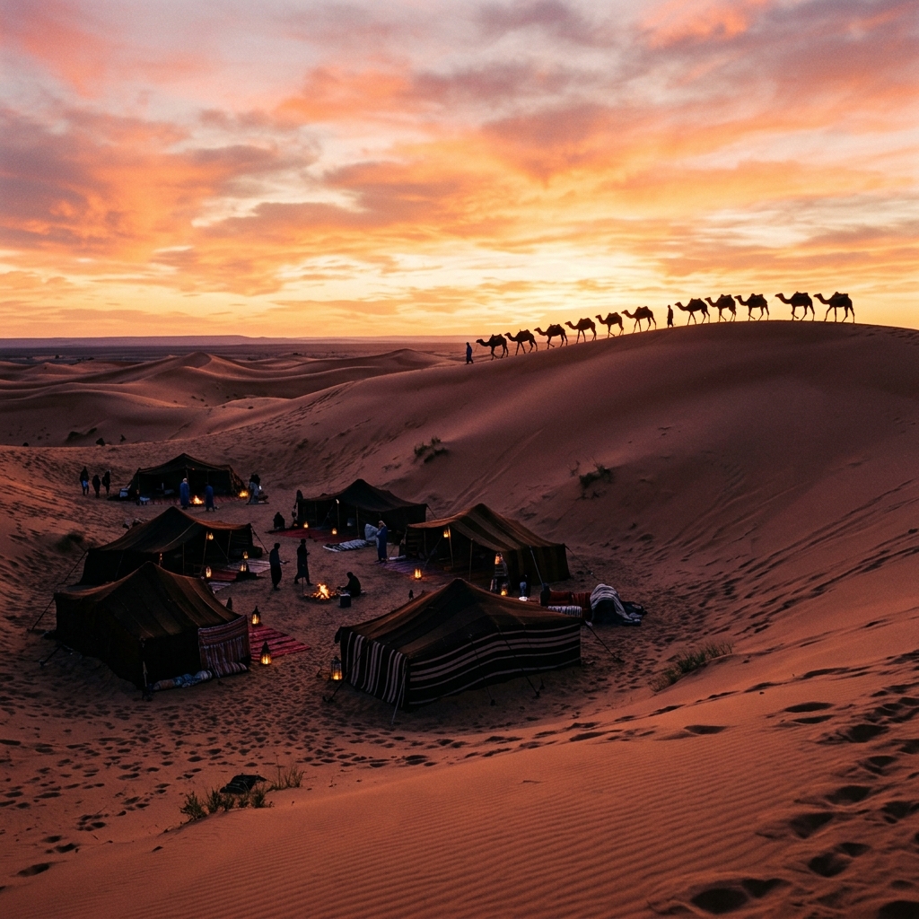 o Oasis & Dunes
Zagora
The gateway to the immense Draa Valley. Palm groves, ancient mud kasbahs, and Berber camps.
o Gateway to the SaharaZagora
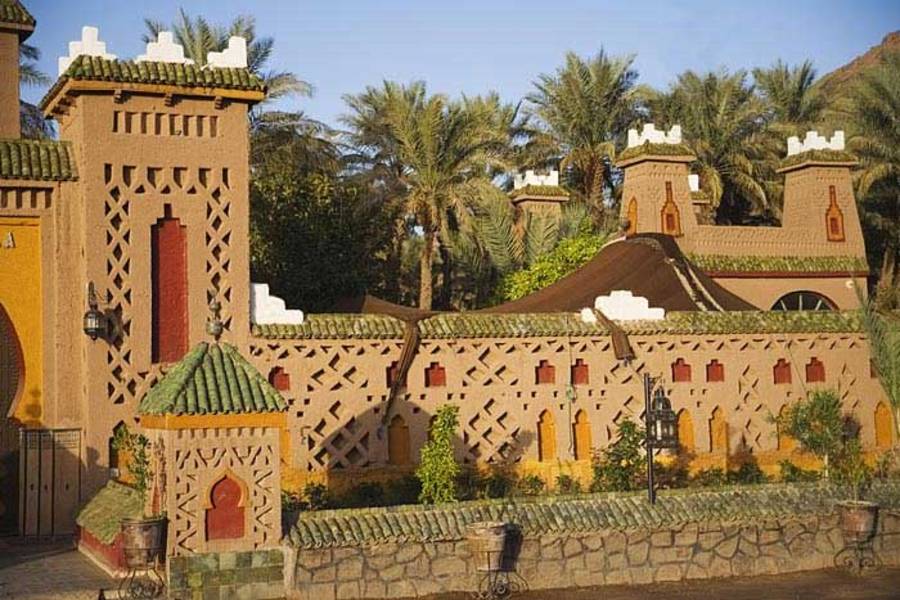
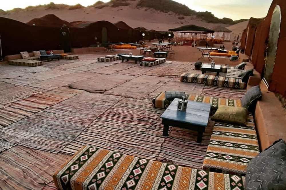
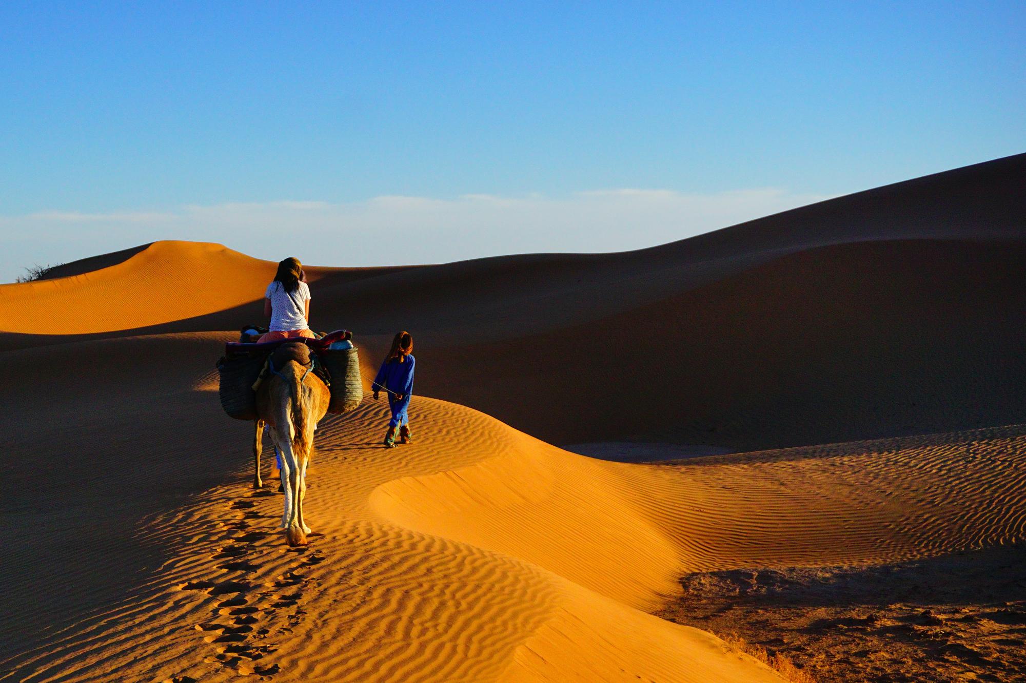
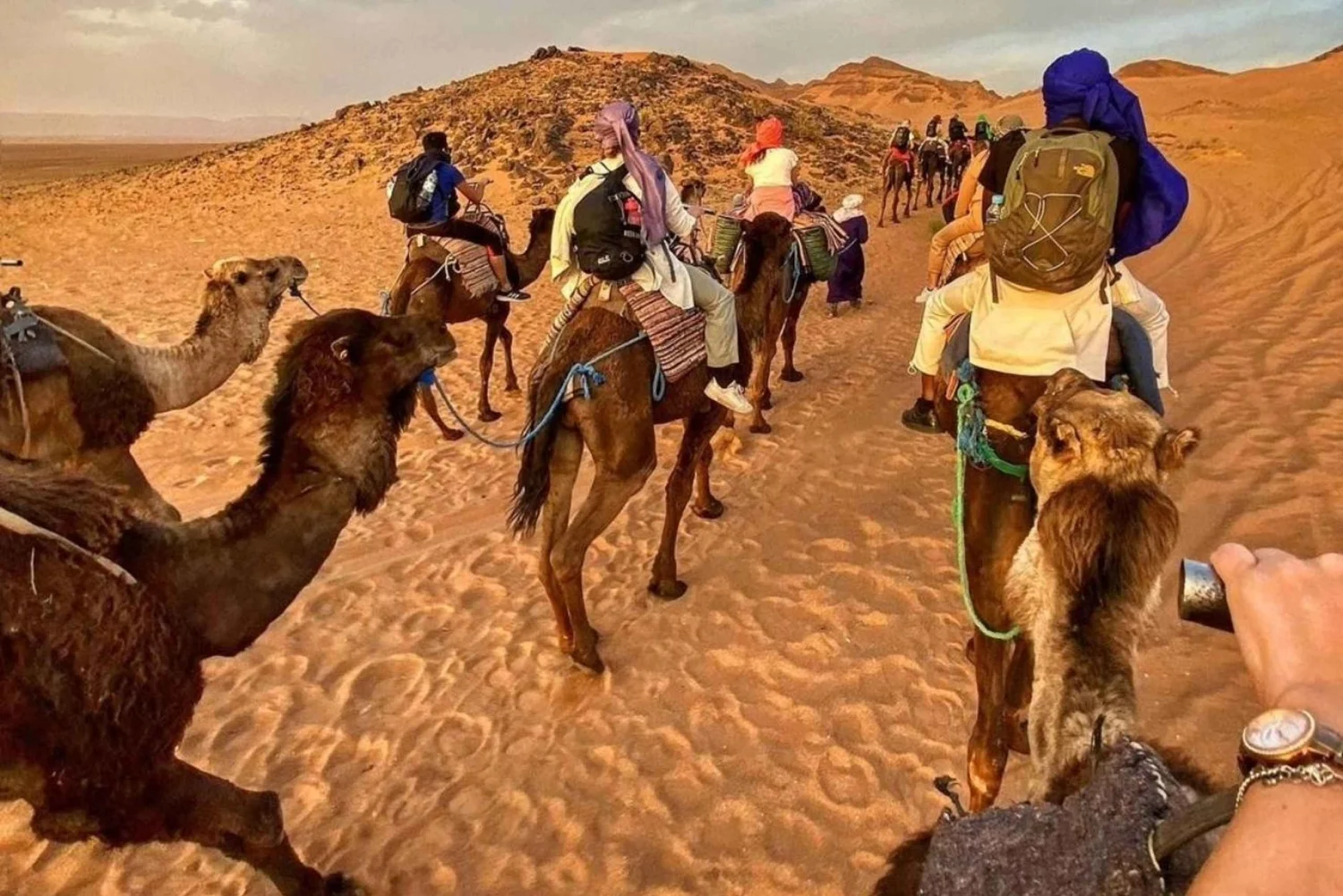
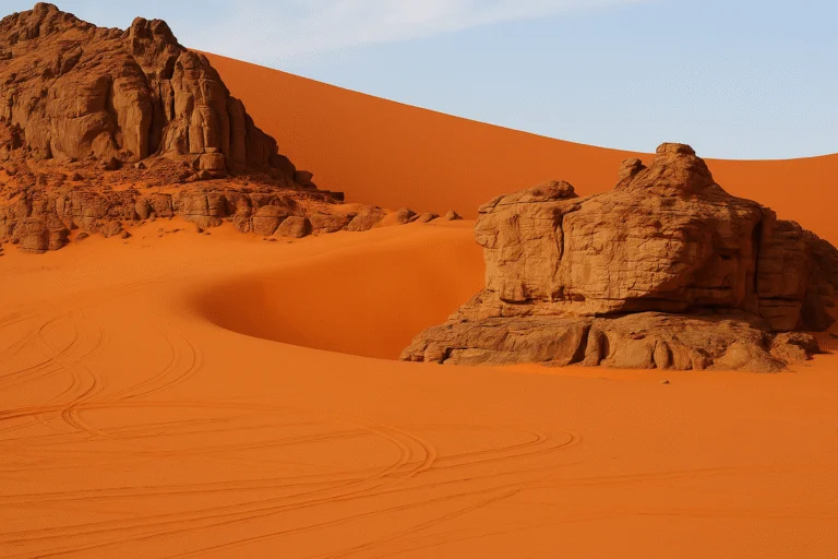
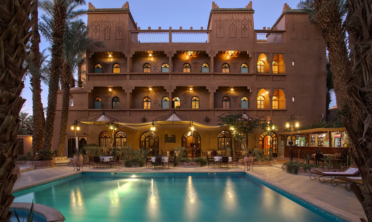
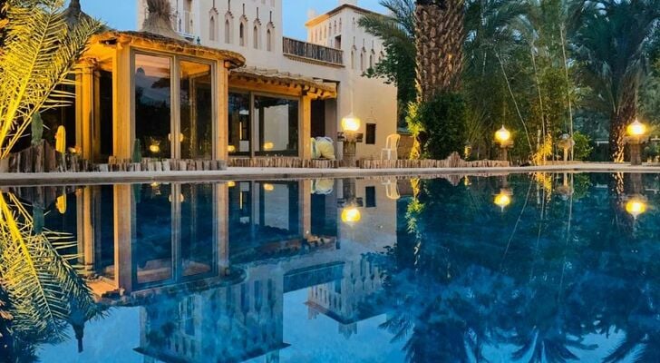
The Zagora Oasis and the Tamegroute Heritage Complex: Trans-Saharan Roots, Vernacular Architecture, and Spiritual Radiance of the Draa Valley
Located in southeastern Morocco, approximately 177 kilometers from Ouarzazate, the Zagora province acts as the geographical, economic, and cultural lock of the Draa Valley. This oasis region, shaped by the course of the Draa River and lined with dense palm groves, historically represents one of the most strategic crossing routes between sub-Saharan Africa and the Mediterranean basin. Zagora's territorial identity goes far beyond its contemporary function as the "Gateway to the Desert"; it is rooted in a millennial memory where long-distance caravan trade, the scholarly knowledge of the Sufi tradition, and fine craftsmanship have inextricably cross-fertilized.
An analysis of this oasis ecosystem reveals a highly dense heritage complex, where raw earth urban structures (ksour and kasbahs) respond to extreme climatic constraints while bearing the mark of centuries-old community social organizations. At the crossroads of mercantile and spiritual dynamics, the Zagora sector and its immediate satellite, the village of Tamegroute, embody the persistence of a material culture and an intellectual tradition of inestimable value, preserved in the heart of the Saharan matrix.
1. Zagora and the Draa Valley: Trans-Saharan Crossroads and Strategic Node
The historical emergence of Zagora as a major urban and administrative center in the Draa Valley directly stems from its position on the great caravan routes linking West Africa to the major Moroccan commercial hubs (Marrakech, Fes). The famous sign reading "Tombouctou 52 jours" (Timbuktu 52 days) still displayed in the city center is not a mere tourist artifact, but rather the tangible testimony of a major geo-economic reality: Zagora was the main Moroccan stage for caravans carrying salt, gold, ivory, and spices across the Sahara.
The spatial articulation of the Draa basin is organized along a linear geographical axis structured by National Route 9 (N9), linking the urban centers of the North to the Saharan expanses of the South. This itinerary begins in Ouarzazate, crosses the oasis lock of Agdz, then delves into the valley down to the city of Zagora, whose center is laid out along Avenue Mohammed V and accessible through the monumental Ouarzazate Gate. Downstream from Zagora, the network branches out towards the immediately adjacent Kasbah of Amzrou, then towards the spiritual and artisanal complex of Tamegroute, before ending at M'Hamid El Ghizlane, the ultimate access point to the Erg Chigaga dune field.
Zagora's urban organization reflects this dual vocation as an administrative center and an oasis refuge. The shaded streets of the city center branch off towards fertile palm groves where the cultivation of exceptional dates constitutes the foundation of the local economy. The continuous presence of water along the Draa riverbed has allowed the maintenance of highly productive tiered agriculture under the canopy of palm trees, protecting vegetable crops against the severity of the Saharan climate.
2. Amzrou: Jewish Heritage and Artisanal Metallurgy
A few kilometers south of Zagora stands the Kasbah of Amzrou, a masterfully preserved earthen architectural complex. Historically, Amzrou housed a large Jewish community specializing in silver craftsmanship and metallurgy. Following the massive departure of these populations in the mid-20th century, the local Amazigh populations fully integrated and perpetuated this ancestral know-how.
Today, Amzrou remains famous for its jewelry and silver workshops. The craftsmen use traditional casting techniques to create ornaments featuring Amazigh and Sub-Saharan motifs. The visit to this kasbah, characterized by its covered alleys and geometric raw earth structures, provides a deep understanding of the socio-economic interactions that characterized the multi-confessional populations of the Moroccan South.
3. Tamegroute: Sufi Hub, Ancient Manuscripts, and Iconic Ceramics
Located about twenty kilometers south of Zagora, the village of Tamegroute constitutes an intellectual and artisanal center of international stature, structured around two fundamental pillars: the Zawiya Nasiriyya and a unique pottery production.
| Heritage Pillar | Historical and Material Foundation | Cultural and Technical Scope |
|---|---|---|
| The Zawiya Nasiriyya | Sufi brotherhood founded in the 17th century by Sidi Mohamed Ben Nacer. | Spiritual center of major influence, managing a vast network of followers across the Maghreb and West Africa. |
| The Coranic Library | Collection amassed by scholars of the brotherhood over centuries. | Preservation of over 4,000 ancient manuscripts, featuring works in theology, astronomy, medicine, and mathematics on gazelle skin. |
| Green Glazed Ceramics | Ancestral firing technique unique to Tamegroute (using an alloy of manganese, copper oxide, and barley). | Production of a green-glazed pottery with a rustic texture, internationally recognized and strictly localized due to the specific local clay. |
| Underground Architecture | Network of covered and semi-subterranean streets within the Ksar. | Optimized thermal regulation allowing inhabitants to protect themselves from summer extremes (often exceeding 45°C). |
The green ceramics of Tamegroute are particularly remarkable. The firing process, conducted in traditional earth kilns, generates uncontrollable variations in temperature, giving each piece a unique gradient of green and an imperfect, raw texture highly sought after in contemporary design. This artisanal ecosystem ensures the economic survival of several dozen families operating in cooperatives.
4. Erg Chigaga: The Authentic Saharan Experience
For travelers seeking a profound immersion into the desert, Zagora serves as the logistical departure point for M'Hamid El Ghizlane and the dunes of Erg Chigaga. Unlike Erg Chebbi (Merzouga), Erg Chigaga is wilder, less accessible (requiring 60 km of off-road 4x4 driving), and offers a vast expanse of dunes spreading over 40 kilometers.
- Logistical Hub: Zagora provides the necessary infrastructure (vehicles, provisions, specialized guides) for expeditions to the deep desert.
- Nomadic Immersion: The Chigaga sector remains deeply marked by the culture of the Sahrawi nomads, offering an experience centered on isolation, contemplation, and traditional bivouacs.
Analytical Conclusion
The Zagora and Tamegroute complex represents much more than a simple geographical stopover; it is an open-air museum of trans-Saharan history. The preservation of its palm groves, the continuity of its green pottery, and the safeguarding of its manuscripts make it a major pole of cultural tourism in Morocco. For travelers, exploring this region offers a comprehensive reading of the socio-economic, spiritual, and architectural dynamics that have allowed human societies to thrive on the threshold of the greatest desert in the world.
How to travel to Zagora
CTM buses from Marrakech or Ouarzazate
Zagora Airport (Ouarzazate also nearby)
Scenic route via N9 from Marrakech (6h)
Expedition Highlights
-
Golden Hour Treks
Glide across the Zagora desert on a camel during a breathtaking sunset and a serene morning sunrise.
-
Night Under the Stars
Spend the night in a traditional Berber desert camp, complete with a hearty dinner, live drum music, and campfire storytelling.
-
Cinematic History
Explore the UNESCO World Heritage site of Kasbah Aït Ben Haddou, famously featured in Gladiator and Game of Thrones.
-
Oasis Landscapes
Journey through the lush Draa Valley, home to Morocco’s largest palm oasis and ancient fortified mud-brick villages.
-
Mountain Vistas
Traverse the spectacular Tizi n'Tichka pass, the highest paved road in North Africa (2,260m).
Your 2-Day Journey Itinerary
Day 1: High Atlas › Aït Ben Haddou › Draa Valley › Zagora Desert Camp
- Your journey begins at 7:00 AM with a pick-up from Marrakech. We’ll ascend the High Atlas Mountains via the Tizi n’Tichka pass.
- Step into history at the iconic Kasbah Aït Ben Haddou, wandering its ancient streets before enjoying lunch at a nearby café.
- We then continue our drive to the Agdz oasis, cruising through the Draa Valley—marveling at its endless date palms and historic kasbahs.
- Upon arriving in Zagora, you will meet your camel caravan. Trek into the rocky desert as the setting sun paints the sky in vibrant hues of pink and gold.
- Settle into your private tent (Standard or Luxury) and sip on traditional mint tea. Enjoy a rich Moroccan dinner under the stars, followed by an unforgettable evening of live Berber drumming around a roaring campfire. (Meals Included: Dinner)
Day 2: Desert Sunrise › Ouarzazate › Return to Marrakech
- Wake up before dawn to witness a magical desert sunrise, watching the soft morning light spread across the dunes in near-total silence.
- After a traditional Moroccan breakfast at the camp, remount your camel for a scenic morning ride back to the main road.
- We’ll begin our return journey through the breathtaking Draa Valley and High Atlas Mountains, with scheduled stops for refreshments, lunch, and a brief visit to the cinematic city of Ouarzazate.
- We will cross the Tizi n'Tichka pass one last time, dropping you off safely at your Marrakech hotel or riad at approximately 6:00 PM. (Meals Included: Breakfast)
What's Included
- Pick-up and drop-off at your Marrakech hotel/riad.
- Transportation in a comfortable, air-conditioned Minibus/Minivan with onboard Wi-Fi.
- Multilingual driver-guide (English, French, Spanish).
- 1 Night in a private desert camp tent (Standard or Luxury).
- Guided sunset and sunrise camel treks in Zagora.
- Half-board meals: 1 Moroccan Dinner and 1 Breakfast.
- Evening campfire entertainment with live Berber music.
- Secure luggage storage in the vehicle.
Not Included
- Mid-day lunches and extra beverages.
- Optional local guide in Aït Ben Haddou (upon request).
- Personal expenses and tipping.
Important Information & What to Bring
Pack Smart
Bring comfortable walking shoes, sunglasses, a hat, and sunscreen. A photocopy of your passport is accepted and recommended.
Clothing
Long trousers are highly recommended for the camel ride.
Desert Climate
The desert has extreme temperature shifts. Expect hot days and very cold nights (Nov–Feb). Dressing in layers is the best way to stay comfortable!
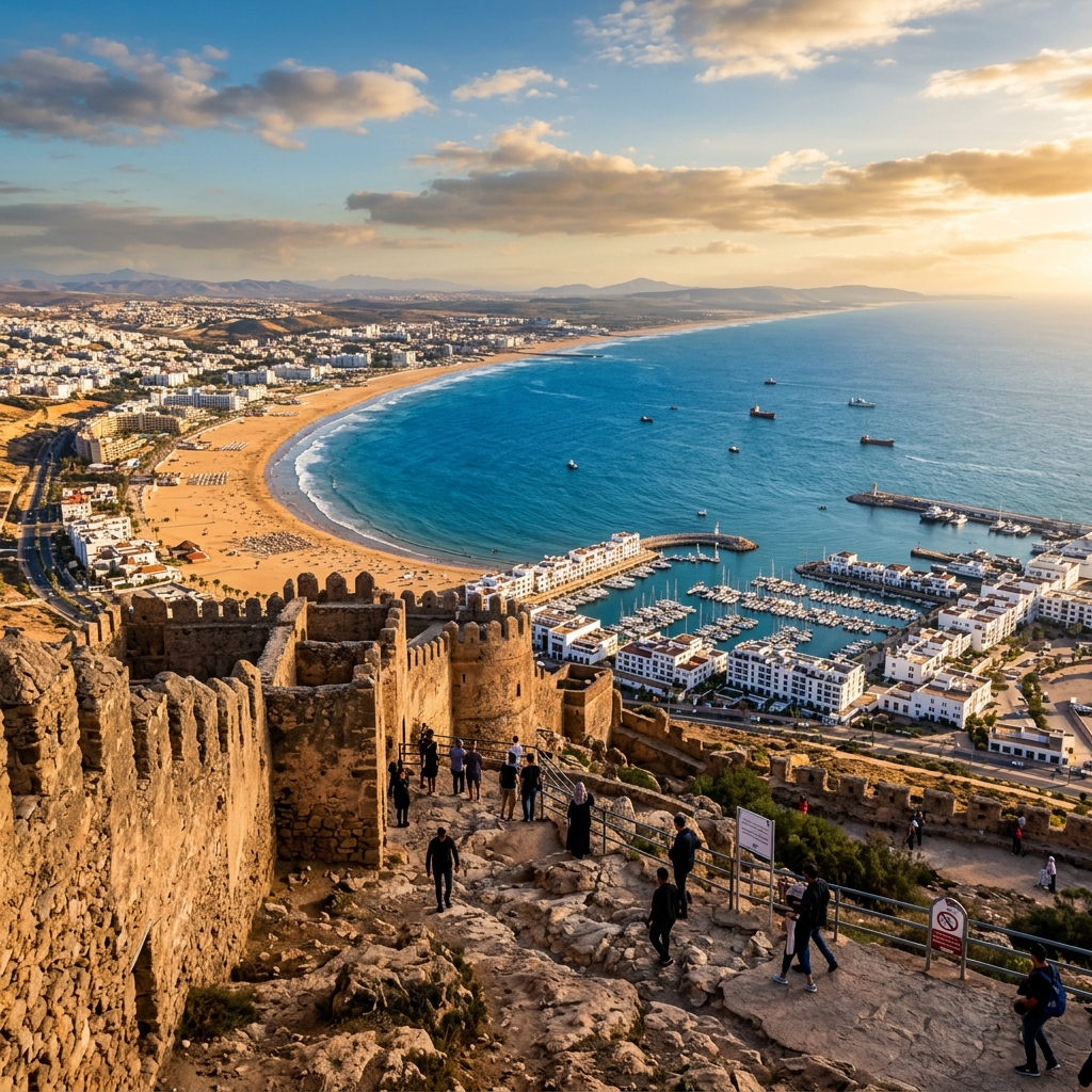 o Ocean Resort
Agadir
Coastal breeze, golden sandy beaches, year-round sunshine, sea promenade, and Aïtlantic waters.
o The Resort HubAgadir
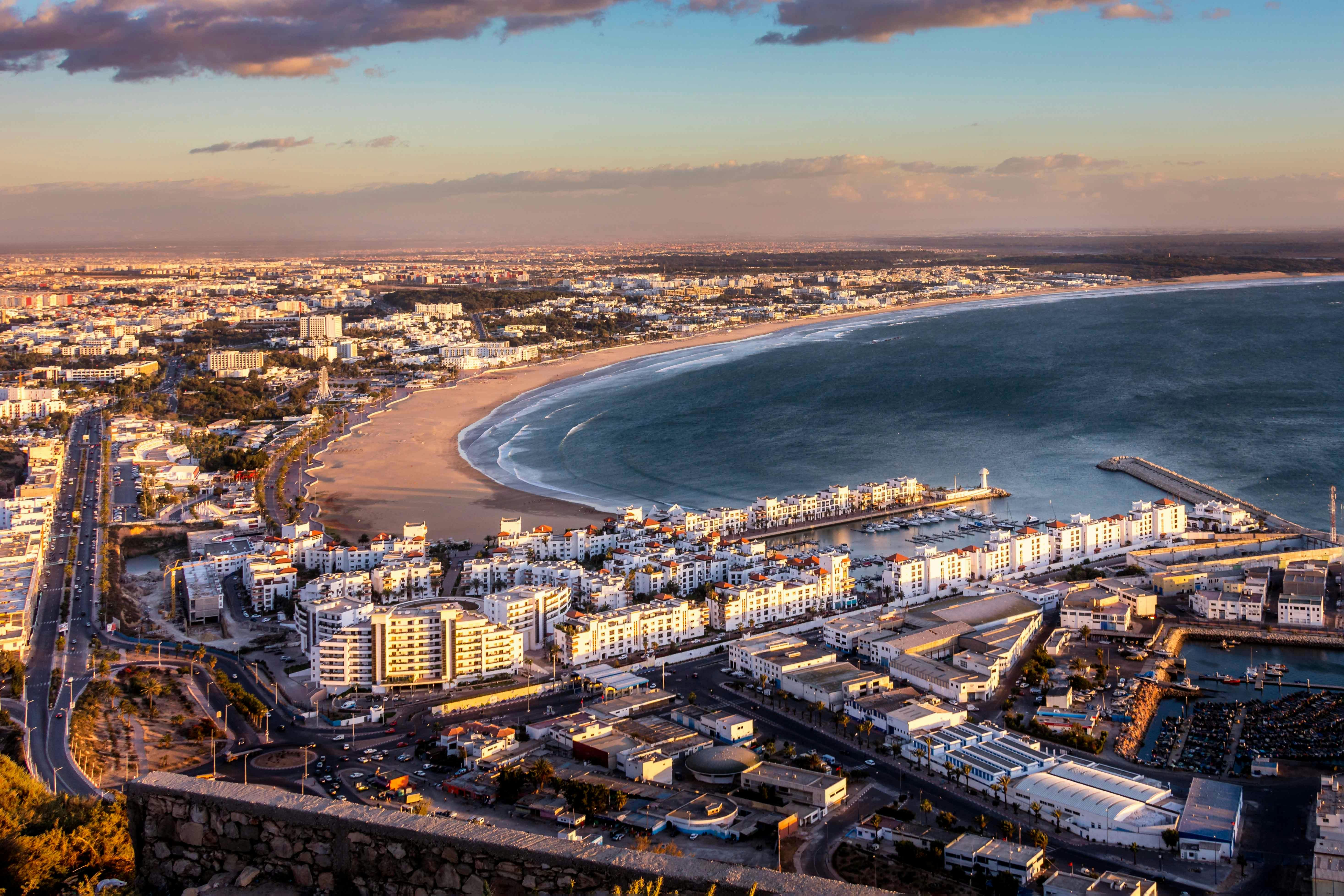
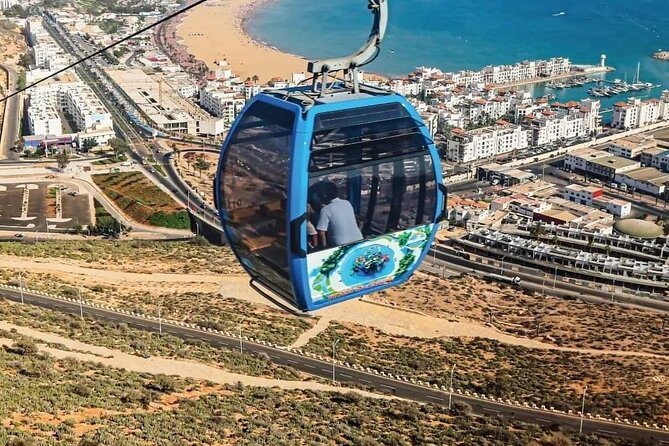
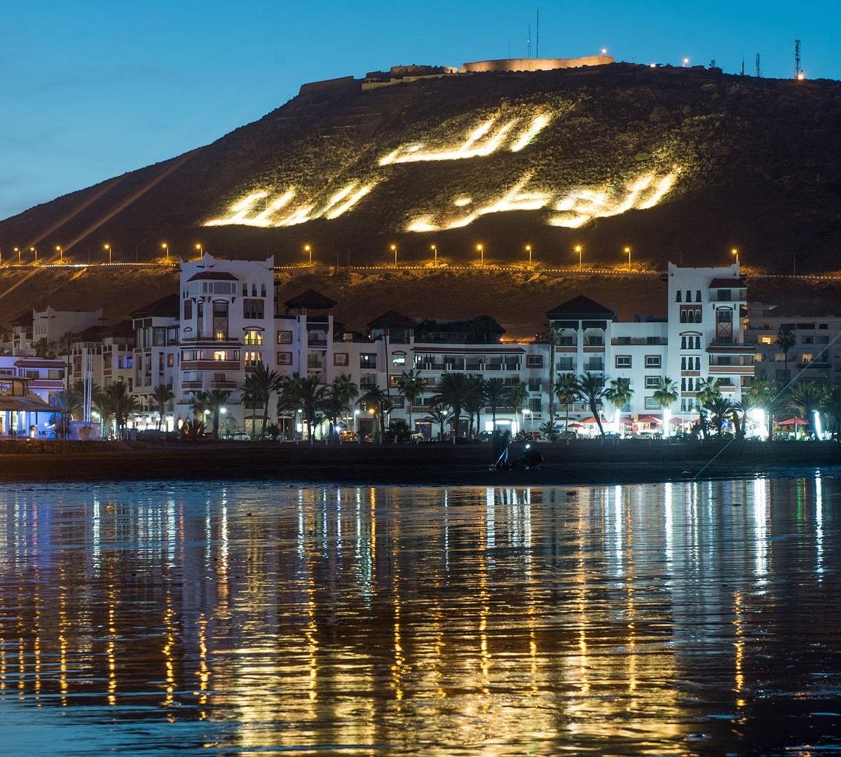
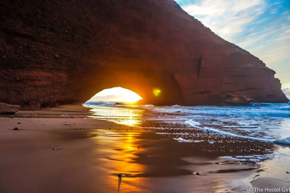
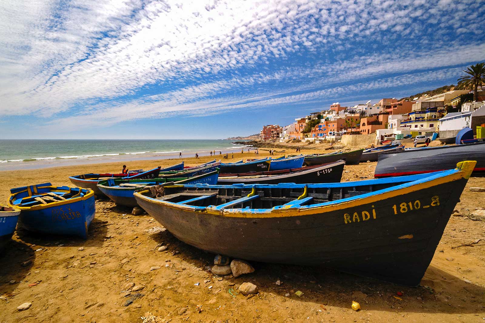
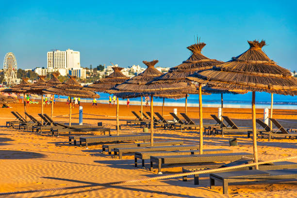
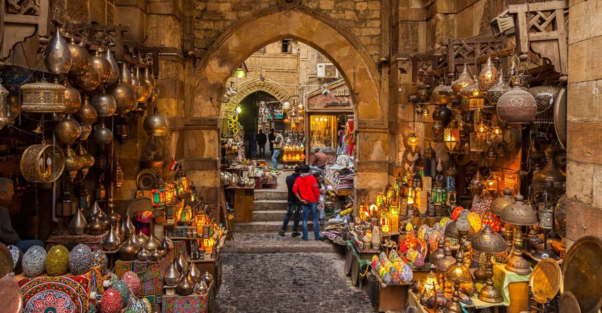
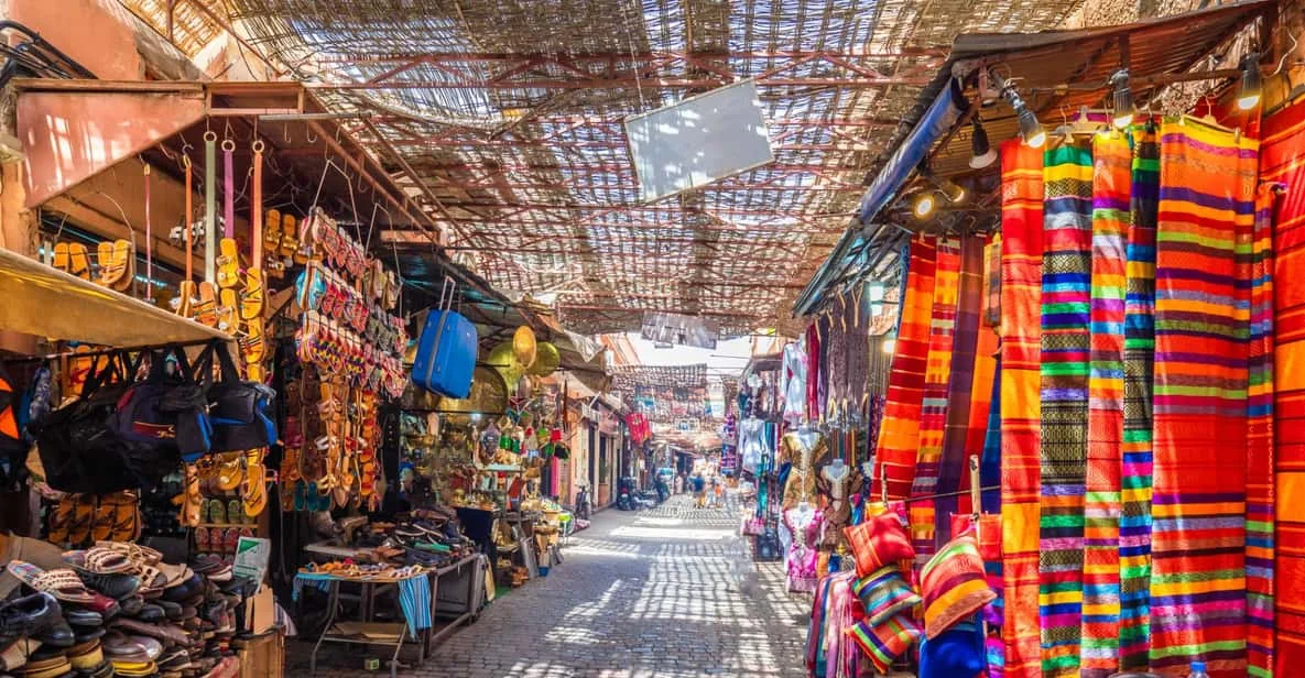
Agadir's Resilient Horizon: An Urban, Cultural, and Tourism Analysis of Morocco's Souss-Massa Capital
Agadir occupies a singular position within the urban and cultural geography of the Kingdom of Morocco. Situated along the Atlantic coastline at the foot of the Western High Atlas Mountains, the capital of the Souss-Massa region functions as both a vital maritime economic hub and a case study in structural urban resilience. Unlike the imperial inland centers of Fez, Marrakech, or Meknes, whose historic urban fabrics remain intact within medieval fortified walls, Agadir was completely re-engineered in the mid-twentieth century. A catastrophic earthquake on February 29, 1960, eradicated the city's ancient core, transforming Agadir into Morocco's primary laboratory for modernist urbanism, low-rise functional architecture, and anti-seismic engineering.
This report provides an analytical examination of Agadir's history, its post-1960 reconstruction, historical memory landmarks such as the Agadir Oufella and La Médina d'Agadir, coastal ecosystems, regional hinterland excursions, and practical travel logistics.
Historical Trajectory and the 1960 Cataclysm
Agadir's early strategic value was determined by its natural Atlantic bay and its role as an oceanic outlet for the agricultural and mineral wealth of the Souss Valley. In the early sixteenth century, Portuguese traders established a fortified maritime outpost named Santa Cruz do Cabo de Gué near the base of the coastal promontory. This foreign presence was brief; by 1541, the Saadian Dynasty captured the fortress, expelling Portuguese forces and establishing a permanent defensive citadel atop the high hill dominating the bay. This hilltop fortification, known as the Kasbah or Agadir Oufella ("Agadir from Above" in Amazigh), became the urban anchor of the region, housing a residential community, a principal mosque, and commercial quarters that linked Atlantic sea lanes with trans-Saharan caravan routes.
Over subsequent centuries, Agadir operated as a regional port, experiencing economic fluctuations under successive Moroccan dynasties. By the mid-twentieth century, under the French Protectorate, the city expanded rapidly down the hillside toward the coastline, establishing dense residential and commercial districts including Founti, Yachech, Talborjt, and an adjacent European municipality.
This historical continuum was interrupted at 23:40 on February 29, 1960. A shallow-focus earthquake lasting fifteen seconds struck directly beneath the city. The shockwaves delivered destructive localized force that overwhelmed the traditional unreinforced stone and rammed-earth (pisé) masonry structures.
The human and physical toll was overwhelming:
- An estimated 12,000 to 15,000 people lost their lives—representing approximately one-third of the city's total population—while an additional 25,000 residents sustained injuries. The nocturnal timing meant the vast majority of residents were asleep indoors, preventing timely evacuation.
- The historical hillside districts of the Kasbah, Founti, and Yachech sustained a 95% structural destruction rate. The primary residential quarter of Talborjt experienced between 60% and 90% destruction, while the newer European quarter sustained approximately 60% structural loss.
- The disaster destroyed both physical infrastructure and centuries of vernacular architectural heritage. Due to the high density of structural collapse and the difficulty of recovery, public health authorities declared the original hillside footprint a collective memorial site, strictly prohibiting full-scale residential rebuilding on those specific slopes.
Post-1960 Reconstruction and Urban Typology
Following the cataclysm, King Mohammed V declared that Agadir would be rebuilt through national resolve. The resulting royal decree initiated a comprehensive re-planning process led by international urbanists, Moroccan architects, and structural engineers. Planners made the decision to shift the city's central administrative and commercial axis approximately two kilometers south of the original epicentral zone, anchoring new foundations on geologically stable alluvial ground away from the active fault line.
The post-1960 reconstruction represents a conscious departure from traditional North African urban design. Rather than replicating the high-density, winding street patterns of a traditional medina, planners adopted mid-century modernism, functionalism, and brutalist structural expressions. The new blueprint established wide, tree-lined boulevards, public green spaces, low-rise reinforced concrete buildings, and distinct functional zoning separating industrial, port, commercial, and residential sectors.
Crucially, Agadir became the birthplace of Morocco's modern seismic construction regulations (normes parasismiques). Mandatory building standards required ductile concrete frames, reinforced steel tie-beams, strict height limits, and continuous structural foundations. This architectural shift produced an urban landscape defined by geometric clarity, whitewashed facades, and open vistas, creating a functionalist aesthetic designed to offer physical security and civic stability.
| Urban Dimension | Pre-1960 Historic Agadir | Post-Reconstruction Modern Agadir |
|---|---|---|
| Primary Settlement Core | Hillside Kasbah, Founti, Old Talborjt | Southern Alluvial Plain (New Talborjt, Charaf, City Center) |
| Structural Materials | Unreinforced stone, mudbrick (pisé), timber supports | Reinforced concrete frames, steel tie-beams, low-rise masonry |
| Spatial Morphology | High-density organic alleys, compact defensible layout | Orthogonal grid, wide multi-lane boulevards, open plazas |
| Seismic Resilience | Unregulated vernacular masonry; high vulnerability | Mandatory seismic codes (normes parasismiques) |
| Socio-Economic Profile | Traditional trading post, local fishing, caravan terminus | Regional administrative capital, tourism resort, commercial port |
Cultural Memory and Historical Landmarks
While post-earthquake Agadir is dominated by mid-century and contemporary infrastructure, several key sites anchor historical memory and preserve regional Amazigh heritage.
Agadir Oufella: The Rehabilitation of a Sacred Citadel
Situated 236 meters above sea level, the fortress of Agadir Oufella remains the dominant physical symbol of the city's history and its 1960 disaster. Originally constructed in 1540 by Saadian Sultan Mohammed ash-Sheikh, the citadel's perimeter walls once protected a community of over 1,000 residents. The 1960 earthquake breached its outer ramparts and collapsed its inner streets, leaving the site as a sacred burial site and memorial.
In recent years, the Kasbah has undergone a rehabilitation project directed by Franco-Moroccan architect and anthropologist Salima Naji. The restoration balances structural stabilization, historical accuracy, and memorial sanctity. To prevent disturbing the remains buried beneath the surface, traditional deep-foundation excavations were ruled out. Naji designed an elevated network of wooden decking that precisely traces the pre-1960 street grid. Visitors navigate the citadel via these raised walkways, observing stabilized stone foundations without stepping directly onto the historic ground.
The restored complex incorporates several key elements:
- The Saadian Gate and Outer Ramparts: Reconstructed using local stone and lime mortars, incorporating the restored gunboat esplanade equipped with historical European artillery cannons.
- Ecumenical Memorial Spaces: Designed points of reflection honoring victims across Muslim, Christian, and Jewish faiths, reflecting the historical diversity of old Agadir.
- Preserved Sacred Sites: Structural consolidation of the site of the historical mosque, including its preserved mihrab niche, and the restored dwelling of Lalla Yamna N'Sidi Brahim.
- Aerial Cable Car (Téléphérique): Transportation access is provided by an Austro-Swiss Doppelmayer-Garaventa cable car system spanning 1,600 meters from the lower station to the summit in six minutes. Operating daily from 10:00 to 23:00, this transit link provides eco-friendly access while mitigating vehicular traffic on the mountain road.
La Médina d'Agadir (Médina Coco Polizzi)
Located in the Ben Sergao district approximately four kilometers south of the city center, La Médina d'Agadir is a landmark project conceived to recreate traditional Moroccan urban space in a post-earthquake setting. Initiated in 1992 by Italian-born master artisan and decorator Beato Salvatore "Coco" Polizzi (1941–2021), this 4.6-hectare complex functions as an open-air architectural museum and active craft center.
Polizzi utilized traditional materials—including rammed earth (pisé), regional Souss stone, lime plasters, and Atlas cedar—to construct an architectural tribute to southern Moroccan building techniques. The complex features shaded alleyways, hand-carved wooden doorways, vaulted archways, and quiet courtyards centered around stone fountains. It houses active artisan workshops dedicated to leatherworking, wood carving, zellige tilework, metalworking, and textile weaving. Unlike commercial souks, prices across the Polizzi Medina are strictly fixed, maintaining an environment focused on cultural preservation and artisan dignity. The site operates daily from 09:00 to 18:00, with entry fees set at 40 MAD for adults and 20 MAD for children.
Civic Memory and Commercial Hubs
The Nouveau Talborjt quarter houses the Jardin Olhão, a public park commemorating Agadir's twin-city relationship with Olhão, Portugal. Within this garden lies the Musée de la Mémoire d'Agadir, an institution displaying historical photographs, press archives, and personal testimonies documenting life before and after the 1960 earthquake. Near the city center along Avenue Hassan II, the Musée du Patrimoine Amazigh displays regional ethnographic collections, including historic silver Amazigh jewelry, carved timber implements, manuscripts, and traditional textiles.
For daily trade, Souk El Had represents the economic heart of modern Agadir. Spanning over 13 hectares and enclosed by crenellated walls, it is one of the largest urban markets in West Africa. The souk contains thousands of individual stalls organized into specialized sectors, supplying fresh agricultural produce, spices, regional ceramics, leather goods, and pure argan oil products.
Coastal Ecosystems, Hinterland Excursions, and Socio-Economic Dynamics
Agadir's geographical location provides direct access to Atlantic coastal ecosystems and the mountainous hinterland of the Western High Atlas.
Taghazout Bay and the Coastal Strip
Agadir's urban shoreline is defined by a ten-kilometer crescent of sandy beach protected from North Atlantic swells by the promontory of Agadir Oufella. The paved seaside promenade (Corniche) runs parallel to the beach, hosting international hotels, dining establishments, and water sports centers.
Following the N1 coastal highway northward, the geography transforms into a rugged coastline dotted with sandy coves and ocean points. Approximately 20 to 30 kilometers north lies Taghazout, a traditional Amazigh fishing village that has developed into an international surfing destination. Surf breaks such as Anchor Point, Killer Point, and Boilers draw ocean sports enthusiasts worldwide. The surrounding area has been further developed through the Taghazout Bay eco-resort initiative, which integrates sustainable hospitality facilities, golf courses, and surf academies while supporting local coastal infrastructure.
Paradise Valley, Tizgui, and the Argan Biosphere
Extending inland along the Tamraght River valley, the foothills of the Western High Atlas contain dramatic geological formations, most notably Paradise Valley. Located roughly 25 kilometers from Taghazout and 45 to 60 minutes from central Agadir, this limestone canyon features natural swimming basins, palm oases, and terraced agricultural plots. The valley road, historically termed the "Honey Road" (Route de l'Miel) due to regional apiculture, offers a scenic transition from the ocean coast into mountain ecosystems.
For travelers seeking quiet alternatives to the primary rock pools of Paradise Valley, the rural village of Tizgui lies 10 kilometers further up the valley track. Tizgui offers access to undisturbed mountain landscapes, traditional terraced agriculture, and authentic local home-cooked meals prepared by Amazigh families.
The surrounding Souss-Massa hinterland forms part of the UNESCO-designated Arganeraie Biosphere Reserve. The endemic Argan tree (Argania spinosa) plays an essential ecological role by stabilizing soils against Saharan desertification. Women's cooperatives operating throughout the Aourir and Tamraght corridors manage the extraction of culinary and cosmetic argan oil. These cooperatives provide sustainable, fair-trade employment for rural Amazigh women, preserving traditional hand-cracking techniques while integrating modern cold-pressing technology. Visitors can tour these working cooperatives, explore botanical gardens, and purchase certified organic argan products directly from the producers.
| Excursion Destination | Distance / Travel Time from Agadir | Primary Attraction / Environmental Features | Recommended Focus |
|---|---|---|---|
| Taghazout Bay | 20–30 km / 40–60 mins North | World-class Atlantic surf breaks, coastal cafes, eco-resorts | Surfing, ocean dining, coastal wellness |
| Paradise Valley | 35–45 km / 45–60 mins Northeast | Limestone canyon pools, palm groves, mountain trails | Hiking, natural swimming, landscape photography |
| Tizgui Village | 55 km / 75–90 mins Northeast | Rural Amazigh architecture, terraced gardens, mountain views | Cultural immersion, uncrowded mountain trekking |
| Argan Cooperatives | 15–25 km / 25–40 mins North | Traditional argan oil extraction, UNESCO biosphere heritage | Artisanal education, fair-trade shopping |
Travel Infrastructure, Logistics, and Visitor Strategy
Agadir functions as the central transport hub for southern Morocco, supported by modern international transit infrastructure.
Transit Infrastructure
Agadir Al Massira Airport (AGA) is located approximately 25 kilometers southeast of the city center. The terminal connects the region to major European cities and domestic hubs including Casablanca, Dakhla, and Tangier. Travel from the airport to the city center or hotel district is serviced by fixed-fare airport grand taxis and pre-arranged private transfers, taking roughly 30 to 40 minutes.
For intra-city transit, small red taxis (petits taxis) operate on metered fares. Regional travel to Taghazout, Aourir, or Inezgane is handled by yellow grands taxis operating from established urban ranks. Rental car services are widely available, providing straightforward navigation via the N1 coastal highway north toward Essaouira or south toward Tiznit.
Climate and Operational Timing
Agadir benefits from an oceanic climate with over 300 sunny days annually. Summer temperatures average between 26°C and 30°C, though morning coastal fog (Moorish haze) frequently occurs when warm Saharan air meets the cold Canary Current. Winter temperatures remain oceanically mild, ranging between 18°C and 22°C, maintaining Agadir's status as a major winter destination.
To maximize cultural and historical exploration, visitors can structure their time across distinct geographical modules. A thorough itinerary balances urban architectural memory with coastal and mountain excursions:
- Initial days are best spent exploring post-earthquake civic design, visiting the Jardin Olhão memorial museum, and navigating the vast aisles of Souk El Had.
- Dedicated morning visits to Agadir Oufella via the cable car allow visitors to walk the elevated decking before peak afternoon heat, followed by an afternoon tour of the artisanal workshops at La Médina d'Agadir.
- Full-day excursions northward along the N1 highway enable visits to working argan cooperatives, surfing activities in Taghazout, and guided hikes through the canyon pools of Paradise Valley or the quiet village trails of Tizgui.
| Detail / Metric | Practical Recommendation |
|---|---|
| Airport Transit (AGA) | 25 km distance; 30–40 min transit time via N1 highway. Confirm grand taxi fares at official terminal displays before departure. |
| Agadir Oufella Access | Cable car runs 10:00–23:00 daily; 6-min transit time. Schedule late afternoon visits for clear sunset views over the Atlantic. |
| La Médina d'Agadir | Open daily 09:00–18:00; 40 MAD entry fee. Bring cash for tickets; artisan prices are strictly fixed with no haggling. |
| Paradise Valley Trekking | 5-hour excursion duration; uneven rocky terrain. Wear sturdy hiking footwear; visit early (08:30–11:00) to avoid mid-day sun. |
Conclusions
Agadir stands as an enduring model of urban rebirth and resilience. The tragedy of the 1960 earthquake severed the city's physical connection to its medieval past, but it catalyzed the creation of a modern, seismically engineered metropolis that remains unique within Morocco. Through thoughtful preservation efforts—such as Salima Naji's elevated rehabilitation of the Agadir Oufella and Coco Polizzi's earth-built artisan sanctuary—the city honors the memory of its past while preserving regional Amazigh craftsmanship for future generations. As the economic and cultural capital of the Souss-Massa region, Agadir successfully blends modernist civic planning, rich memorial landmarks, Atlantic marine recreation, and Atlas eco-tourism into an inviting destination.
How to travel to Agadir
Premium CTM and Supratours available nationwide
Agadir Al Massira Airport (AGA)
A3 Highway direct from Casablanca or Marrakech
Expedition Highlights
-
Sahara Immersion
Trek deep into the Erg Chebbi dunes on a camel and spend a magical night camping beneath a canopy of stars.
-
Canyon Wonders
Stand in awe beneath the towering, 300-meter-high limestone cliffs of the magnificent Todra Gorge.
-
Verdant Valleys
Journey through the lush date palm groves of the Draa Valley and the spectacular landscapes of the Rose and Dades Valleys.
-
Cinematic History
Explore the ancient, fortified village of Ait Ben Haddou, a UNESCO World Heritage Site famous for its appearances in Hollywood epics.
-
Cultural Connection
Experience genuine Berber hospitality with traditional campfire music, storytelling, and mouthwatering local cuisine.
-
Alpine Contrasts
Traverse the cedar forests of the Middle Atlas Mountains, keeping an eye out for wild Barbary macaques, before arriving in Fes.
Your 3-Day Journey Itinerary
Day 1: Agadir › Ait Ben Haddou › Rose Valley › Tinghir
- Your adventure kicks off with a 7:00 AM pick-up from your Agadir accommodation.
- We’ll travel inland, winding through the breathtaking, rugged scenery of the Anti-Atlas Mountains.
- Our first major stop is the iconic Kasbah of Ait Ben Haddou. After enjoying lunch and exploring this ancient UNESCO-listed fortress, we continue our drive along the legendary "Road of a Thousand Kasbahs."
- Passing through the fragrant Rose Valley and the dramatic Dades Valley, we will arrive in the town of Tinghir for a relaxing evening, complete with dinner and an overnight stay in a traditional riad or mid-range hotel. (Meals Included: Dinner)
Day 2: Tinghir › Todra Gorge › Merzouga › Erg Chebbi Desert Camp
- After a hearty breakfast, we dive into the scenic Todra Valley, a vibrant green ribbon of palm groves dotted with traditional Berber villages.
- You'll have time to walk through the breathtaking Todra Gorge, marveling at the sheer rock walls carved by the river.
- From there, we head toward the Sahara, passing through the fossil-rich towns of Tinjdad, Melaab, and Erfoud.
- As we reach the edge of the golden Erg Chebbi dunes in Merzouga, you'll trade your vehicle for a camel.
- Enjoy a scenic ride across the sweeping sands as the sun sets, arriving at your luxury desert camp. End the day with a feast under the stars, accompanied by the rhythmic beats of Berber drums around a roaring campfire. (Meals Included: Breakfast, Dinner)
Day 3: Merzouga › Ziz Valley › Middle Atlas › Fes
- Wake up early to catch a peaceful and mesmerizing sunrise over the dunes from the back of your camel.
- After returning to the village for breakfast, we begin our journey north.
- We’ll cruise through the expansive Ziz Valley, home to the largest palm oasis in Morocco, before ascending into the Middle Atlas Mountains.
- Enjoy the changing landscapes as we pass through the town of Midelt and the lush cedar forests of the Middle Atlas—where you might spot the native Barbary macaques.
- After a quick stop in Ifrane, known as Morocco's "Little Switzerland," we will arrive in the cultural heart of Fes by early evening (around 7:00 PM), dropping you off directly at your accommodation. (Meals Included: Breakfast)
What's Included
- Transportation in a comfortable, modern, air-conditioned vehicle.
- Services of an experienced, professional English-speaking tour driver.
- 1 Night accommodation in a charming, mid-range hotel/riad in Tinghir.
- 1 Night accommodation in a beautiful Erg Chebbi desert camp.
- Meals as specified: 2 Dinners (Days 1 & 2) and 2 Breakfasts (Days 2 & 3).
- Guided camel trek into the Sahara Desert (one camel per person).
- Thrilling sandboarding experience in the Merzouga dunes.
- A dedicated local guide for your visit in Tinghir.
Not Included
- Mid-day lunches along the route.
- Additional beverages.
- Local guide fees in Ait Ben Haddou.
- Entrance fees to specific monuments.
- Gratuities and tipping (Optional).